The morning fog has evaporated across Alabama and low clouds over the Tennessee Valley and East Alabama has broken up into a nice field of puffy cumulus clouds.
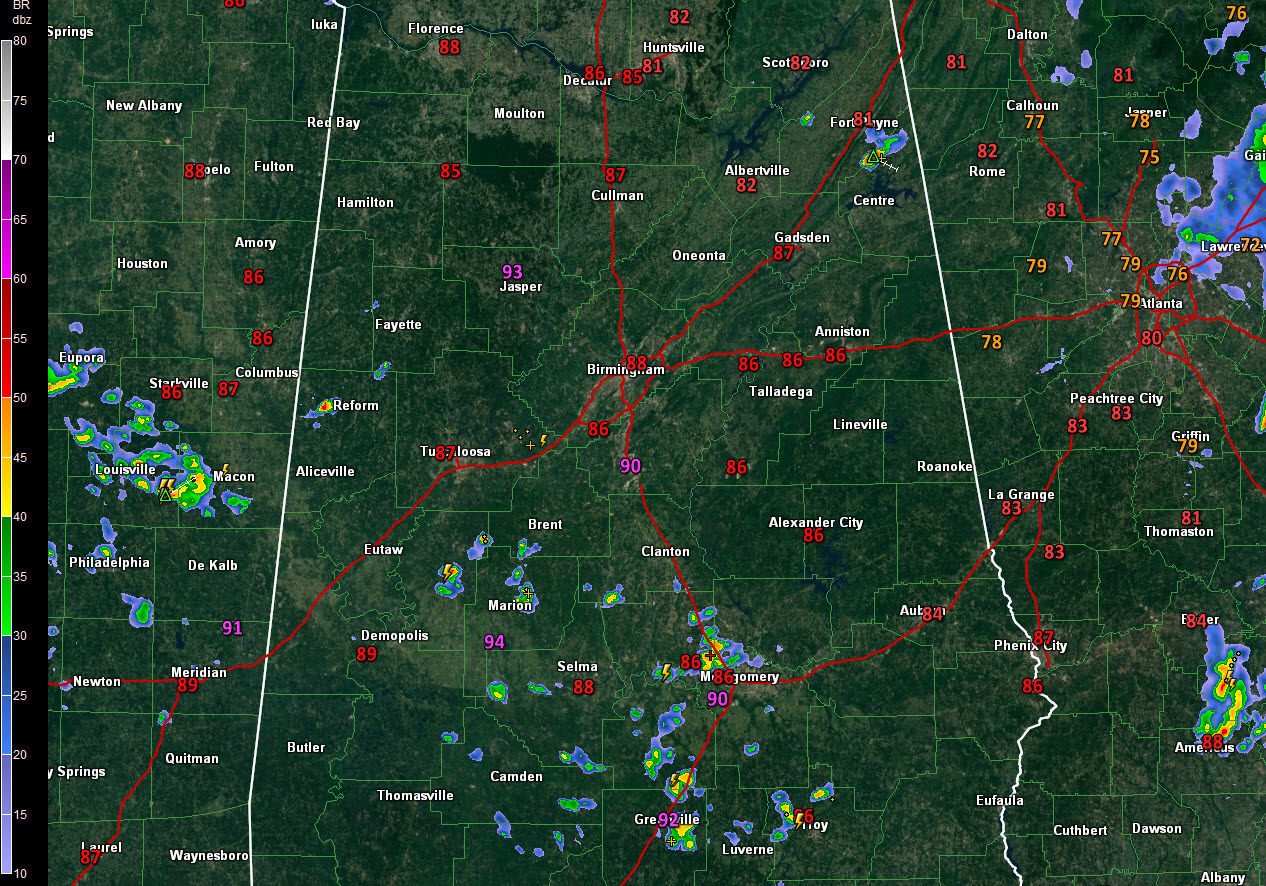
Temperatures are warming through the 80s and into the lower 90s right now. It is 93F at Marion, 90F at Calera, 92F at Greenville and 90F at Evergreen. In the I-20 Corridor, it is 87F at Tuscaloosa, 88F at the Birmingham Airport, and 86F at Anniston.
Convective temperatures today are running around 89F. That is the reading that surface temperatures must generally exceed given the current set of conditions to create convection. Accordingly, showers are proliferating across South Central Alabama from parts of Hale COunty east and southeast to between Montgomery, and Greeneville, and Troy. The heaviest shower had developed lightning northwest of Montgomery, near Prattville.
Across the higher ridges of Northeast Alabama, a storm was forming along the Cherokee/DeKalb County line.
Another developing storm was over northwestern Pickens County, west of Reform.
Movement is east southeast in the general upper flow.
Additional showers and storms will form this afternoon. If you find yourself under one, you will experience heavy rain, wind gusts as high as 40 mph and dangerous lightning. Remember, if you can hear thunder, you can be struck by lightning. And watch out for developing storms. When skies become dark, lightning may be about to form. There is no thunder before that first strike.
Showers will die after sunset, leaving a warm, humid, and partly cloudy night across the state. Monday will be a lot like today, with scattered afternoon and evening storms. Tuesday will feature fewer storms.