


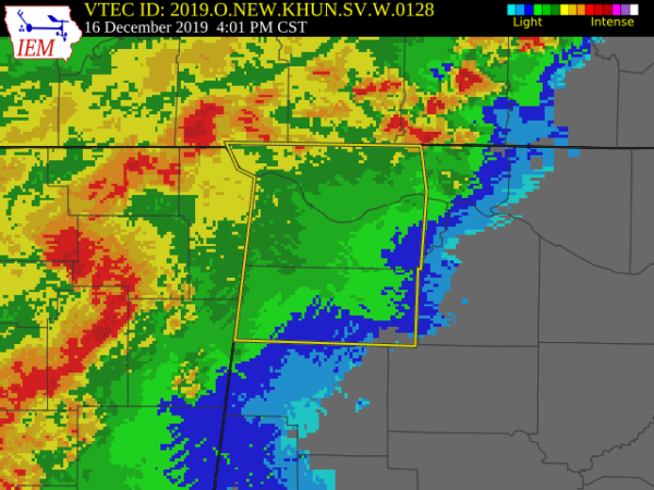
The National Weather Service in Huntsville Alabama has issued a
* Severe Thunderstorm Warning for…
Lauderdale County in northwestern Alabama…
Colbert County in northwestern Alabama…
Franklin County in northwestern Alabama…
* Until 500 PM CST.
* At 358 PM CST, severe thunderstorms were located along a line
extending from Jumpertown to 7 miles southwest of Burton to near
Houston, moving east at 55 mph. This line of storms has a history
of producing damaging wind gusts and tornadoes.
HAZARD…60 mph wind gusts.
SOURCE…Radar indicated.
IMPACT…Expect damage to roofs, siding, and trees.
* Locations impacted include…
Florence, Muscle Shoals, Russellville, Sheffield, Tuscumbia, Red
Bay, Phil Campbell, Killen, Cherokee and Littleville.
PRECAUTIONARY/PREPAREDNESS ACTIONS…
A Tornado Watch remains in effect until 1100 PM CST for north central
and northwestern Alabama.
Remain alert for a possible tornado! Tornadoes can develop quickly
from severe thunderstorms. If you spot a tornado go at once into the
basement or small central room in a sturdy structure.
For your protection move to an interior room on the lowest floor of a
building.



