


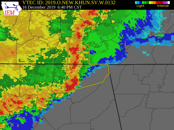
The National Weather Service in Huntsville Alabama has issued a
* Severe Thunderstorm Warning for…
Northern Jackson County in northeastern Alabama…
Eastern Franklin County in Middle Tennessee…
* Until 745 PM CST.
* At 639 PM CST, severe thunderstorms were located along a line
extending from 8 miles northwest of Sewanee to 6 miles southwest of
Scottsboro, moving east at 50 mph.
HAZARD…60 mph wind gusts.
SOURCE…Radar indicated.
IMPACT…Expect damage to roofs, siding, and trees.
* Locations impacted include…
Scottsboro, Winchester, Bridgeport, Decherd, Estill Springs,
Stevenson, Cowan, Hollywood, Skyline and Sewanee.
PRECAUTIONARY/PREPAREDNESS ACTIONS…
A Tornado Watch remains in effect until 1100 PM CST for north central
and northeastern Alabama…and Middle Tennessee.
For your protection move to an interior room on the lowest floor of a
building.



