


National Weather Service Huntsville AL
530 PM CST Sun Dec 29 2019
The National Weather Service in Huntsville Alabama has issued a
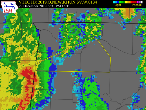
* Severe Thunderstorm Warning for…
Southeastern Colbert County in northwestern Alabama…
Franklin County in northwestern Alabama…
Lawrence County in northwestern Alabama…
* Until 615 PM CST.
* At 530 PM CST, a severe thunderstorm was located 7 miles northeast
of Tremont, or 8 miles south of Red Bay, moving northeast at 65
mph.
HAZARD…60 mph wind gusts.
SOURCE…Radar indicated.
IMPACT…Expect damage to roofs, siding, and trees.
* Locations impacted include…
Russellville, Moulton, Red Bay, Phil Campbell, Town Creek,
Littleville, Leighton, Courtland, Belgreen and North Courtland.
PRECAUTIONARY/PREPAREDNESS ACTIONS…
A Tornado Watch remains in effect until 900 PM CST for north central
and northwestern Alabama.
For your protection move to an interior room on the lowest floor of a
building.
Torrential rainfall is occurring with this storm, and may lead to
flash flooding. Do not drive your vehicle through flooded roadways.



