


BULLETIN – IMMEDIATE BROADCAST REQUESTED
Severe Thunderstorm Warning
National Weather Service Birmingham AL
739 AM CST Sat Jan 11 2020
The National Weather Service in Birmingham has issued a
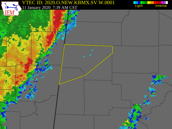
* Severe Thunderstorm Warning for…
Marion County in northwestern Alabama…
Northern Lamar County in west central Alabama…
* Until 845 AM CST.
* At 739 AM CST, severe thunderstorms were located along a line
extending from near Fairview to near New Salem to near Prairie,
moving east at 40 mph.
HAZARD…60 mph wind gusts.
SOURCE…Radar indicated.
IMPACT…Expect damage to roofs, siding, and trees.
* Locations impacted include…
Hamilton, Haleyville, Sulligent, Guin, Hackleburg, Detroit,
Beaverton, Brinn, Weston, Bear Creek, Henson Springs, Tessner,
Shottsville, Pearces Mill, Rankin Fite Airport, Upper Bear Creek
Reservoir, Byrd, Pine Springs, Bexar and Pigeye.
PRECAUTIONARY/PREPAREDNESS ACTIONS…
A Tornado Watch remains in effect until 100 PM CST for northwestern
and west central Alabama.
For your protection move to an interior room on the lowest floor of a
building.



