


A quick update on the Alabama weather situation this morning.
Rain covers the northern third of Alabama, generally north of US-278 from Hamiton to Cullman to Gadsden. It extends back into Mississippi, where there is some lightning over the Delta between Greenville and Greenwood.
Large high-pressure north of the Great Lakes is trying to push a cold front down into North Alabama. It will be partially successful and this will set up a range in temperatures later today across our state. Right now it is 49F in Decatur and 64F in Birmingham and 62F in Montgomery.
This is what temperatures should ook like at 10 a.m.:
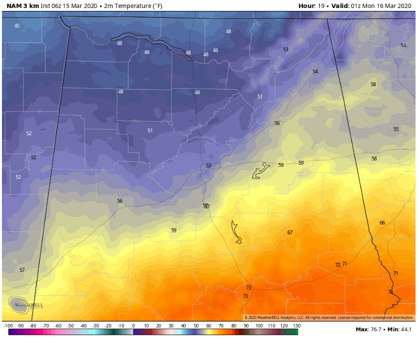
The front should reach I-20 around 10 a.m. or so, with readings in the 50s to the north, 60s n the transition zone just south of I-59, and 70s tto the south.
This is what the radar should look like then as well.
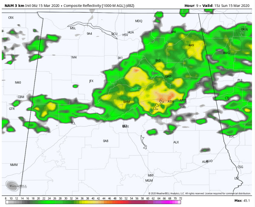
The rani will slowly sag southeast and gradually thin out as it moves into Georgia later this afternoon. Skies will be mostly cloudy all day, except for a little sunshine in South Central Alabama in places like Selma, Montgomery, and Aubirn.



