


Here is an update on the Alabama severe weather situation this evening…

A line of strong thunderstorms continues tonight from Scottsboro in Jackson County in Northeast Alabama to west of Oneonta in Blount County to west of Birmingham to east of Tuscaloosa to near Eutaw and Demopolis.
Very heavy rain, strong winds, and frequent lightning are accompanying these storms.
Severe thunderstorm warnings continue for Etowah, Blount, eastern Jefferson, St. Clair, and northeastern Shelby County. The NWS is monitoring circulations in Blount County. A barn was just destroyed in Blountsville.
Tornado warnings continue for DeKalb and Marshall Counties. Another tornado warning is in effect for parts of Marengo County.
Storms are really ramping up over Southwest Alabama, These storms could produce significant tornadoes as they move toward the Montgomery and Greenville areas over the next couple of hours.
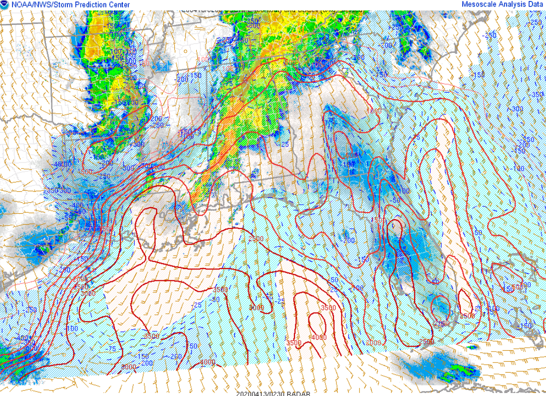
Instability values are still high south oof II-20, running over 1,000 joules/kg.
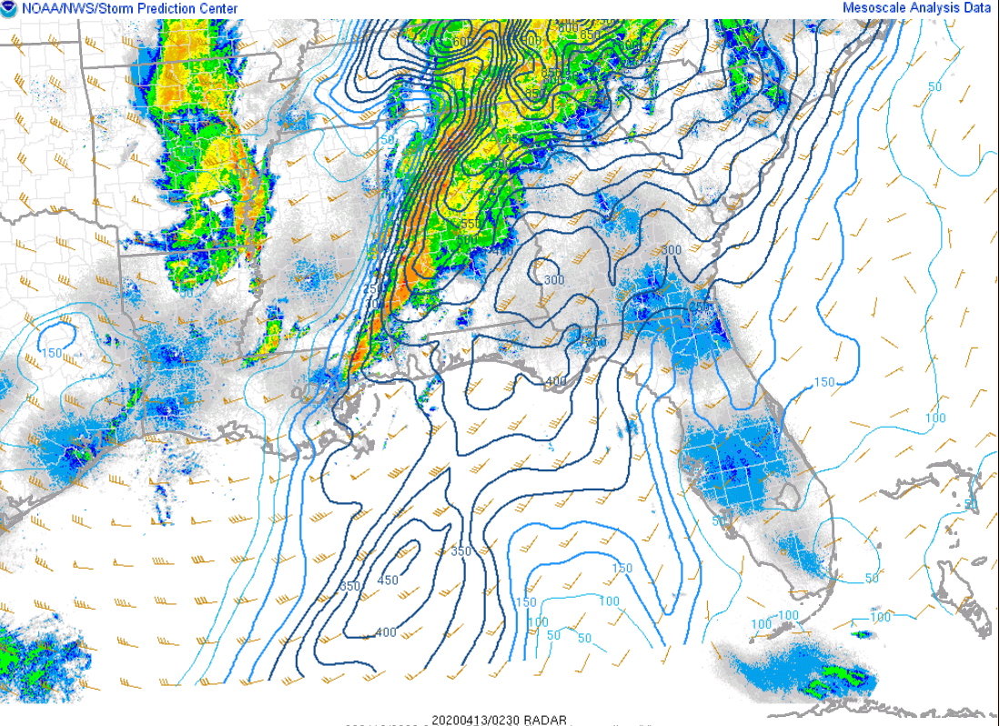
Helicity values are still high, indicating a potential for tornadoes still:
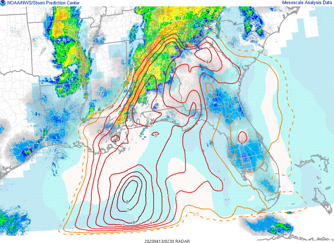
Significant tornado parameter values are running high as a result:
The line will push through the Birmingham area between now and 11 p.m. The line should be out of southeastern Central Alabama around Auburn around 2-3 a.m.
Tornado watches continue for many counties across Northeast Alabama, Central Alabama, as well as Southwest and South Alabama.
Have a reliable way to get warnings overnight. Have WEA allerts enabled on your phone and have your Weatheradio on.
Storms crossing the Mississippi River will weaken as they push deeper into Mississippi over the next couple of hours. They should not affect us.



