


The blog is busier than a one armed paper hanger this weekend…so scroll down for several posts both current and historic as well as beautiful.
Ana and newly named Bill are making the headlines in the tropics, but there is also a disturbance in the southeastern Gulf of Mexico that the NHC says has a low potential to develop into a tropical cyclone.
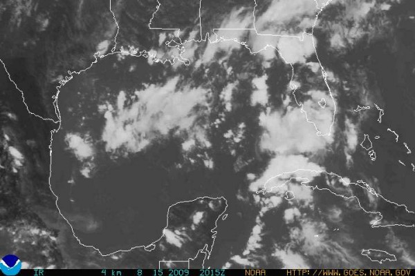
Here is the latest from the Hurricane Center.
THUNDERSTORM ACTIVITY ASSOCIATED WITH A TROPICAL WAVE HAS BECOME
MORE CONCENTRATED TODAY OVER THE FLORIDA KEYS AND THE ADJACENT
SOUTHEASTERN GULF OF MEXICO. PRESSURES REMAIN HIGH IN THIS AREA…
AND ANY ADDITIONAL DEVELOPMENT…IF ANY…SHOULD BE SLOW TO OCCUR
AS THE SYSTEM MOVES NORTHWESTWARD OVER THE EASTERN GULF OF MEXICO. THERE IS A LOW CHANCE…LESS THAN 30 PERCENT…OF THIS SYSTEM BECOMING A TROPICAL CYCLONE DURING THE NEXT 48 HOURS.
This system and its associated moisture will bring lots of rain to Northwest Florida and South Alabama Sunday night and into the rest of Alabama on Monday.
We will keep an eye on it.



