


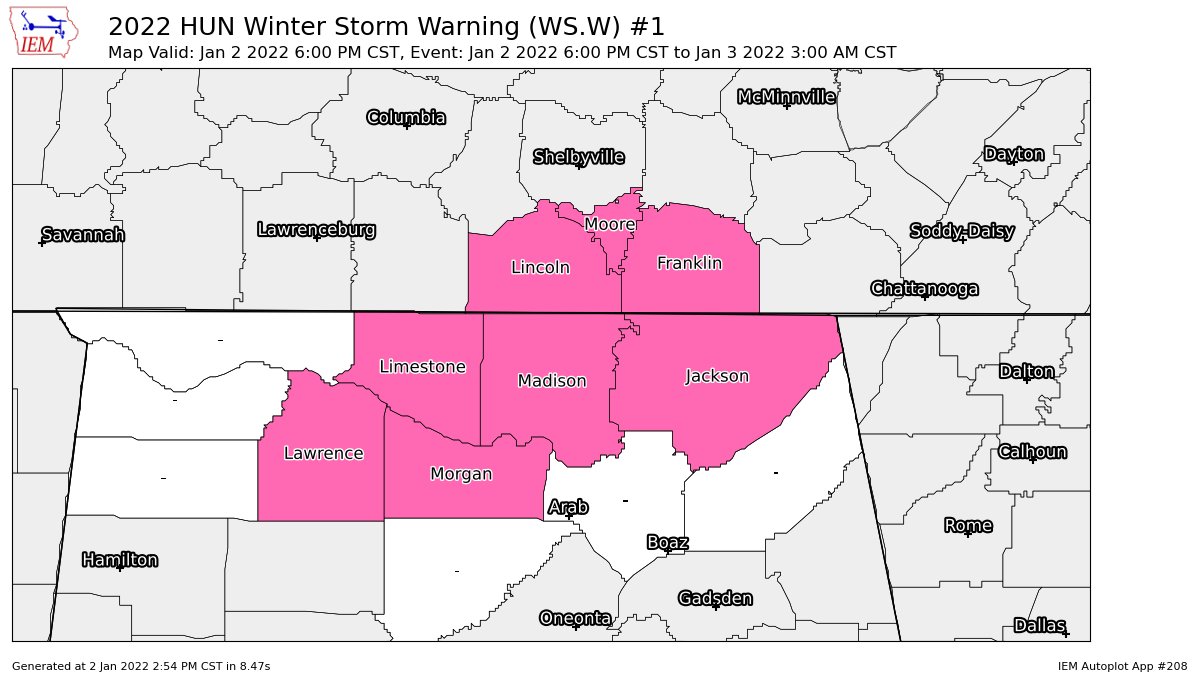
NWS Huntsville has decided to upgrade portions of their county warning area to a WINTER STORM WARNING starting at 6 pm and set to expire at 3 am Monday morning. Those upgraded counties are Jackson, Lawrence, Limestone, Madison, and Morgan.
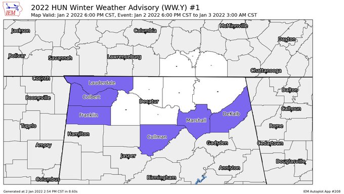
The rest of Huntsville’s county warning area (Colbert, Cullman, DeKalb, Franklin, Lauderdale, and Marshall counties) continue in a WINTER WEATHER ADVISORY from 6 pm tonight and set to expire at 3 am Monday morning.
Here is the Winter Storm Warning text from NWS Huntsville:
…WINTER STORM WARNING IN EFFECT FROM 6 PM THIS EVENING TO 3 AM CST MONDAY…
* WHAT… Heavy snow expected. Total snow accumulations of 2 to 3 inches, with locally higher amounts.
* WHERE… In Alabama, Lawrence, Limestone, Madison, Morgan and Jackson counties. In Tennessee, Moore, Lincoln and Franklin TN counties.
* WHEN… From 6 PM this evening to 3 AM CST Monday.
* IMPACTS… Travel could be very difficult.
PRECAUTIONARY/PREPAREDNESS ACTIONS…
If you must travel, keep an extra flashlight, food, and water in your vehicle in case of an emergency.
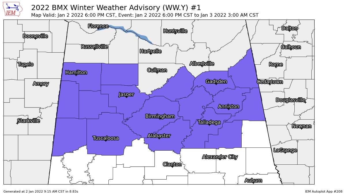
NWS Birmingham continues a WINTER WEATHER ADVISORY set to go into effect at 6 pm tonight and expire at 3 am Monday morning for the following counties in their county warning area: Blount, Calhoun, Cherokee, Clay, Cleburne, Etowah, Fayette, Jefferson, Lamar, Marion, Pickens, Shelby, St. Clair, Talladega, Tuscaloosa, Walker, and Winston.
Here is the Winter Weather Advisory text from NWS Birmingham:
…WINTER WEATHER ADVISORY IN EFFECT FROM 6 PM THIS EVENING TO 3 AM CST MONDAY…
* WHAT… Snow expected. Total snow accumulations of up to two inches in higher elevations are possible.
* WHERE… Portions of north-central Alabama.
* WHEN… From 6 PM this evening to 3 AM CST Monday.
* IMPACTS… Plan on slippery road conditions with the higher totals.
PRECAUTIONARY/PREPAREDNESS ACTIONS…
Slow down and use caution while traveling.



