


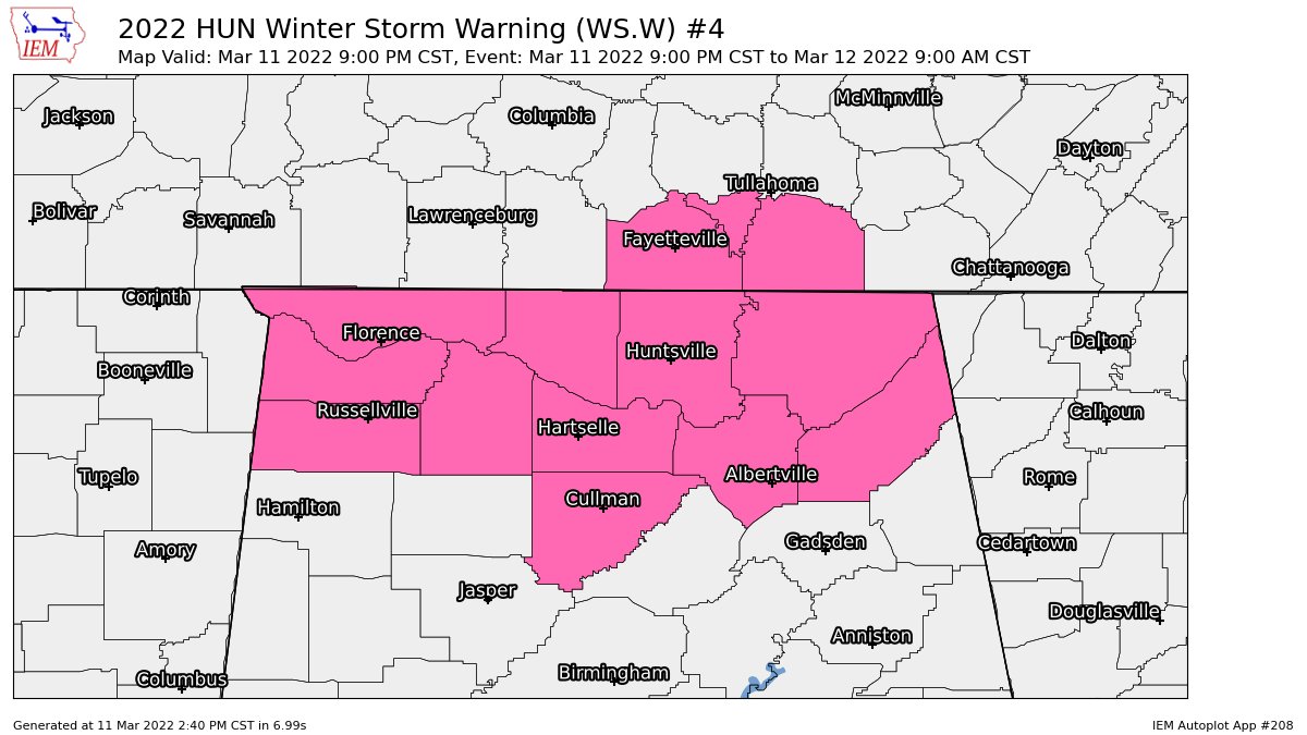
NWS Huntsville has upgraded Cullman, DeKalb, and Marshall counties in North Alabama to a Winter Storm Warning from 9 pm tonight until 9 am Saturday morning. These counties have been added to Colbert, Franklin, Jackson, Lauderdale, Lawrence, Limestone, Madison, and Morgan counties already in the warning.
Snowfall Totals:
– Widespread totals of 2 to 4 inches across northern Alabama (potentially up to 5 inches in southern Middle Tennessee).
– Potential still exists for locally higher amounts beneath persistent snow bands.
Timing and Duration:
– Rain transitions to snow northwest to southeast from 9 pm to 2 am.
– Accumulating snow will taper off to flurries Saturday morning before ending.
Potential Impacts:
– Very hazardous travel conditions will develop late this evening into Saturday morning.
– Snow accumulations of 2 to 4 inches are likely for most areas, with locally higher amounts up to 5 inches across southern Middle Tennessee and beneath any persistent snow bands.
– North northwest winds of 20 to 25 MPH, with gusts of 35 to 45 MPH.
– Bitterly cold wind chills in the single digits to teens both tonight and Saturday night. Saturday afternoon high temperatures will only reach 28 to 32 degrees.
– Combination of winds and snowfall may lead to tree and power line damage.



