



A tornado watch is in effect for about the western half of Alabama (see JB’s post below). A strong cold front is approaching us from the west right now, and is currently near a line from Jackson, TN to Starkville, MS. Temperatures ahead of the front are really warming up…with the sun coming out over eastern MS and western AL temperatures are in the lower 80s with dewpoints near 70.
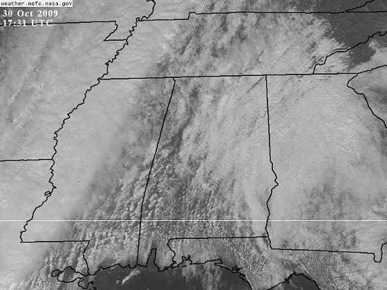
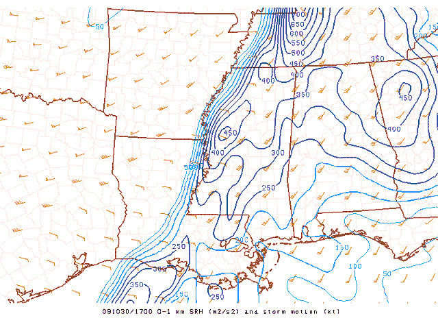
Strong southerly winds ahead of the system (gusting to 30 mph at the surface at times and near 60 mph at 5,000 ft.) are producing wind shear. Helicity, or a measure of potential storm rotation due to low-level wind shear, is near 300 m2/s2 over west AL, sufficient for a few rotating storms.
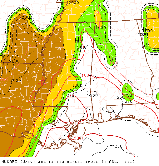
However, the limiting factor that will likely prevent a major tornado outbreak is the lack of instability, due to very warm air aloft, from 700 mb up to 200 mb. Still, with the very warm and humid air near the surface, CAPE values are 500 to 1,000 J/kg over west Alabama. This instability is enough to support a few isolated storms out ahead of the main line.
This should not be a major tornado outbreak, but 1 or 2 tornadoes are possible in Alabama given the warm temperatures and wind shear. The threat should diminish some after sunset when temperatures cool off a little, so it may be that areas from BHM east only see a severe thunderstorm watch this evening. Either way, expect strong storms to move in this afternoon and evening from west to east, with a widespread threat of winds up to 40 mph, possibly bringing some trees down. Scattered storms are possible in BHM as early as 4 pm, but the more widespread rain should move in after 8 pm.



