


FAST FACTS ON IDA
9:00 AM CST Sat Nov 7
Location: 17.9°N 84.1°W
Max sustained: 60 mph
Moving: N at 9 mph
Min pressure: 997 mb
HIGHLIGHTS
…Ida better organized…may become a hurricane Sunday
…Will pass between Yucatan and Cuba Sunday afternoon and into Gulf
…May affect northern Gulf Coast, but should be extratropical by then
…Ida may bring strong winds (tropical storm force) to Gulf Coast, heavy rains into Alabama Monday night/Tuesday
It’s hard to imagine that Ida won’t become a hurricane over the next 24 hours. Satellite imagery indicates deep convection near the center.
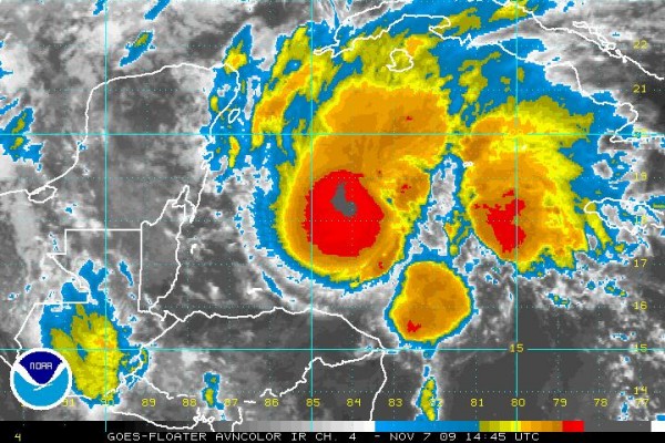
But the National Hurricane Center does not expect Ida to become a hurricane. As Ida continues northward, it will encounter increasing easterly shear because of a large anticyclone over the northern Gulf. Ida will become a strong tropical storm or perhaps a hurricane as it nears the Yucatan Channel on Sunday. A hurricane watch has been issued for parts of the Yucatan. Tropical storm warnings continue for northeastern Yucatan and western Cuba.
Air Force recon is enroute to investigate the storm right now.
The eventual track, type of storm and intensity Ida will be is complex.
Ida will move into the southern Gulf Sunday afternoon. It will be encountering increasing shear, so it should stop strengthening or even weaken. It will be moving north northwest around the retreating high to the north. It will be preceded by a huge slug of tropical moisture moving northward from the Bay of Campeche.
Ida will likely make the transition from tropical storm to extratropical storm on Monday. It will then approach the northern Gulf Coast Monday night and turn eastward early Tuesday.
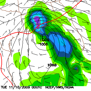
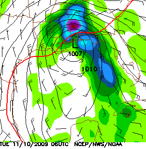
Here is a sneak peek at the morning run of the GFS:
Monday night 6 p.m.
Midnight Tuesday morning
6 a.m. Tuesday morning
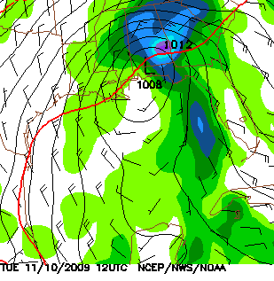
As you can see, the GFS model brings a strong extratropical storm to just off the mouth of the Mississippi River Monday evening then to near Mobile Bay by midnight then turns it slowly eastward over the Florida Panhandle and weakens it.
Under this scenario…heavy rains will set up late Sunday into Monday over Mississippi and Louisiana as the Bay of Campeche moisture is sucked northward. As Ida moves toward the coast Monday, this rain will push into Alabama from the southwest during the day. Heavy rain will overspread much of the state Monday night ahead of the storm as it turns northeast and east. It will also be windy, not so much because Ida will be an intense storm, but rather because of a tight pressure gradient between the high to the north and the low to the south.
Ida may bring tropical storm force winds, heavy rains, heavy surf, coastal erosion and minor storm surge flooding to the Mississippi, Alabama and Northwest Florida coast Monday and Tuesday. Tropical storm force winds especially in gusts, may affect South Alabama. Winds of 15-30 mph with higher gusts will affect Central Alabama. Two to three inches of rain will be possible across Central Alabama, with some 4+ inch amounts over Southwest Alabama.



