


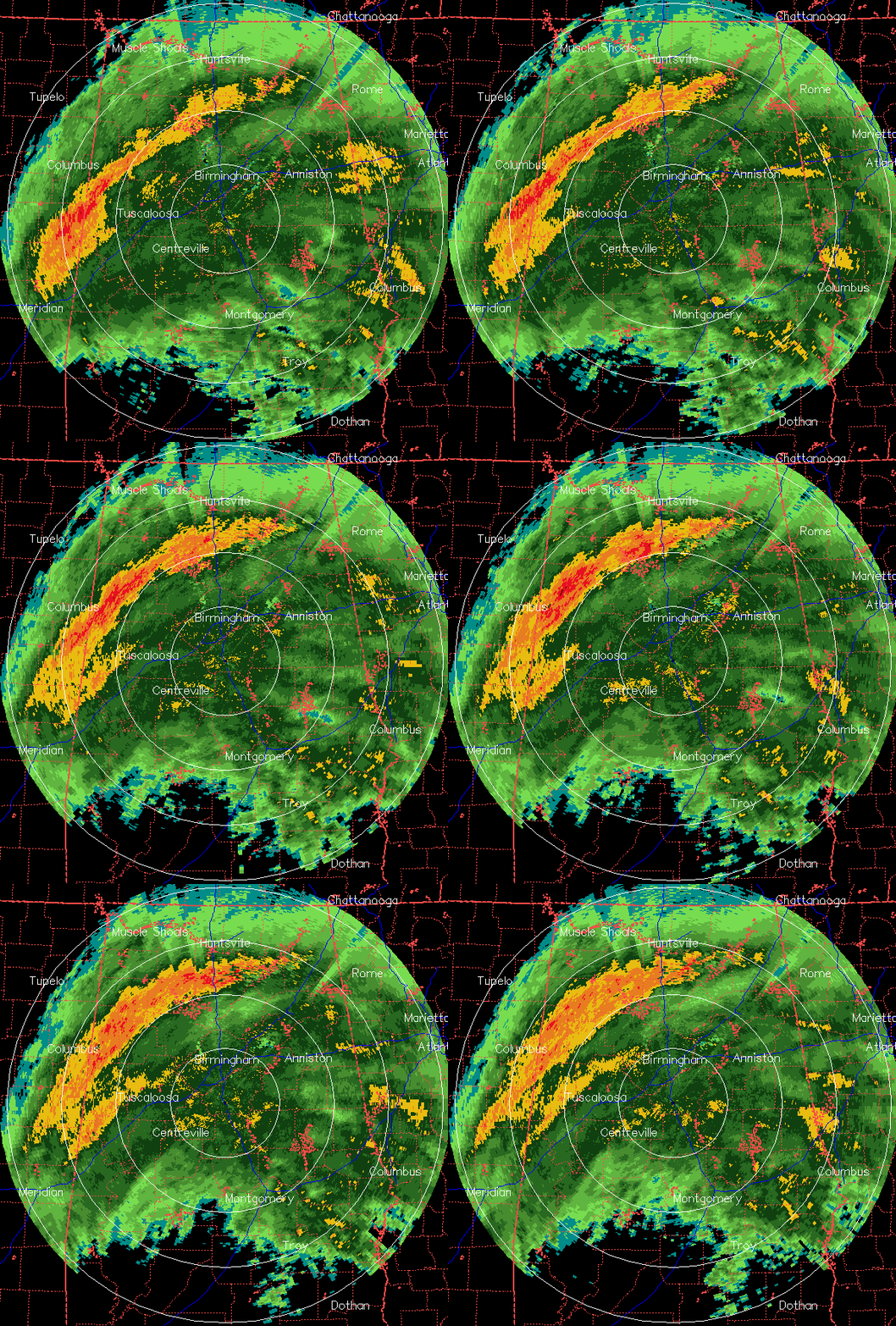
(Repost of earlier blog with updated radar)
Ida continues to slow down and weaken as it moves toward Mobile Bay. Winds will continue to gust over 50 mph near the coast early this morning, and it will also be windy in central and south Alabama, with wind gusts as high as 40 mph at times today in BHM. However, the threat for wind damage with Ida appears to be decreasing.
I am starting to be concerned about the possibility of flooding in Alabama, as far north as Tuscaloosa, Birmingham, and Anniston. Computer models in recent days have been taking the storm rapidly eastward after landfall, and taking the heaviest rain across south Alabama and into north Georgia. However, the storm is slowing down, and will eventually interact with an upper-level disturbance. Also, the storm is starting to look more like a winter-time system than a tropical system, with most of the heavy rain well to the north and east of the center (see satellite below.)
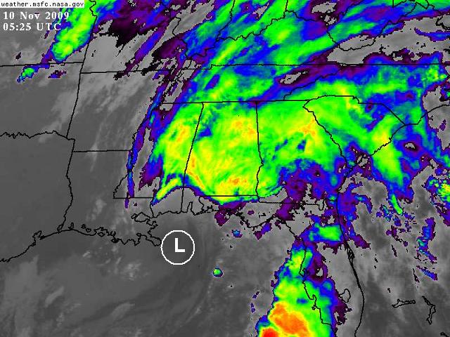
The consensus of the computer models places the center of Ida still in south Alabama, somewhere near Opp, Luverne, or Andalusia, by 6 pm today. Radar clearly shows that heavy rain has spread inland well to the north and even NW of the center. Take a look at radar-estimated rainfall totals as of 345 am.
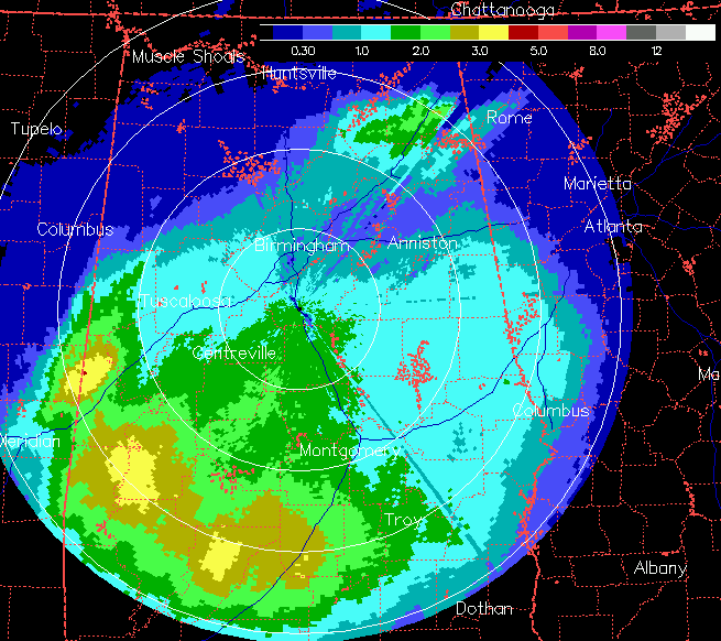
Many places in south Alabama have already received 2″ of rain, with many hours of rain left to go. Some local totals as of 345 am: BHM airport 0.62, Hoover 0.92, NWS Calera 1.10, TCL 0.90, Brent 1.61, MGM 1.42, Alex City 1.16, Selma 1.60, Troy 2.38, Evergreen 3.29, Florala 2.77, Dothan 0.91.
Predicting rainfall amounts in locations is difficult, since small changes in speed or direction of storm motion can make a huge difference. But, some of the computer models are showing big rainfall totals over parts of central and south Alabama between last night and Wednesday morning. Some examples for BHM (amounts south and east of BHM are in some models larger):
GFS: 6.5″
NAM: 3″
GEM: 4-5″
NOGAPS: 6″
UKMET: 2.5″
The average here is what NCEP is going with, about 3″ in BHM with a maximum of 5-6″ from Demopolis to Anniston. With the soil saturated and the lakes still above seasonal normals from so much rain this year, flash flooding (localized, rapidly occurring flooding) and river flooding (larger scale) could become a problem by tonight and tomorrow. It helps that Alabama Power and the Army Corps of Engineers have already started letting seasonal lakes down some for the winter, but if the higher model amounts are correct, flooding problems are likely.
If you live in a low-lying area prone to flash flooding, keep an eye on things today and tonight. If you encounter a roadway covered in water, don’t drive over it. The water may be deeper than you think, or the road could be washed away. If you have lake property, we should know which lakes will be affected the most later today.



