


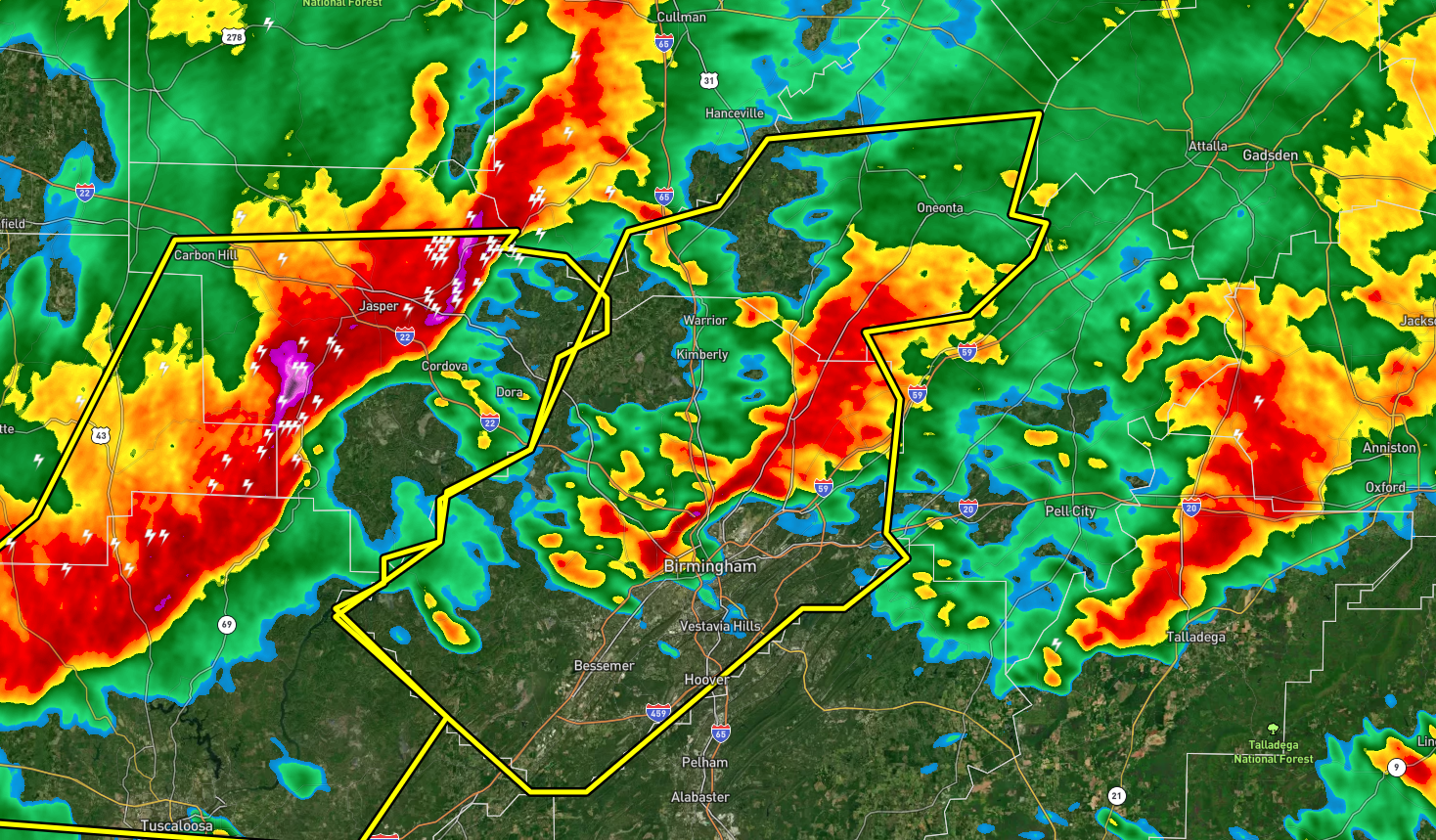
The National Weather Service in Birmingham has issued a
* Severe Thunderstorm Warning for…
Blount County in central Alabama…
Jefferson County in central Alabama…
* Until 145 AM CST.
* At 1226 AM CST, severe thunderstorms were located along a line
extending from near Smith Dam to near Binion Creek Landing, moving
east at 55 mph.
HAZARD…60 mph wind gusts.
SOURCE…Radar indicated.
IMPACT…Expect damage to roofs, siding, and trees.
* Locations impacted include…
Birmingham, Hoover, Vestavia Hills, Bessemer, Homewood, Mountain
Brook, Trussville, Hueytown, Gardendale, Irondale, Leeds, Moody,
Fairfield, Fultondale, Oneonta, Cleveland, Dallas, Center Point,
Pleasant Grove and Clay.
PRECAUTIONARY/PREPAREDNESS ACTIONS…
A Tornado Watch remains in effect until 600 AM CST for central and
west central Alabama.
For your protection move to an interior room on the lowest floor of a
building.



