


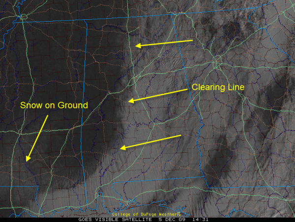
This visible satellite photo shows the clearing line is as far east at Fayette and Walker Counties in Alabama. But what this still image does not show is that the clearing has stopped its eastward progression. Wraparound moisture continues to flow southward on the back side of the low over Carolinas, helping the stratocumulus clouds hang tough. This will delay clearing in areas east of I-65. Sun will gradually peek through as the clouds slowly erode. Even as I write this, a little sun shows through here in Trussville.
One other thing this visible satellite photo shows: snow on the ground over southern Mississippi.
Temperatures are in the 30s over the state. Brisk northerly winds continue to pump in colder air and this will limit the temperature rise even in areas that see sunny skies. I wouldn’t be surprised to see some 30s over eastern sections for daytime highs.
Expect a solid freeze tonight with lows in the middle 20s on average. Colder spots could end up in the lower 20s.



