


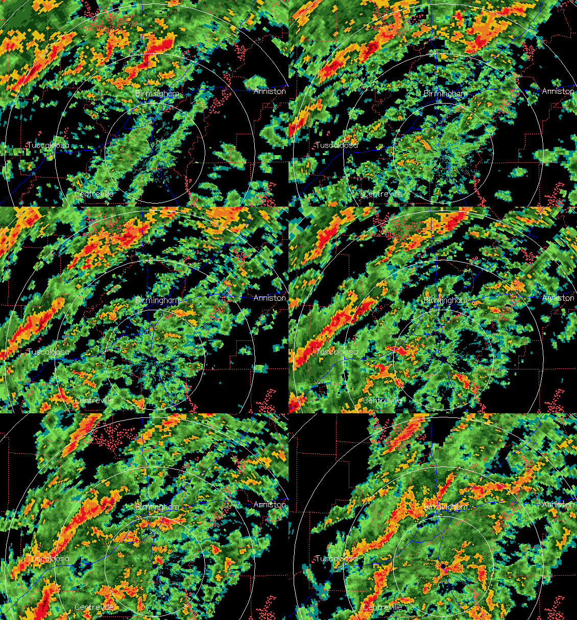
It continues to be windy and rainy out there tonight, with numerous thunderstorms, some of them producing over an inch of rain per hour, and gravity waves moving NE at 90-100 mph, producing winds of 40-60 mph, downing some trees and powerlines. The winds at 850 mb (4,000 feet) are now 80 knots (90-95 mph), about the highest I have ever seen outside a hurricane.
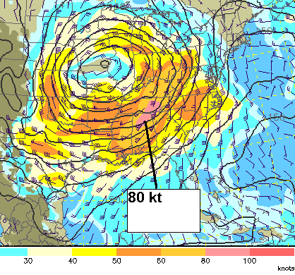
These winds occasionally mix down to the surface, causing the wind gusts. Some wind gusts tonight…
BHM airport 53 mph
Calera NWS 41 mph
Clay 41 mph
Albertville 51 mph
Anniston 40 mph
SE Huntsville 54 mph
Cullman 38 mph
Downtown BHM 60 mph (on top of building)
Tuscaloosa 51 mph
Fort Payne 46 mph
The tornado threat is still with us due to high shear and a little instability, but it seems like the main threat of that was over once the likely tornado moved through TCL county. A tornado watch is still in effect, and with this much wind shear, tornadoes are still possible.
Flooding has also become an issue, and may continue to get worse overnight. The latest radar-estimated rain at 1230 am:
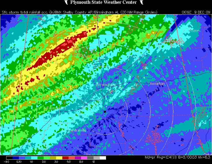
Some places in NW Alabama, from Millport to Hartselle, have received over 4″ of rain. By the time the rain ends later tonight, many spots may see 2-3″ of rain, with isolated amounts up to 6″.
Keep the weather radio on if you’re going to bed. Even though the tornado threat is diminishing, it’s not quite gone, and people in flood planes need to be aware of flash flooding also.
For your meteorological consulting needs, Coleman and Peters, LLC, can provide you with accurate, detailed information on past storms, lightning, flooding, and wind damage. Whether it is an insurance claim needing validation or a court case where weather was a factor, we can furnish you with information you need. Please call us at (205) 568-4401.



