


Santa is not the only one busy today… here is a look at our variety of weather issues at late morning:
GRADIENT WINDS: NWS Huntsville has issued a high wind warning for their counties up in the Tennessee Valley, and one could very well be needed down to I-20 as winds average 20 to 40 mph this afternoon and tonight with gusts to over 50 mph at times, especially on the ridges. This could mean tree and power line damage across the northern half of the state. Be sure and secure anything now that might blow away, including Christmas decorations.
SEVERE WEATHER: SPC has now issued a moderate risk of severe storms for this afternoon and tonight over Southeast Louisiana and South Mississippi. In Alabama, a slight is in place south of a line from Tuscaloosa to Columbiana to Roanoke. There is very little surface based instability available, but we have to watch the radar for an isolated strong to severe storm since the dynamics are extremely impressive with very high low level helicity values. My main concern is still the pressure gradient wind, which will be widespread.
HEAVY RAIN: Rain amounts of 1 to 2 inches are likely statewide, there could be a few isolated flooding problems. People in flood prone areas need to monitor weather conditions this afternoon and tonight.
WHITE CHRISTMAS: Below is the 12Z RPM output valid at 11:00 a.m. tomorrow:
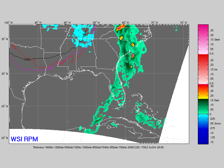
Light snow/snow flurries will need to be mentioned for North Alabama, especially for areas north of Birmingham. The deeper moisture is gone, but this could be enough for dusting, especially over Northwest Alabama. Snow on the back side of a departing storm system rare gets out of hand here, but having a few snow flakes Christmas morning is way too cool. Be sure and look out the window when you are opening those presents tomorrow.
Stay tuned for updates through the day…



