


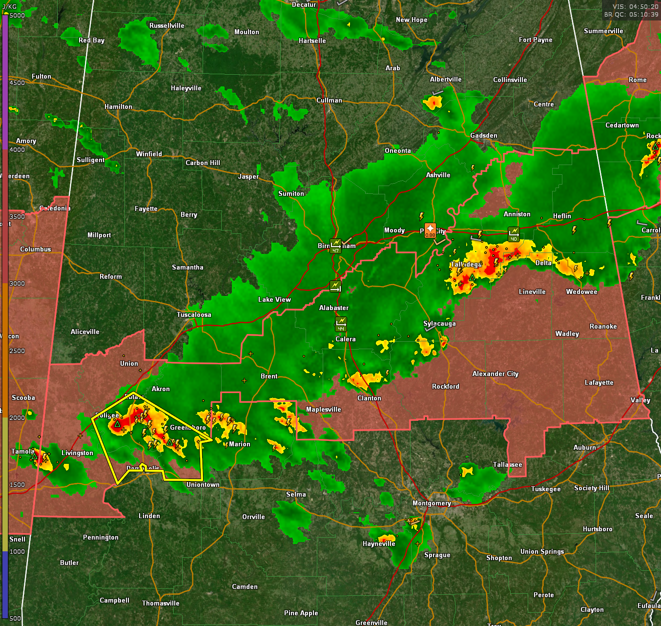
Our line of storms is now completely south of I-20. It extends from Woodland in Randolph County pack to Talladega then becomes weaker, and more broken through Sylacauga, Jemison, and Centreville.
Stronger storms are over parts of Sumter, Greene, and Hale Counties, where a severe thunderstorm warning is in effect for places like Eutaw, Boligee, Forkland, Greensboro and New Bern.
Moderate rain continues across the Birmingham Metro where several reports of trees down were received, including a large tree down on Brookwood Road in Mountain Brook, and reports of trees down near Shades Crest Road including in front of the old Tip Top Grill according to John Talbot. John also reports a tree down at Acton Road and Camp Horner Road. A tree was down on a house on Riverchase Parkway in northern Shelby County. Other reports of trees down were reported across Vestavia Hills and Hoover in southern Jefferson County.
Winds gusted to 44 mph at the Shelby County Airport at 11:30 p.m.
Winds also gusted to 47 mph at Birmingham’s Protective Stadium.
The storms should continue to slowly weaken over the next few hours.
A severe thunderstorm watch continues until 2 a.m. for Bibb, Calhoun, Chambers, Chilton, Clay, Cleburne, Coosa, Greene, Hale, Randolph, Shelby, Sumter, Talladega, and Tallapoosa Counties.



