


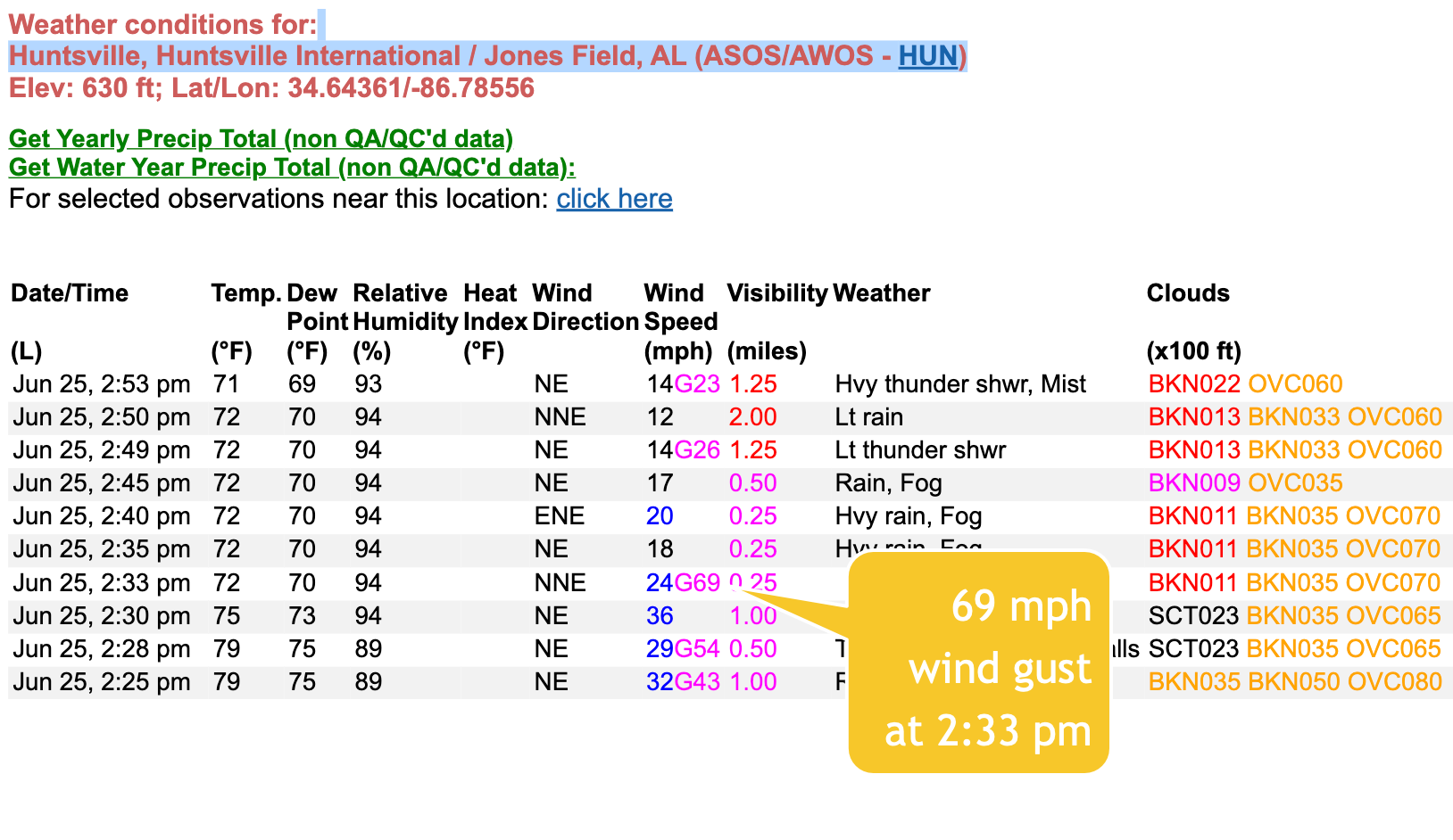
1.75 inch hail was reorted along County Line Road just west southwest of Madison at 2:29.
The SPC just issued a new Mesoscale Discussion…
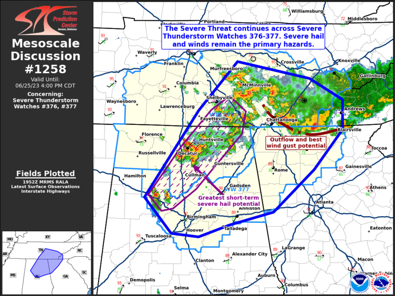
SUMMARY…The severe threat continues across Severe Thunderstorm
Watch 376 into 377. Large hail remains the main threat with the more
discrete storms, with damaging gusts the biggest concern with a
southward-sagging MCS.
DISCUSSION…An MCS with a history of damaging gusts continues to
propagate southward in middle/eastern TN toward GA, while more
discrete convection southwest of the MCS has produced multiple
instances of 1-2 inch hail in the last few hours. Though deep-layer
and low-level shear remains weak across the warm sector, 7+ C/km
surface-500 mb lapse rates and rich low-level moisture will continue
to support severe potential ahead of the aforementioned MCS and
transient supercells along its flank to the southwest. Large hail
remain the main threat with the transient supercells, with damaging
gusts likely continuing along the leading edge of the MCS.



