Warnings are still coming fast and furiously with our volatile atmosphere today…
Here is an update:
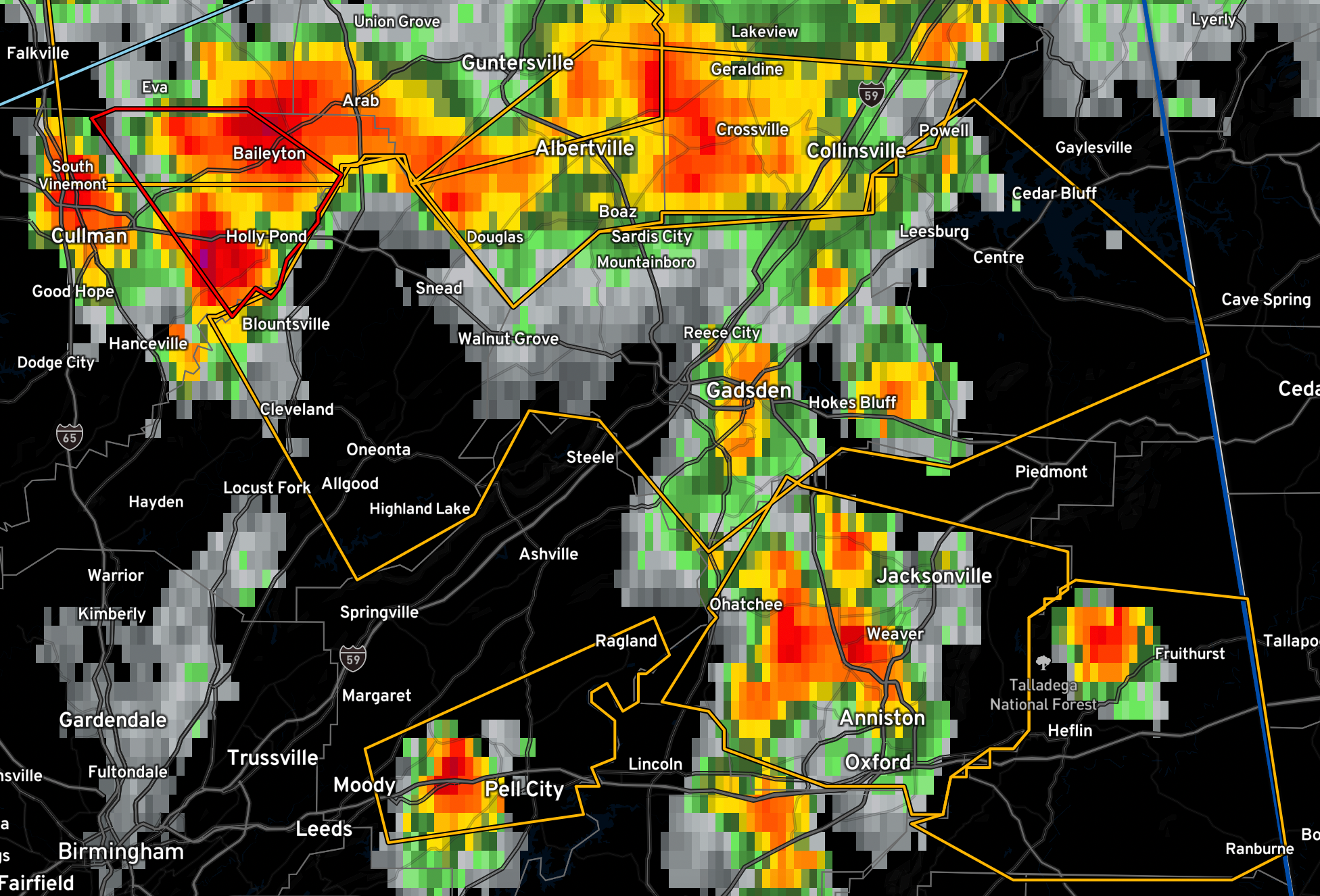
BMX issues Severe Thunderstorm Warning [wind: 60 MPH (RADAR INDICATED), hail: 1.00 IN (RADAR INDICATED)] for St. Clair [AL] till 4:45 PM CDT
BMX issues Severe Thunderstorm Warning [wind: 60 MPH (RADAR INDICATED), hail: 1.00 IN (RADAR INDICATED)] for Calhoun [AL] till 4:45 PM CDT
BMX issues Severe Thunderstorm Warning [wind: 60 MPH (RADAR INDICATED), hail: 1.00 IN (RADAR INDICATED)] for Cleburne [AL] till 5:15 PM CDT
BMX continues Severe Thunderstorm Warning [wind: 60 MPH (RADAR INDICATED), hail: 1.00 IN (RADAR INDICATED)] for Blount, Cherokee, Etowah [AL] till 5:00 PM CDT…Impressive hail core moving into Blount County…no plans to issued tornado warning for Blount.
Clay and Randolph Counties were added to the watch…
BMX continues Severe Thunderstorm Watch for Blount, Calhoun, Cherokee, Cleburne, Etowah, Jefferson, Shelby, St. Clair, Talladega, Walker, Winston [AL] till 7:00 PM CDT
BMX extends area of Severe Thunderstorm Watch for Clay, Randolph [AL] till 7:00 PM CDT