


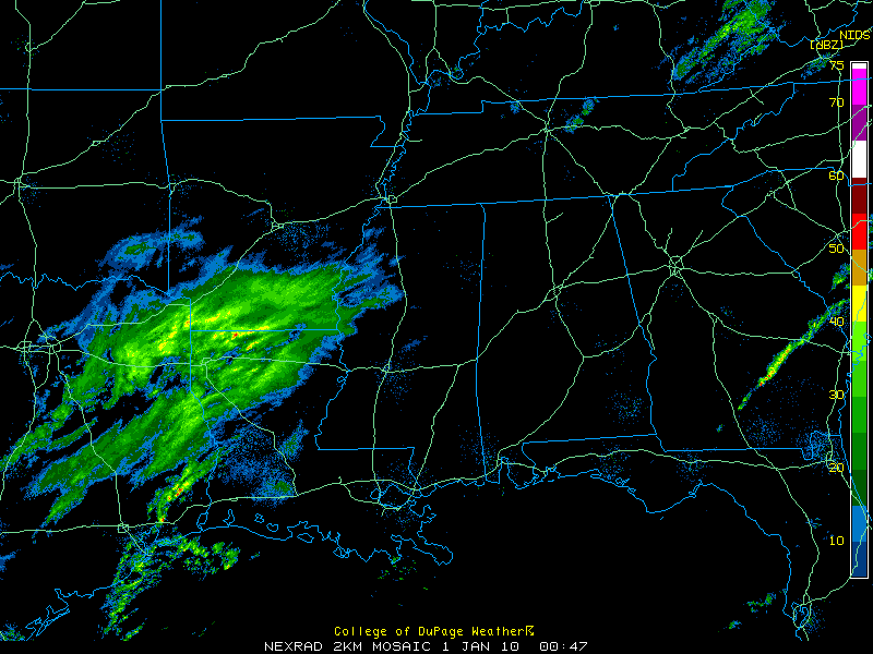
The upper level disturbance to the west of Alabama continues moving eastward this evening, spreading light rain ahead of it.
The precipitation is moving eastward at 40 mph. It is approximately 150 miles west of the Alabama border at this hour. It should reach western Alabama by midnight, progressing across the state during the predawn hours.
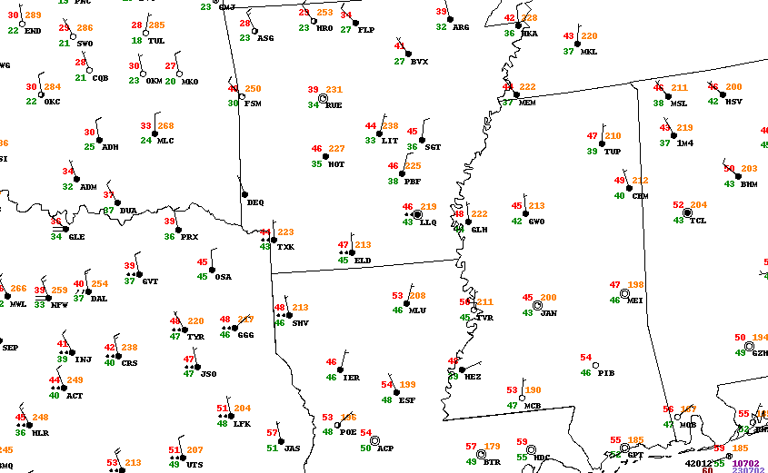
Meanwhile, northwesterly winds across Alabama are starting to filter in colder air. That process will accelerate with time this evening as winds pick up. Temperatures now are in the upper 40s and lower 50s across Central Alabama. Temperatures will fall to around 34F by daybreak on average. Indications are that the atmosphere will become cold enough to support light snow between midnight and 6 a.m.
It now looks like the precipitation will start out as light rain and possibly change to a rain/snow mix and then to all snow flurries by daybreak across Central Alabama. The precipitation is holding together very well, but the RPM model indicates it will weaken with time.
No travel problems are anticipated because surface temperatures will remain above freezing and precipitation is expected to be light.
Highs on New Year’s Day will be in the lower 40s. Skies should clear during the morning hours over western Alabama, around noon or just before in the I-65 corridor and after that over eastern Alabama.
Some very cold air is going to affect Alabama over the next 7-10 days. We will experience several days with highs in the 30s and 40s, including some days where the mercury doesn’t get over freezing. Lows will be in the upper teens and 20s, with some single digits at some point.
Lots of uncertainty about the potential for snow. The afternoon run of the GFS continues the idea of snow on Thursday night and Friday morning for parts of Central Alabama. It is too early to take that idea seriously, but it is a possibility.



