


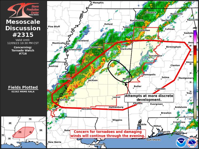
Here is the latest from the SPC:
The severe weather threat for Tornado Watch 716 continues.
SUMMARY — Tornadoes and damaging winds will remain possible through the evening. Discrete storms ahead of the cold front would pose a higher tornado threat, but their maturation is uncertain. A downstream watch is likely for parts of central/southern Alabama in the next couple of hours.
DISCUSSION — Convection continues to become more linear along the cold front advancing through Mississippi into northwestern Alabama. This general trend should continue as the main synoptic trough continues east/southeast. A few more discrete elements have been noted in east-central Mississippi. While the longevity of these storms is not certain, they would pose a greater tornado threat and may reach the edge of WW 716 sooner should they mature. That being said, the cold front will likely be the zone for severe storms this evening. Objective mesoanalysis and the KBMX VAD suggest sufficient low-level shear for tornadoes. Furthermore, an increase in low-level winds is expected in parts of Alabama later tonight which would promote an increase in QLCS tornado potential. Damaging winds can also be expected, particularly with any QLCS circulations.
A new tornado watch is likely for parts of central into southern Alabama within the next couple of hours. The exact timing of the watch will be somewhat dependent on whether cellular convection matures ahead of the line.



