


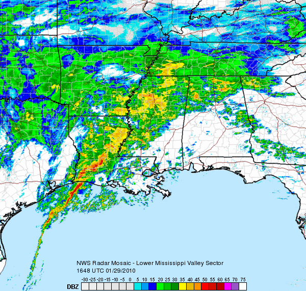
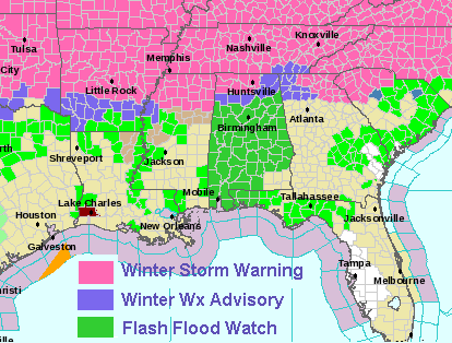
A major winter storm continues just north of the BHM area today. Look at the huge area of winter storm warnings from Oklahoma to North Carolina. Sleet has been reported, along with some icing, in parts of north and northwest Alabama this morning (see James’ posts below), and there may be some icy roads, especially bridges and hilltops, this afternoon and evening over north Alabama, mainly north of a line from Hamilton to Cullman to Cedar Bluff. Please drive carefully if you have to drive at all in north Alabama! The temperature at UAH right now is 31.
There are several competing factors going on to determine the temperatures at the ground and aloft, and the precipitation type. We have cold air moving in on NE winds at the ground, with temperatures in the 20s in Nashville. However, at 850 mb (4,000 feet), we have SW winds bringing in warmer air. This is why some sleet has occurred today. The precipitation melts on the way down, and then refreezes in the shallow, cold air near the surface.
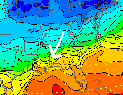
Surface temps and NE winds at 6 pm
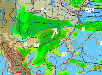
850 mb temps and SW winds at 6 pm
Once precipitation starts to fall, more happens. Raindrops’ evaporating causes cooling, and snowflakes melting do the same. Once it starts raining in BHM, our temperatures will drop into the 30s, but no travel problems are expected here. Also, the raindrops that fall from the warmer air aloft transport warmth to the ground. Even if it is 35 at the ground, 40 degree raindrops falling, once the air is saturated, will warm the air up some.
With so many competing things going on, it is nearly impossible to know exactly where sleet, freezing rain, snow, and rain will fall. We have to rely on computer models doing these calculations, and adjust according to observations. Take a look at the NAM model time-height section of temperatures at Cullman through noon tomorrow.
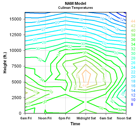
Notice the area of temperatures in the lower 40s tonight near 5,000 feet? Raindrops falling from there should warm the air enough near the surface, at least over all but the northern 1/4 of Alabama, to keep temperatures above freezing, and help us avoid icing. It will be difficult hour-by-hour in Florence, Moulton, Decatur, Cullman, Huntsville, Albertville, Fort Payne, and NE Alabama, as mountain ridges may see more icing than low spots, and it will be difficult to tell when enough warm air comes in aloft to change the precip over to rain.
The bottom line is that we expect about 1″ of rain in BHM this afternoon through tomorrow morning, and it could end as light snow flurries tommorrow afternoon. No travel problems expected. In north Alabama, there are some travel issues already, and it may get worse this afternoon and tonight before it gets better, especially on bridges and mountaintop roads.



