UPDATE 2:55 PM
The NWS Huntsville continues the flash flood warning for parts of Cullman and Morgan Counties until 315 pm.
Rain is moving back into Cullman Counties from the west at this time but it is not heavy.
Additional heavy rain is possible later today and tonight.
ADDITIONAL REPORT
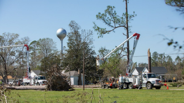
Tree reported down in Baileyton earlier with road completely blocked. On Bryant Road. Probably cleared by now…but just another reminder of it doesn’t take much to take down drought weakened trees especially when the ground is saturated.
ORIGINAL POST
Radar estimates indicate over 1.5 inches of rain has fallen from southern Cullman northeast through eastern sections of the city to areas north of AL-157 west of Pleasant View.
Flooding could be occurring or is imminent.
Remember the main rule for flooding survival: Turn Around, Don’t Drown!
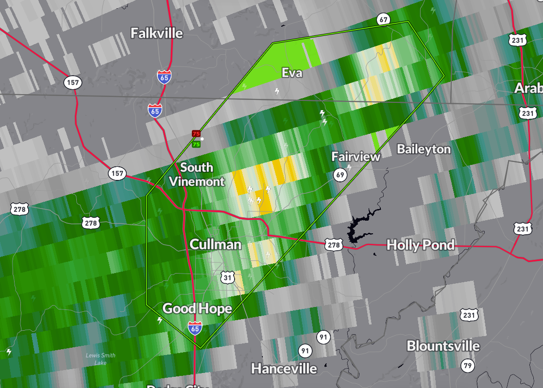
The National Weather Service in Huntsville has issued a
* Flash Flood Warning for…
North Central Cullman County in north central Alabama…
Southeastern Morgan County in north central Alabama…
* Until 315 PM CDT.
* At 1219 PM CDT, Doppler radar and automated rain gauges indicated
thunderstorms producing heavy rain across the warned area. Between
1 and 3 inches of rain have fallen. The expected rainfall rate is
1 to 3 inches in 1 hour. Flash flooding is ongoing or expected to
begin shortly.
HAZARD…Flash flooding caused by thunderstorms.
SOURCE…Radar and automated gauges.
IMPACT…Flash flooding of small creeks and streams, urban
areas, highways, streets and underpasses as well as
other poor drainage and low-lying areas.
* Some locations that will experience flash flooding include…
Cullman, Good Hope, Baldwin, Vinemont, Eva, Phelan and Ryan
Crossroads.