


That’s a potent little storm about 65 miles southwest of Hamilton at this hour.
It is moving northeast at 50 mph. It may pass just northwest of Hamilton, but it could affect the city and surrounding areas directly just as easily. It will most certainly affect northwestern Marion and Franklin Counties.
I am concerned that this storm and potentially later ones will find enhanced conditions for large hail over parts of Northwest Alabama.
Here is the CAPE (or instability) map for the hail growth region aloft.
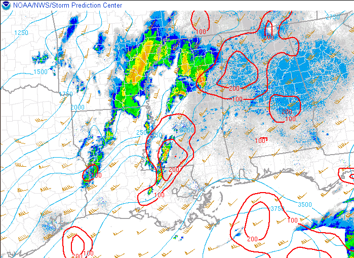
As you can see, there is an area from Haleyville to Gordo to Birmingham and back to the northwest where CAPE In the hail growth part of the atmosphere is at least 200 k/kg2. Much of North Alabama is in a region that is favorable for large hail overnight.
No warnings right now in Alabama or Mississippi.
A severe thunderstorm watch does continue until 5 a.m. for the western half of Central Alabama.



