


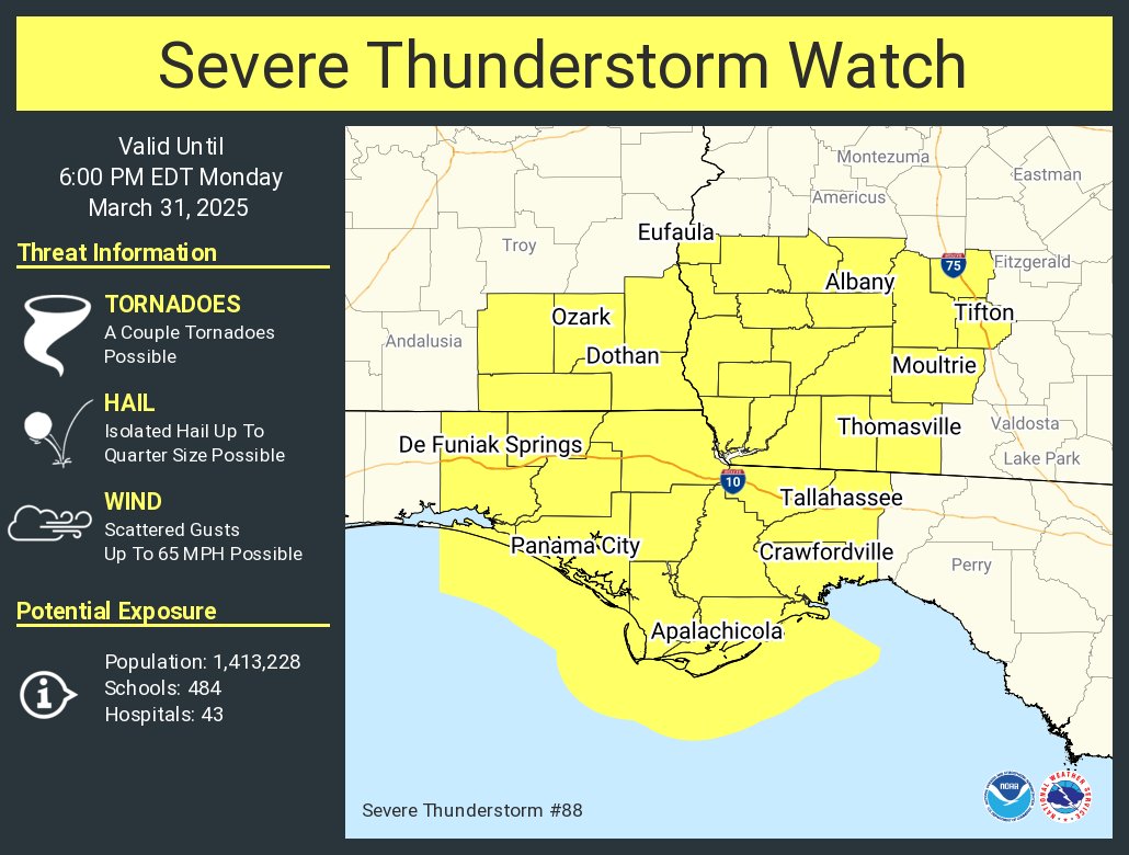
Here is the information on this severe thunderstorm watch from the SPC:
   The NWS Storm Prediction Center has issued a

   * Severe Thunderstorm Watch for portions of
     Far Southeast Alabama
     Florida Panhandle
     Southwest Georgia
     Coastal Waters

   * Effective this Monday morning and evening from 1150 AM until
     600 PM EDT.

   * Primary threats include...
     Scattered damaging wind gusts to 65 mph possible
     A tornado or two possible

   SUMMARY...A squall line will move into the Watch from the west and a
   risk for scattered damaging gusts (55-65 mph) may accompany more
   intense portions of the line.

   The severe thunderstorm watch area is approximately along and 80
   statute miles north and south of a line from 60 miles northwest of
   Panama City FL to 25 miles south of Moultrie GA. For a complete
   depiction of the watch see the associated watch outline update
   (WOUS64 KWNS WOU8).

   PRECAUTIONARY/PREPAREDNESS ACTIONS...

   REMEMBER...A Severe Thunderstorm Watch means conditions are
   favorable for severe thunderstorms in and close to the watch area.
   Persons in these areas should be on the lookout for threatening
   weather conditions and listen for later statements and possible
   warnings. Severe thunderstorms can and occasionally do produce
   tornadoes.



