


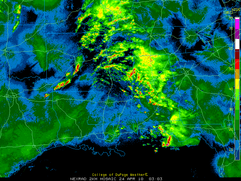
Rain and thunderstorms continue over the western half of Alabama tonight.
The overall intensity of the storms has weakened, but they are still putting out lots of lightning and heavy rain.
Since the storms are elevated in nature, meaning their bases are higher than ordinary storms, they can produce some really loud thunder.
The heaviest activity at this hour is over Monroe Co Mississippi extending into western Marion County and over Fayette County near the city of Fayette. Intense lightning around Fayette and a good bit of lightning from west of Jasper down to near Centreville.
The storms weaken as they move east because the airmass is drier and instability weaker. But warm, moist air continues to pour into areas to our west and this will set the stage for a day of severe weather on Saturday as it moves into Alabama.



