


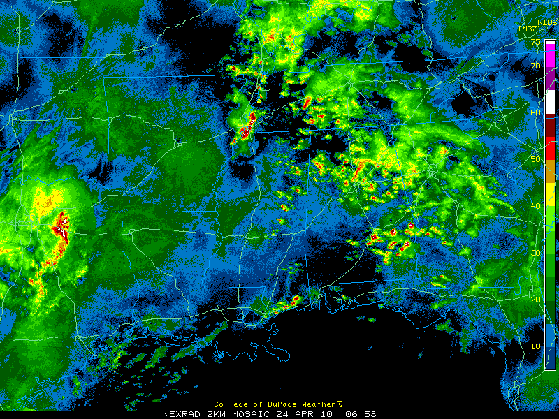
Strong thunderstorms continue early this morning over South Central Alabama from just south of the Montgomery area over to southwest of Eufaula. Severe thunderstorm warnings have been in effect for some of these storms.
Storms and rain continue over North Central Alabama early this morning from Fayette/Lamar/Marion Counties into Winston/Walker, Blount/Jefferson, as well as St. Clair and Talladega Counties.
Moderate rain and some thunder continues over Northeast Alabama’s DeKal, Cherokee, Calhoun, Cleburne and Randolph Counties.
Showers and storms were increasing over eastern Mississippi at this hour and will affect western Alabama during the pre-dawn hours. This activity is in association with the increasing warm air advection pattern setting up ahead of our strong spring storm system. Watches could be required as this activity heats up.
Further to the west, the SPC is busy posting tornado watches from eastern Texas through Louisiana that are in addition to the watches over Arkansas, Tennessee and northern Mississippi.
The SPC has also placed much of Alabama in a Moderate (or enhanced) severe weather outlook for today with much of Northern and Central Alabama in a high risk outlook, their highest categorical severe weather forecast.
It is going to be a busy day with lots of dangerous weather. Review your safety plans now and be prepared in case warnings are issued for your location.



