


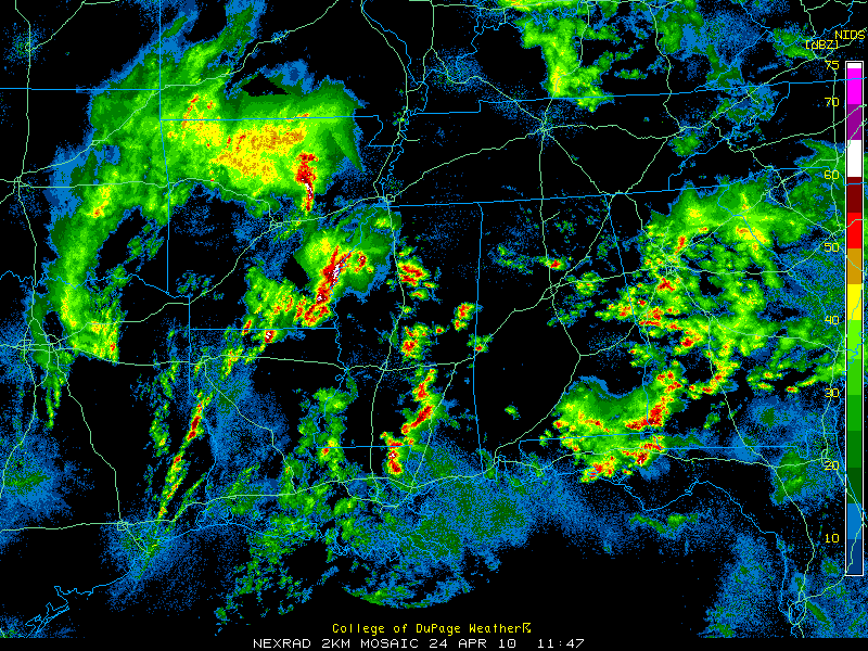
Lots of people waking up this morning and saying, “Oh the radar doesn’t look bad. It’s not going to do anything.”
Listen folks. This event hasn’t even gotten started. The storms last night and early this morning are the warm up act.
You might even see the sun come up some later this morning. That is not good. That is very bad.
That susnhine will only serve to heat up the atmosphere and drive instability values higher. So when someone says, “Oh look, the sun’s coming out, the weather must be getting better,” you will know differently.
This morning, storms will develop to the west of Alabama and move our way. You can already see really strong storms near the Mississippi River and south of Oxford back in Mississippi.
This is a particularly ominous situation, because unlike many recent systems, this one will arrive at the peak heating part of the day, not in the middle of the night when they are generally weakening.
The last high risk that was issued for Alabama on the 06Z severe weather outlook was March 1, 2007. Do you remember what happened that day? The Enterprise Tornado. 9 people died. There were a couple of really bad tornadoes that day.
High risk outlooks are rare. There were only a total of two high risk days last year across the country, and five in 2008 and five in 2007.
The SPC only issues high risk outlooks when there is a particularly dangerous severe weather event expected.



