


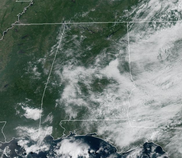
ROUTINE AUGUST WEATHER: Today through Sunday, afternoon highs will be in the upper 80s and lower 90s, which is right at average for this time of year. Each day will bring the chance of some afternoon and evening showers and storms, but rain chances are less than 30% today through Saturday, meaning some spots will get rain, while most spots will remain dry. Rain chances will be a bit higher on Sunday, closer to 50%, as showers and storms become more scattered in nature.
BIRMINGHAM ALMANAC: For August 7th, the average high for Birmingham is 91° and the average low is 72°. The record high is 103° set in 1935, while the record low is 58° set in 1950. We average 0.15” of precipitation on this date and the record value is 2.58” set in 1952.
NEXT WEEK: To start the week, temperatures will not change much, upper 80s to low 90s, but towards the end of the week, heat levels look to climb into the low to mid 90s as the upper ridge begins to rebuild across the Deep South. Rain chances for the first half of the week will be above average, 50-60%, but will decrease for the second half of the week as showers and storms become more isolated due to the strengthening ridge.
IN THE TROPICS: The National Hurricane Center continues to monitor three features, but none are a threat to Alabama or the U.S.
DEXTER: Tropical Storm Dexter has become post-tropical, meaning it is not longer tropical. At 1100 AM AST, the center of Post-Tropical Cyclone Dexter was located near latitude 41.4 North, longitude 50.4 West. The post-tropical cyclone is moving toward the east-northeast near 17 mph and this general motion is expected to continue during the next few days.

Maximum sustained winds are near 60 mph with higher gusts. Dexter is expected to continue strengthening as an extratropical low through early Friday. The cyclone is forecast to weaken beginning late Friday and Saturday. Tropical-storm-force winds extend outward up to 185 miles from the center. The estimated minimum central pressure is 998 mb (29.47 inches).

Elsewhere, off the Southeastern United States, a A weak area of low pressure located a couple of hundred miles off the coast of the southeastern United States is producing minimal shower and thunderstorm activity. Some slow tropical or subtropical development is possible over the weekend while the system moves northward to northeastward, remaining well off the east coast of the United States. By early next week, the low is expected to become extratropical, ending its chances for tropical development. Formation chance through 7 days…low…30 percent.
In the Central Tropical Atlantic (AL96) is a tropical wave over the central tropical Atlantic is producing disorganized shower activity. Environmental conditions are forecast to become more conducive for gradual development in a few days, and a tropical depression could form late this weekend or early next week while the system moves west-northwestward to northwestward across the central tropical and subtropical Atlantic. Formation chance through 7 days…medium…60 percent.
The next names up are Erin and Fernand.
WORLD TEMPERATURE EXTREMES: Over the last 24 hours, the highest observation outside the U.S. was 123.3F at Basrah International Airport, Iraq. The lowest observation was -91.7F at Dome A, Antarctica.
CONTIGUOUS TEMPERATURE EXTREMES: Over the last 24 hours, the highest observation was 119F at Mohawk, AZ. The lowest observation was 26F at Peter Sinks, UT.



