ALABAMA THIS MORNING
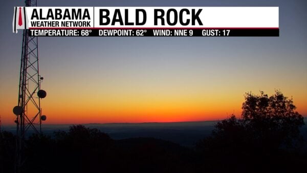
Clear skies dominate across Alabama at daybreak, with only patchy fog noted in a few northeast valleys. Temperatures are mostly in the low 60s across the north, mid 60s through central counties, and upper 60s to near 70 in the south. Conditions remain calm and pleasant to start this final Sunday of September, with another warm and mostly sunny afternoon ahead.
DANCING WITH THE STATS
Richmond, VA soaked up 2.18 inches of rain on Saturday, edging past the old daily record of 2.05 inches set in 1985.
NATIONAL OUTLOOK
SHOWERS LINGER ALONG THE SOUTHEAST COAST
A stalled front near the Southeast coast will keep showers and thunderstorms going from Florida through the Carolinas today. Localized flash flooding is possible where heavier bands set up. Tropical Depression Nine is tracking north through the Bahamas—full tropical update coming below.
FLASH FLOOD RISK IN THE SOUTHWEST
Another day of widespread storms will impact New Mexico, far West Texas, and southern Colorado, fueled by deep tropical moisture. Heavy rainfall rates could quickly overwhelm burn scars, slot canyons, and other flood-prone terrain. A marginal severe threat also exists for gusty winds and hail.
HEAT HOLDS IN THE PLAINS AND GREAT LAKES
From the central Plains through the Upper Midwest and into the Northeast, temperatures will run 10 to 20 degrees above average. Highs reach the 70s and 80s, with pockets near 90 in the nation’s midsection. Cooler readings linger in areas stuck under clouds and showers.
PACIFIC SYSTEM ARRIVES MIDWEEK
The Southwest begins to dry out Monday as the upper low departs, but attention then shifts to the Pacific Northwest. A new front pushes inland by Tuesday, spreading showers across Washington, Oregon, and into the northern Rockies through midweek.
NATIONAL HIGH AND LOW TEMPERATURE
The nation’s high on Saturday was 103° at Death Valley, CA. The lowest temperature was 23° at two locations: west-southwest of Mackay, ID, and northeast of Kirk, OR.
ALABAMA WEATHER FORECAST
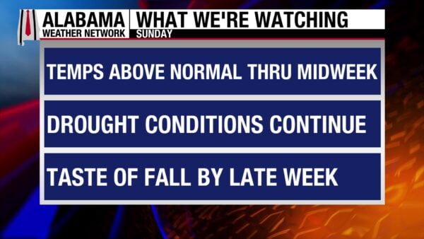
SUNNY AND WARM TODAY
High pressure keeps skies mostly sunny and conditions dry across Alabama. Afternoon highs climb into the mid to upper 80s, with a few low 90s possible in the southwest. Patchy fog lingers along rivers early this morning but fades quickly after sunrise.
QUIET TONIGHT
Clear skies and light winds will allow for a calm night. Lows fall into the 60s statewide, coolest in the valleys and upper 60s to near 70 closer to the Gulf Coast.
MONDAY STAYS DRY FOR MOST
The ridge holds firm, keeping most of the state rain-free. A few isolated afternoon showers may pop up in east Alabama, but coverage will be limited. Highs again reach the 80s to near 90 in the south and west.
MIDWEEK TROPICAL INFLUENCE POSSIBLE
By Tuesday and Wednesday, attention turns to Tropical Depression Nine (likely Imelda) moving north of the Bahamas. While the system is expected to turn east, its moisture may brush northeast Alabama with low rain chances. Elsewhere remains mainly dry, with highs in the low to mid 80s north and upper 80s south.
EXTENDED OUTLOOK
Late week brings cooler air as high pressure builds down the Appalachians. Highs drop into the low to mid 70s north and upper 70s to low 80s south by Thursday and Friday, with lows in the 50s inland. The weekend may bring slightly higher rain chances near the coast, while most of the state stays dry.
DROUGHT PERSISTS
With rain chances limited, drought conditions will continue across the state. Any meaningful relief depends on future tropical influences, which remain uncertain at this stage.
TROPICS
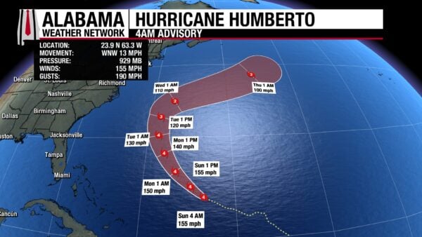
HURRICANE HUMBERTO THREATENS BERMUDA
Hurricane Humberto remains an extremely dangerous Category 4 storm this morning with maximum sustained winds near 155 mph and a central pressure of 929 mb. The hurricane is located about 585 miles south of Bermuda and is moving west-northwest at 13 mph. A turn to the north is expected Monday, taking Humberto close to Bermuda Tuesday night into Wednesday. Even if the center passes west, the island faces a 50% chance of tropical-storm-force winds, along with dangerous surf and rip currents reaching the U.S. East Coast beginning Monday.
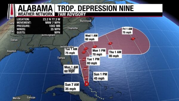
TROPICAL DEPRESSION NINE (SOON TO BE IMELDA)
Tropical Depression Nine is centered near the central Bahamas, moving north-northwest at 7 mph with top winds of 35 mph. It is forecast to become Tropical Storm Imelda later today and likely strengthen into a hurricane by late Monday or Tuesday. NHC guidance has shifted east in recent cycles, with most reliable models now keeping the center offshore of the Southeast U.S. coast. However, confidence is still limited, as small track changes could mean more direct impacts. Even if the system stays just offshore, heavy rainfall of 6–12 inches will drench the Bahamas, with 2–4 inches (locally up to 7) possible along the Carolina coast into Wednesday.
BEACH
Sunny skies, warm surf, and highs in the upper 80s set the stage for a classic late-September beach day along the Alabama and Florida Panhandle coast. Water temperatures sit in the mid-80s, with surf around 1 foot and a low rip current risk — great for relaxing by the shore. The UV Index is very high, so sunscreen is a must. Conditions stay friendly for now, but look for stronger winds and higher rip current risks as the week goes on.
FUNK BRUNCH AT SLOSS FURNACES IN BIRMINGHAM
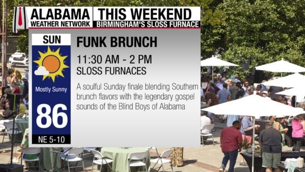
Today from 11:30-2 pm, enjoy Gospel Bird at the Sloss Furnaces National Historic Landmark — a soulful celebration where food, music, and culture collide. Honoring the Southern tradition of Sunday communal feasts centered around fried chicken, Funk Brunch blends flavors, sounds, and community spirit in an unforgettable experience.
WEATHER HISTORY
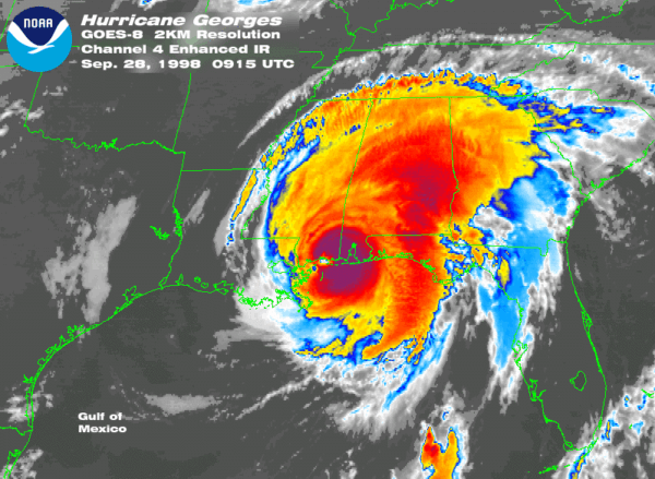
HURRICANE GEORGES (Sept 28, 1998):
Hurricane Georges made its seventh and final landfall near Biloxi, Mississippi, as a Category 2 storm with winds near 110 mph and a central pressure of 964 mb. Along the Alabama coast, storm surge reached 7–12 feet, with an 8.94-foot crest at the Mobile State Docks that flooded the Causeway and forced I-10 to close at the Florida line. Widespread freshwater flooding followed, highlighted by a remarkable 38.46 inches of rain at Munson, Florida. Georges also spawned more than 40 tornadoes, including nine in Alabama and an F2 near Live Oak, Florida. While the U.S. toll was limited to one drowning in Mobile County, the basinwide death toll soared to 615, most of them in Hispaniola, underscoring the storm’s devastating reach.
WEATHERBRAINS