


MILD DAY: Temperatures are in the 70s across Alabama this afternoon with a sunny sky. Tonight will be fair and cool with lows in the 40s and 50s.
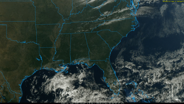
Alabama’s weather won’t change much tomorrow; the sky will be partly to mostly sunny with a high in the 70s.
RAIN RETURNS: An approaching cold front will bring showers and thunderstorms back to Alabama Friday and Friday night. SPC has introduced a “marginal risk” of severe thunderstorms for the northern 2/3 of the state, and a “slight risk” (level 2/5) for the western half of the Tennessee Valley.
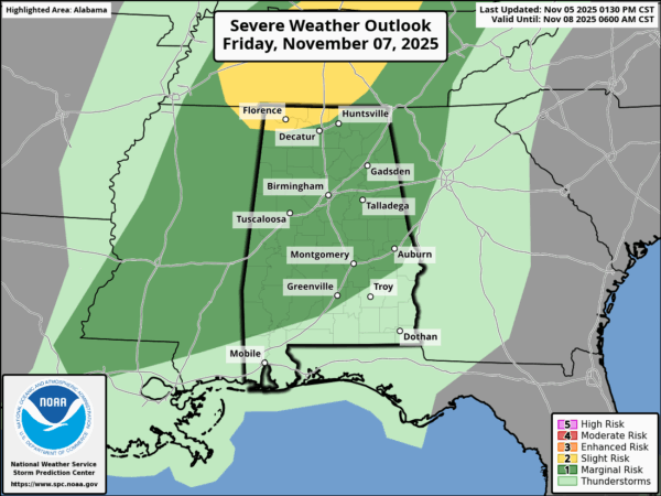
With modest instability and increased wind fields ahead of the front, a few storms could produce small hail and gusty winds Friday afternoon and Friday night. We do not expect a tornado threat. Unfortunately rain amounts will be generally 1/2 inch or less, not a drought buster. Temperatures reach the 70s again Friday.
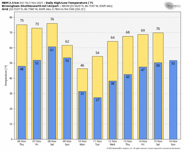
THE ALABAMA WEEKEND: The front will drift into South Alabama and fizzle Saturday. Most of the day will be dry with only isolated showers; the weather stays mild with highs in the 70s. Then, on Sunday, an Arctic front will move quickly through the state with a chance of showers late Saturday night into early Sunday morning. Behind the front north winds will ramp up to 15-25 mph with steady or falling temperatures over the northern half of the state.
COLD: Monday will be a cold, blustery day with highs in the 40-47 degree range over the north/central counties… a gusty north wind will make it feel colder. Global models continue to hint at snow flurries across the northeast corner of Alabama Monday; no accumulation or impact. Best chance of seeing a few snow flakes will be across higher terrain of Madison, Jackson, Marshall, and DeKalb counties.
By Tuesday morning we expect a clear sky, light wind, and a widespread freeze for all of Alabama except coastal communities. Most places will be in the 20s, ending the growing season.
The rest of the week will be dry with warming trend; highs will be in the 60s and low 70s by Thursday and Friday. See the video briefing for maps, graphics, and more details.
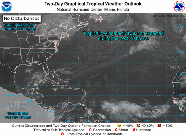
TROPICS: The Atlantic basin remains quiet and tropical storm formation is not expected for at least the next seven days.
FOOTBALL WEATHER: Saturday Auburn plays Vanderbilt in Nashville (3p CT kickoff)… with a partly to mostly sunny sky temperatures will fall from the low 70s at kickoff into the upper 60s by the final whistle.
Alabama will host LSU Saturday night at Bryant-Denny Stadium/Saban Field (6:30p CT kickoff). The sky will be mostly cloudy, and we will mention a small risk of a passing shower during the game. Temperatures will fall slowly through the 60s.
ON THIS DATE IN 2002: A tornado tore through the center of Abbeville, destroying homes and businesses and severely damaging the high school. One third of the buildings and homes in the town were damaged. Trees and power lines fell on city streets. Nearly the entire town was without electricity. A total of twenty people were injured. One man died when the tornado destroyed his home on Rock Hill Circle.
Look for the next video briefing here by 6:00 a.m. tomorrow…



