


Daily Weather Briefing
December 28, 2025
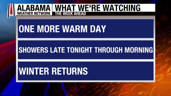

ALABAMA YESTERDAY
Saturday was another cloudy day, but highs still reached the low 70s north and upper 70s south. Some drizzle fell in north Alabama, but rainfall amounts were not measurable.
Katy McCain tagged James Spann in this picture of her dog digging a hole on the foggy Dauphin Island shore yesterday afternoon.
ALABAMA THIS MORNING
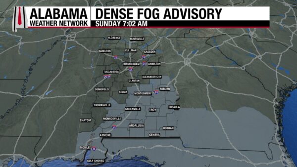
Fog persists in the southern areas of our state, with a Dense Fog Advisory in effect until 10 AM. North Alabama has stayed cloudy throughout the night. Temperatures are unusually warm this morning, sitting in the low to mid 60s as of 5:20 AM.
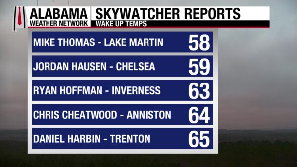
The Skywatchers are sending in observations in the upper 50s and mid 60s this morning.
Join the team! Learn how to become a Spann Skywatcher: https://www.spannskywatchers.com/
ALABAMA 7 DAY FORECAST
Today is the final day of above-average temperatures before a cold front moves through tomorrow morning, ushering arctic air into the state. Tuesday through Thursday will be cold and dry, before another cold front moves through between Thursday and Friday. It will become stationary producing rain Friday into Saturday.
GET OUTSIDE TODAY!
If you’re a warm-weather enjoyer, there is some bad news. Today is the last day of high temperatures in the 70s. Clouds will prevail throughout the day, and winds will pick up toward the evening. The upcoming week will be chilly, so if you haven’t gotten the chance to soak up the spring-like weather, your chance is now!
RAIN OVERNIGHT
Showers ahead of the cold front will enter the northwestern portion of the state between 11 PM and midnight, then move southeast overnight. Severe weather and thunderstorm potential are low, though a rumble may occur. There is a low potential for a stronger storm or two in northwest Alabama. Rainfall amounts will be small, as most of the state is expecting 0.1-0.25”. The main line of showers will be out of the state by around 7 to 8 AM, with a few showers lingering behind in southeast Alabama. Winds will be strong as some wind gusts are forecast to reach 45-55 mph, especially in northwestern Alabama.
COLD SETTLES IN MONDAY
The high temperature on Monday will be set around midnight. After the cold front, temperatures will only reach the upper 30s north, and 40s in central and south Alabama, despite the absence of clouds. Make sure to grab your winter coat and umbrella before leaving your house on Monday morning! Lows will fall to the 20s and low 30s across the state.
CHILLY TUESDAY
Tuesday morning will be frigid before temperatures rise into the upper 30s to upper 40s over the state. Skies will be clear once again.
SLOW WARM UP WEDNESDAY AND THURSDAY
Highs will slowly increase each day starting Wednesday, with highs climbing into the low to mid 50s. Thursday will see more improvement as highs will top out at the low 50s north and upper 50s and low 60s south.
SHOWERS FRIDAY AND SATURDAY
A weak cold front will enter the state Thursday through Friday and stall out in central Alabama. This stationary front will increase rain chances Friday through Saturday. Mid 50s to mid 60s are expected on Friday, and upper 50s to upper 60s are expected Saturday.
SOUTHEASTERN COAST EXPERIENCES WARMTH
The record-breaking warmth that has traversed the country over the past week has now arrived on the Southeast Coast. North Myrtle Beach, South Carolina, reached a high of 76 degrees, breaking the 1949 record of 75 degrees.
INTENSE WINTER STORM IN THE EAST
An intense low-pressure system will bring a multitude of weather impacts to the east as the week begins. The system gets its intensity from the interaction of strong arctic air from Canada and warm, moist air from the south.
This morning, snow has already fallen in the northern plains and rain/thunderstorms have impacted the central plains.
Today, the system is expected to rapidly intensify and move eastward. As that occurs, it will produce snow in the upper Midwest, becoming heavy this evening. The associated warm front will cause freezing rain to fall in the Northeast today and New England tonight. The Great Lakes area can expect rain and thunderstorms through the night.
Tomorrow, freezing rain will give way to just rain in New England, and the rain over the Great Lakes is forecast to turn into a blizzard. 2 feet of snow is expected along the shore of Lake Superior.
These conditions will make travel particularly dangerous, and extreme caution is advised.
END OF THE WARM SOUTH
The associated cold front with the low-pressure system will bring an end to the above-average warmth the south has been experiencing this past week. This cold front is called a “Blue Norther” and will bring strong thunderstorms to the Midwest, Ohio/Tennessee Valleys through Monday morning. The thunderstorms’ strength weakens as they approach the Deep South and Southeast.
QUIET WEST
Snowfall is expected to taper off today in the Rockies and Pacific Northwest, giving way to a much-needed quiet weather pattern in the West. The only impact expected through Tuesday is snow in southeastern New Mexico.
NATIONAL HIGH AND LOW
Rio Grande Village, Texas, reached a national high yesterday, hitting 94 degrees! The national low was hit in Maine again yesterday as well, falling to –18 degrees at Presque and Escourt Station.
LAST DAY OF GOOD BEACH WEATHER!
Today is your last chance to enjoy 70-degree weather and calm waters in December! Today, the rip current risk is low, and the surf height is around 1 foot. Highs will be in the 70s, and skies will be mostly sunny. Rain moves into the forecast overnight, then cold will be the story next week.
BIRMINGHAM BOWL
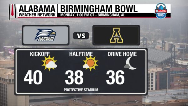
This Birmingham Bowl will take place at Protective Stadium on Monday at 1 PM CT. Appalachian State takes on Georgia Southern on a cold and windy afternoon. Temperatures will be around 40 degrees at kickoff, then fall to the 30s by the end of the game.
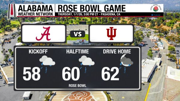
ROSE BOWL
The Tide takes on the Hoosiers Thursday at 3 PM CT in Pasadena, California. Overcast skies and periods of showers are in the forecast. Temperatures will rise from the upper 50s to the low 60s through the game.
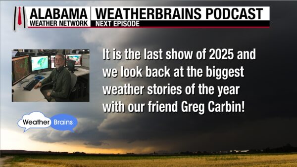
WEATHERBRAINS 1041:
The last episode of 2025 airs tomorrow, featuring our friend Greg Carbin and a recap of the biggest weather stories of the year!
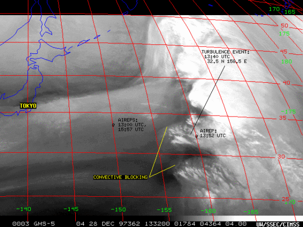
TODAY IN WEATHER HISTORY
December 28, 1997 – United Flight 826 Turbulence Disaster
On December 28, 1997, United Airlines Flight 826—a 747 en route from Tokyo to Honolulu—encountered two violent bursts of clear-air turbulence high over the Pacific. Clear-air turbulence is nearly impossible to detect and often strikes along the edges of fast-moving jet-stream winds. Satellite data later showed a powerful 135–155 knot jet streak crossing the flight path, helping create the unstable conditions. The aircraft suddenly shot upward roughly 100 feet, then plunged the same distance six seconds later, violently throwing unbelted passengers and crew through the cabin. One passenger was killed, 18 suffered serious injuries, and more than 160 others were hurt. Despite the chaotic cabin damage, the jet itself remained structurally sound, and the crew diverted safely back to Tokyo. Only one commercial airliner has crashed due to turbulence in the past 40 years, underscoring the rarity of an event this severe.
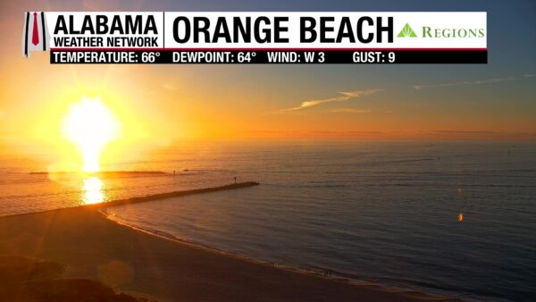
IMAGE OF THE DAY
A vibrant sunrise on Orange Beach greets early birds.



