


Daily Weather Briefing
Saturday, February 28, 2026
ALABAMA THIS MORNING
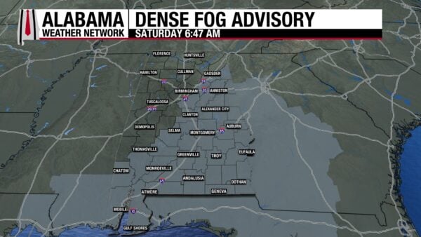
A Dense Fog Advisory stretches from the eastern portion of north-central Alabama to the south this morning. Travel could be difficult at times. It is in effect for the central areas until 8 a.m. and until 9 a.m. in the south. North and west Alabama, on the other hand, are under clear skies. Temperatures sit in the upper 30s and lower 40s through the northern half of the state and the mid 40s to low 50s in the southern half. A few pockets of cooler air are present in the south, where fog has cleared.
ALABAMA 7 DAY FORECAST
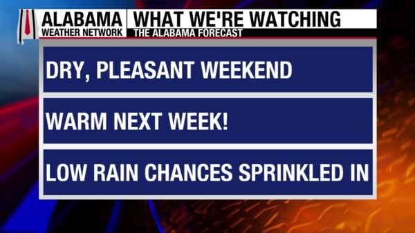
Mostly dry, quiet, and warm conditions are expected over the next week as upper-level ridging dominates the Deep South region. There is a low chance of showers from Sunday night to Monday morning in north Alabama. Low rain chances pop back into the forecast Friday.
DRY, WARM WEEKEND
Today will be a beautiful, spring-like day. Light winds, mostly clear skies, and highs ranging from the low to mid 70s from east to west will be great conditions for a walk or a picnic in the park. Clouds may linger in the south during the day.
Dry and mostly clear conditions tonight will allow for lows to fall to the mid to upper 40s from north to south-central Alabama. South Alabama will stay in the low 50s. Clouds begin to increase in the morning hours in the east.
Tomorrow brings in March with another pleasant day. Highs will climb to the low 70s north and mid to upper 70s from north-central to south Alabama. Low rain chances are present in the north Sunday night into Monday morning due to the passage of an upper-level shortwave. Everywhere else should stay dry.
WARM START TO MARCH
Monday and Tuesday will be very similar in conditions. Partly cloudy to mostly clear skies will dominate. Monday, highs will be in the upper 60s to low 70 north, and mid 70s to low 80s farther south. Tuesday, the 70s will stretch all the way into the north, but central and south Alabama will be limited to the upper 70s.
WARMER LATTER HALF OF THE WEEK
With nothing to disturb the upper-level ridge, temperatures will continue to climb next week. Wednesday through Friday will be quite warm.
Wednesday, highs will sit in the upper 70s to low 80s across the state.
Thursday is the same, with temperatures increasing by one to two degrees compared to Wednesday.
Friday will be the warmest day of the week, with highs in the upper 70s to low 80s north, low to mid 80s centrally, and mid to potentially upper 80s in the south! A low chance of rain returns to the area on Friday as well.
WORSENING DROUGHT CONDITIONS
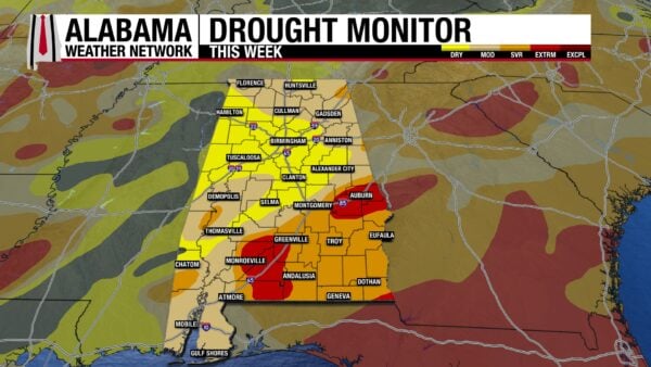
The drought conditions across Alabama have worsened over the past week. 13.38% of the state was drought-free last week, but now only 0.13% of the state remains drought-free. Meanwhile, the Abnormally Dry (D0), Moderate Drought (D1), and Severe Drought (D2) categories have seen an increase since last week. Most notably, Moderate Drought has increased by almost 10% since last week, now sitting at 38.84%. The Extreme Drought (D3) category still sits at 7.68% and none of the state is experiencing Exceptional Drought (D4).
BEAUTIFUL BEACH DAY
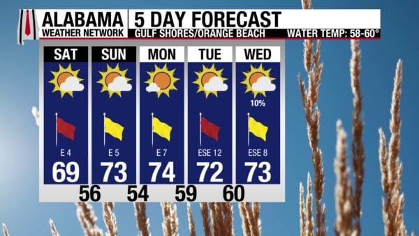
After an unsettled weather pattern this week, upper-level ridging will calm the Gulf Coast weather this week, and a gorgeous week is in store. Today, a high around 70 degrees, moderate UV Index, and winds around 5 mph will make the shores pleasant. Patchy dense fog this morning will give way to mostly sunny skies. The water will be calm, with a low rip current risk and surf height around two feet.
TODAY IN WEATHER HISTORY
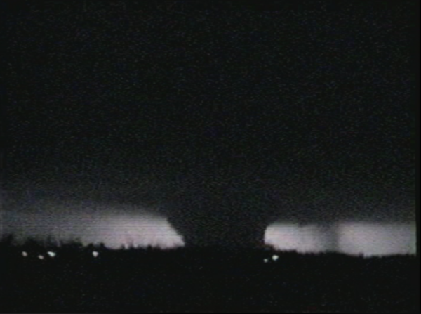
February 28, 2007 – The First EF4 Tornado
On February 28, 2007, a powerful tornado struck near Blue Mound, Kansas, becoming the first tornado rated EF4 on the then-new Enhanced Fujita Scale. The twister touched down at 7:30 p.m., crossing from Anderson County into Linn County. On its 24-mile path, it stretched 800 yards and caused extensive damage in rural areas. The complete destruction of a well-built farmhouse that was swept clean from its foundation was evidence of the storm’s extreme intensity. Vehicles were tossed, outbuildings demolished, and trees were shredded or debarked along the path. Only one residence was destroyed just north of Blue Mound. Fortunately, despite the violence of the storm, no fatalities occurred. Finally, the storm lifted around 8:10 p.m. north-northeast of Pleasanton. The tornado set the record for the earliest F/EF4+ tornado ever recorded in Kansas during a calendar year. It also marked the beginning of a deadly and historic multi-day outbreak that would continue into March across the southern United States.
IMAGE OF THE DAY
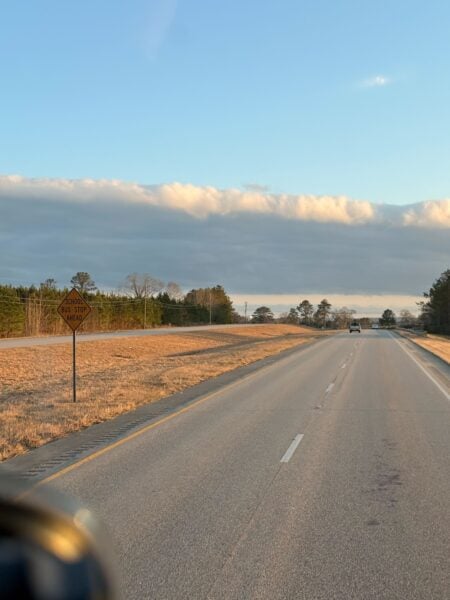
Skywatcher Steven Strickland sent in this cool stationary shelf cloud in Brantley yesterday.



