


Daily Weather Briefing
Sunday, March 15, 2026
ALABAMA THIS MORNING
This morning is calm and partly cloudy, with temperatures sitting in the upper 50s and lower 60s across the state.
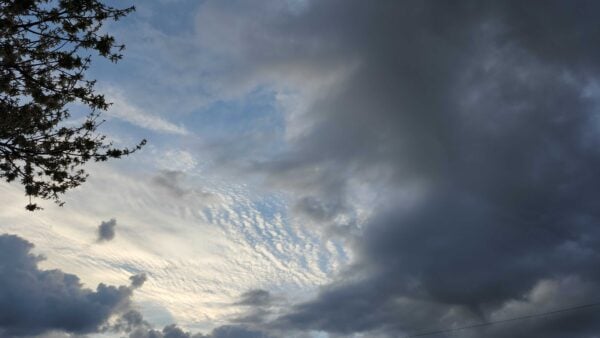
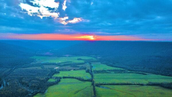
Skywatchers Sandra Kirkwood and Daniel Harbin provide beautiful content of the Sunday morning skies. Sandra’s picture is from New Market, and Daniel’s picture is from his drone in Trenton.
ALABAMA 7 DAY FORECAST
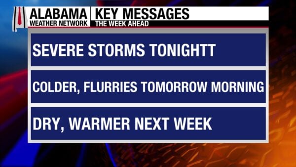
The state will experience a large range of weather over the next few days before a calm period begins in the latter half of the week. Today will be warm, windy, and partly cloudy, with the chance of a few isolated pop-up thunderstorms mainly in the south. Then a strong cold front will bring a squall line to the state tonight, and it will make its way through the state throughout the night. Severe weather is expected. Behind the front, an Arctic airmass brings temperatures down quickly, allowing for the chance of snow flurries in north and north-central Alabama Monday morning. Monday’s highs will be much cooler than they have been recently and will feel colder due to windy conditions. A freeze is expected Monday night through Tuesday morning. Tuesday will be cold as well until a warmer, calmer pattern begins to settle in on Wednesday and continues through Saturday.
SUNDAY WARMTH AND SHOWERS
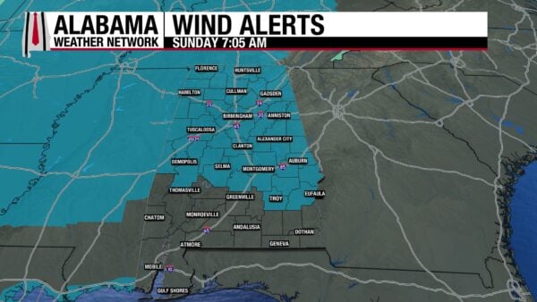
Today will be a partly cloudy day. Winds will be gusty ahead of tonight’s cold front, prompting a Wind Advisory for the northern two-thirds of the state today. Southwest winds will sustain at 10-20 mph and gust to 40 mph. The advisory will go into effect today at 1 p.m. CDT and expire Monday at 7 a.m. in the north and at 1 p.m. in central Alabama. Winds will be strong in the south, too, just not strong enough for a Wind Advisory for now. There is also a low chance for pop-up isolated thunderstorms, especially toward the south today, as daytime heating and increased moisture encourage shower development. They will not be severe if they develop. Highs will rise to the upper 70s north and lower 80s in central and south Alabama.
SEVERE WEATHER TONIGHT
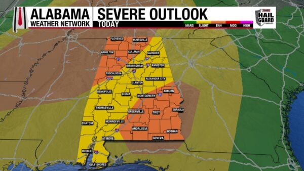
A strong cold front will enter the state at 9 p.m. tonight. Along the main line will be strong to severe thunderstorms with the main threat including damaging winds of 60-70 mph and embedded (in the line) spin-up tornadoes.
North Alabama: The Storm Prediction Center has placed most of north Alabama under an Enhanced Risk (Level 3/5) of Severe Thunderstorms tonight. The eastern corner of the north is under a Slight Risk (Level 2/5). The line of severe storms will enter the northwest around 9 p.m., then travel east/southeast throughout the night. By 12/12:30 a.m. tonight, the entire area will have received impacts from the main line of storms. The main concern in the north seems to be strong, damaging straight-line winds that can knock trees and power lines down, but an isolated, brief tornado cannot be ruled out. As the main line moves out of the north, cold air will rush into the state, and as lingering showers impact the area, the rain could transition to snow, causing flurries. There is even a chance for light accumulations of up to one-tenth of an inch (maybe a little more at higher elevations). Lows will fall to the low 30s in the northwest, mid 30s in the middle third of the north, and upper 30s in the northeast. But winds will still be gusty behind the front, so wind chills will be 5-10 degrees below the actual temperature.
Central Alabama: The northwest and southeast corners of the state are under the Enhanced Risk of Severe Weather tonight, while the other areas are in a Slight Risk. The main line will bring impacts to the northwest portion of the area starting at 10 p.m., while the southeast area will not see impacts until around 2 a.m. The areas north and west of the Enhanced Risk in the southeast can expect damaging straight-line winds as the line’s primary severe weather threat, with a lower chance of brief spin-up tornadoes. The southeast Enhanced Risk, on the other hand, has a chance to see thunderstorm cells develop ahead of the main line of storms. The environment here is conducive to supercell thunderstorm development, which could produce stronger and longer tornadoes. This isn’t a guarantee as the line could move quicker than expected, but it is a possibility. Once the main line hits, however, the same strong winds and lower tornado threat situation will be present in the southeast. The most northern portions of the area have a chance to see some flurries after the main line has passed, as showers continue behind it and temperatures plummet. No accumulation is expected as the ground will be too warm.
South Alabama: The southwestern half of Alabama is under the Slight Risk of Severe Thunderstorms, while the southeastern half is under the Enhanced Risk. The line will enter the southwest around 12 a.m., bringing strong straight-line winds and the potential for brief spin-up tornadoes. The southeast will see a similar situation of possible supercell thunderstorms and, therefore, potentially stronger and longer tornadoes as the southeast of central Alabama will see. It all depends on just how well that environment develops, but it is certainly something to be prepared for. These supercells could begin as early as 1 a.m., and the line will impact the area around 3 a.m. Temperatures will get cold behind the front in the southwest, but not enough for flurries, while the southeast will take longer to cool down.
Bottom Line: Severe weather is expected tonight. Damaging winds are the main threat for most of the state, while the tornado threat remains lower, and the environment is conducive to weak, short-lived tornadoes. The southeast does have a higher potential for stronger and longer tornadoes tonight. EVERYONE needs a reliable way to receive warnings, and if you live in a mobile home, plan to find a sturdy shelter for the night. The Alabama Weather Network will be live tonight, so you can stay informed and safe.
COLD BEGINS MONDAY
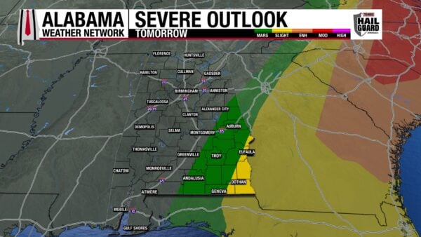
As the line of storms moves out of the area early Monday morning, it gives reason for a Slight Risk of Severe Thunderstorms to the most southeastern corner of the state and a Marginal Risk extending to southeast of Alexander City, east of Greenville, and just west of Andalusia. Storms move out, the residual showers dissipate in the late morning, and the day will be dry and cold. Highs will top out in the lower 40s north, mid to upper 40s centrally, and low to mid 50s south. The coast will sit in the upper 50s and lower 60s.
WINTER CONTINUES TUESDAY
Monday night into Tuesday morning spells out a statewide freeze as clear skies and calmer winds cause radiational cooling and very cold temperatures. Lows Tuesday morning will sit in the lower 20s north, upper 20s through central and south-central Alabama, and the lower 30s in the south. Despite clear skies, highs will only reach the mid to upper 40s north and the upper 40s to lower 50s centrally and in the south.
WARMING TREND BEGINS WEDNESDAY
Wednesday onwards will see an increase in highs every day through Saturday as a high-pressure regime settles in, and the airmass modifies.
On Wednesday, highs will reach the upper 50s east and lower 60s west.
Highs Thursday increase to the upper 60s east and lower 70s further west.
Temperatures like the ones we saw early last week return Friday, as upper 70s are expected north and east, and the south and west will hit the lower 80s.
Saturday will be in the upper 70s and lower 80s as well.
ANOTHER BEAUTIFUL BEACH DAY
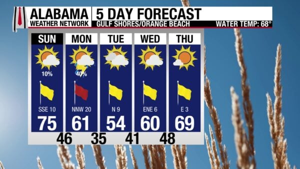
The calm before the storm is certainly the story for the coast today. The high will be in the mid 70s, skies will be mostly sunny, and the UV Index will be very high. It will be windy at times, with south winds hitting 10-15 mph. The rip current risk is low (although it will increase quickly this evening), and the surf height is only 1 to 2 feet. This beautiful day precedes a stormy night and a chilly start to the week, so make sure to get out there and enjoy the weather today!
WEATHERBRAINS 1052
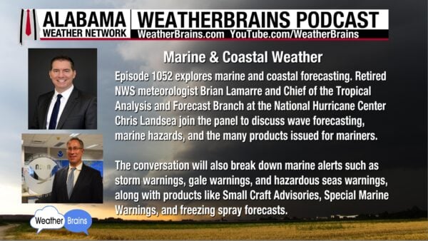
Tomorrow’s WeatherBrains episode features Brian Lamarre and Chris Landsea, marine and coastal weather experts. Marine products, wave forecasting, and marine hazards will be just a few of the many topics discussed. Listen anywhere you get your podcasts or watch the episode here.
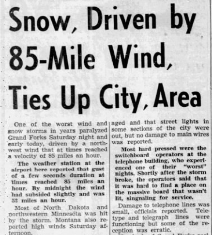
TODAY IN WEATHER HISTORY
March 15, 1941 – Ides of March Blizzard
One of the greatest blizzards in American history struck the northern plains on March 15, 1941. Forecasts that morning called for snow and cold temperatures, but there was nothing about blizzard conditions. Many people were out on the town that Saturday night when the temperatures suddenly dropped 20 degrees in less than 15 minutes. Winds picked up quickly and reached hurricane-force winds of 85 mph in Grand Forks, North Dakota. 10-to-12-foot snow drifts piled up outside people’s homes. Many people were traveling in cars or walking outside and were blown from their original place, and were found days after the event, sadly frozen to death. Over 100 people died from the storm, and the fierceness of the storm, combined with the lack of warning, caused a change in the US Weather Bureau. The public criticized the Chicago weathermen, who, although responsible for forecasting for the Midwest, seemed more preoccupied with the Chicago forecast. More independence was given to weathermen in the Red River Valley region from then on.

IMAGE OF THE DAY
Skywatcher Jordan Hausen sent in this absolutely breathtaking view of the sunrise in Gatlinburg this morning, saying, “The winds are brutal this morning”.



