


Daily Weather Briefing
Sunday, April 5, 2026
ALABAMA THIS MORNING
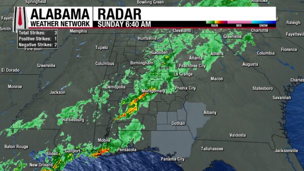
Showers and sub-severe thunderstorms have moved toward the southeast slowly this morning along the cold front that entered the state yesterday evening. Rain spreads from the northeast corner of the state to Alexander City, Montgomery, and to Monroeville, and south of Mobile. Huntsville to Birmingham and west is dry now. Southeast Alabama still awaits its rain, with Coffee, Dale, Henry, Geneva, and Houston Counties under a Dense Fog Advisory until 9 a.m. CDT. Cooler temperatures in the lower 50s are present in the north right now, while Gadsden and the northeast corner are still in the mid 60s. Central and south Alabama range from the mid 60s to low 70s.
ALABAMA 7 DAY FORECAST
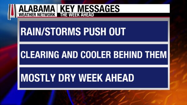
Showers are expected in southeast-central and southeast Alabama through this afternoon, while rain and clouds clear elsewhere. Cooler temperatures with the front are expected and winds will gust to around 20 mph. Lows will be in the 40s in the morning then most of Monday should be dry, with a few showers in the south possible. Tuesday will be dry despite a cold front pushing through during the day. A low chance of showers is present Wednesday and Thursday in the southern half of the state, while the north will continue its drier pattern. Temperatures will warm throughout the week, with Friday and Saturday returning to the 80s.
WET EASTER
Showers will continue to move southeast today, with clearing beginning into the north and spreading to central Alabama. Central and southwest Alabama will have a drizzly commute to church this Easter morning, while the north and southeast will manage a mostly dry morning. Southeast Alabama may even get away with a dry Easter Egg hunt, as showers from the cold front don’t begin in the area until lunchtime. The rest of the state should plan for Easter Egg hunts indoors. South Alabama will stay rainy through the afternoon, finally becoming dry by early evening. Highs will be much cooler than they have been over the past week as they will only hit the mid to upper 60s in the north and the low 70s across central and south Alabama. The shore and areas surrounding Geneva will stay in the mid to upper 70s. Winds will be breezy but not super strong with the front, only reaching to around 20 mph.
COLD TONIGHT
The new colder air and clear skies will help lows fall to low to mid 40s in the north, the upper 40s centrally, and the upper 40s to low 50s south.
MOSTLY QUIET MONDAY
The weather will be relatively quiet tomorrow. Skies will be clear, and highs will be in the upper 60s to around 70 degrees statewide. The only disturbance is the 10% chance of showers in south Alabama as a result of lingering moisture. Any showers will be very isolated and light in nature.
DRY COLD FRONT TUESDAY
Another cold front will push through the state on Tuesday, but it will bring little impact. No rain is expected, and temperatures will stay relatively similar after the passage. Highs Tuesday will hit the upper 70s north and the mid 70s centrally and in the south.
WINDY WEDNESDAY
Highs will sit in the low 70s in the east and mid 70s in the west Wednesday, and winds will be strong at times, possibly hitting around 30 mph. A low chance of rain returns for the southern half of the state as well.
NICE THURSDAY
Despite the lingering rain chance in the south, Thursday will be a nice day. Highs will sit in the mid 70s across Alabama, and winds will be much calmer.
WARMING FRIDAY AND SATURDAY
Temperatures will really begin to warm Friday and Saturday as a high-pressure system dominates the region. Highs Friday will teeter on the 78–80-degree line over all of Alabama. In the north Saturday, highs will be in the mid 70s, but everywhere else will hit the low 80s.
RAINY DAY
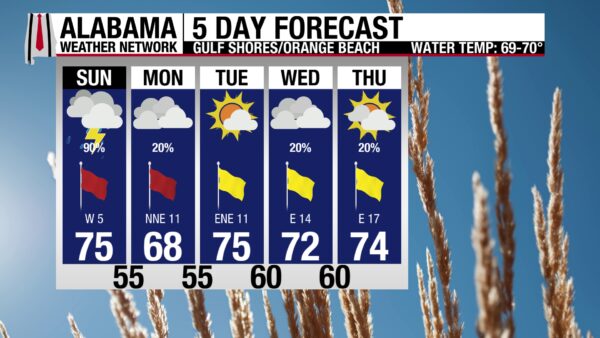
Showers and thunderstorms are expected on the coast for most of the day, keeping skies overcast and the UV Index low. The high will be in the mid 70s, and winds will blow from the southwest at 5 mph, then shift to the northwest this afternoon as the front pushes through the area completely. Another day of a high rip current risk is in store as well. Waters will be calmer for a few days this coming week, and conditions much drier.
WEATHERBRAINS 1055
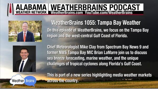
Tampa Bay weather experts Mike Clay and Brian LaMarre join the WeatherBrains to discuss all things Tampa Bay tomorrow! Listen to the episode wherever you get your podcasts or watch here.
TODAY IN WEATHER HISTORY
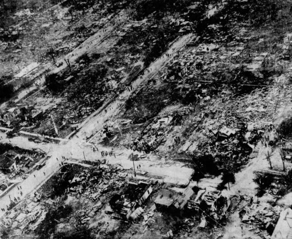
April 5, 1977 – The 1936 Tornado Outbreak
On April 5 and 6, 1936, northern Alabama was struck by two destructive F3 tornadoes as part of a larger outbreak across the Deep South that killed 446 people and injured well over 2,000. The deadliest tornado of the outbreak struck the northern half of Tupelo, Mississippi, as an F5, with a track 15 miles long and a maximum width of three-quarters of a mile. It killed 216 people and injured 700, with several entire families killed, including one with 13 members, and leveled roughly 48 city blocks. Temporary housing included about 150 box cars, and a local movie theater was converted into a hospital. In Alabama, the first tornado entered from Itawamba County, Mississippi, and crossed Franklin and Colbert counties, damaging or destroying about 30 homes near Red Bay, killing four people in homes, three at a service station, and one near Frankfort, and injuring 55 along its 25-mile path in the state. Later that evening, a second F3 tornado touched down in Lauderdale County, moved across Limestone and Madison counties, and crossed into Lincoln County, Tennessee. In Alabama, it remained on the ground for 35.7 miles, reached a maximum width of 200 yards, killed four people near Elkmont, and injured four others near Rogersville. Combined with its impacts in Tennessee, the second tornado caused a total of five deaths and thirteen injuries. The following day, the system produced more violent tornadoes in Gainesville, Georgia, killing 203 and injuring 934.
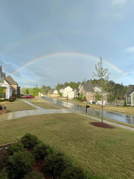
IMAGE OF THE DAY
Skywatcher Andy Klein captured a vibrant rainbow in Helena after a quick evening shower yesterday!



