


Daily Weather Briefing
Sunday, April 19, 2026
ALABAMA THIS MORNING
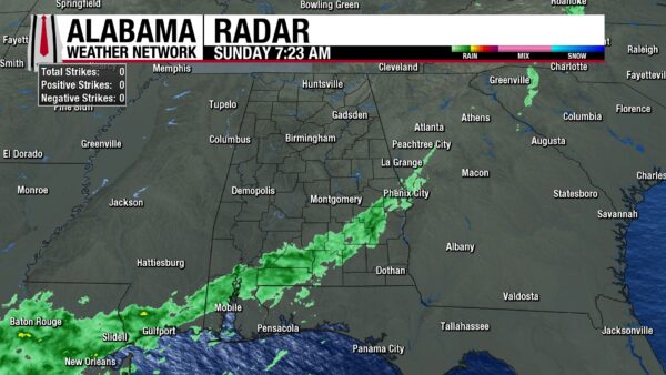
It’s been or will be a rainy morning for most of south Alabama as a line of light showers stretches from Phenix City to north of Mobile. North and west of this line is dry, and clouds linger in the sky. Southeast Alabama awaits the showers that will push through the area later this morning. Clouds envelop the area as well. North Alabama to Clanton sits in the mid to upper 40s as the cold air behind the front rushes in. From Slema to Atmore, temperatures sit in the low to mid 50s, while the southeast (Eufaula, Dothan, and Geneva) is recording temperatures in the 60s.
ALABAMA 7 DAY FORECAST
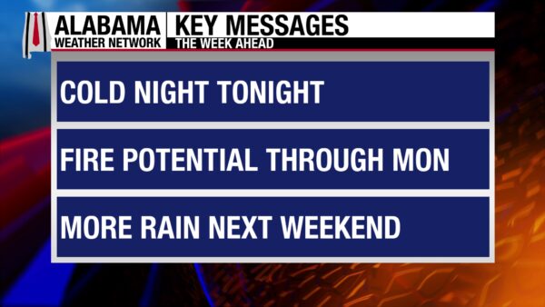
The cold front’s showers will push through the southeast through the rest of the morning, then the entire state will be dry, windy, and cool. Near-critical fire conditions will be present for Alabama, and extreme caution should be used around open flames. Fire conditions are exacerbated tomorrow as relative humidities drop, winds stay gusty, and temperatures warm. A dry warming trend is expected throughout the week until Friday, when another cold front approaches the state and brings showers ahead and with it. Thunderstorm chances are 60% in the north and 40% in the south on Saturday.
COOL, WINDY SUNDAY
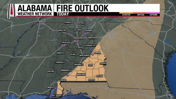
North and central Alabama are already done with their turn with the rain today and will spend the day drying out. North Alabama will see wind gusts at 25-30 mph and clearing skies. The gusts will advect in dry, cool air, and temperatures will only reach the mid to upper 60s. Central Alabama is similar, with gusts reaching 25 mph and highs hitting the upper 60s and lower 70s. South Alabama will see the light showers continue southeastward through the morning. Rain should move out of the southeast corner of the state by mid-afternoon. Winds will gust from 20-25 mph in the area, and highs will stay in the 69–71-degree range. Fire is a concern for all of the state, as the rain did little to actually wet the ground, and the strong wind gusts. The Storm Prediction Center has highlighted much of southeast Alabama as an area of Elevated (1/3) Fire Weather concern today. Caution should be used around open flame, and no burning is advised.
COLD NIGHT
The heavy coats are still needed, as clear skies and the dry airmass will allow lows to fall to much lower than what we’ve seen recently. From north to south-central Alabama, low temperatures are expected to be in the low to mid 40s. South Alabama will hit the upper 40s and lower 50s. The potential for a quick spreading fire dwindles somewhat overnight, but not completely.
FIRE CONCERNS MONDAY
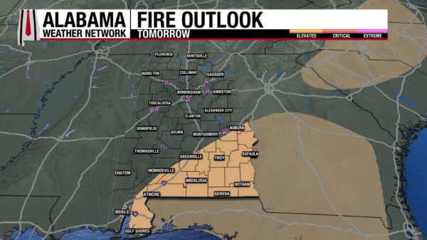
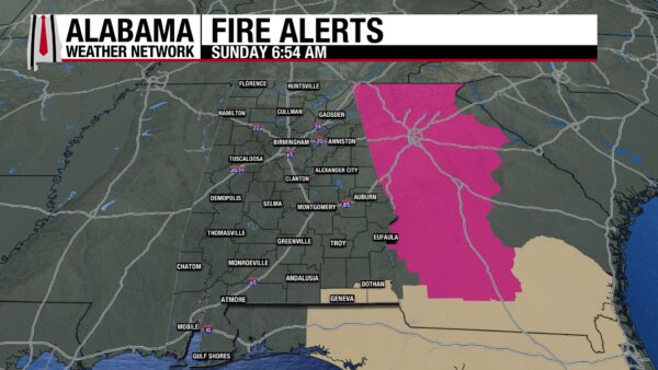
Fire concerns are most elevated tomorrow, as relative humidities continue to drop, and winds gust from 10-15 mph across the state. The concern is greater in the south, and a Fire Weather Watch is in place for Geneva and Houston counties from Monday morning to Monday evening. Additionally, parts of southeast Alabama are under an Elevated Fire Weather concern by the SPC. Again, caution should be exercised, and burning should be avoided. Temperatures begin to increase, and highs will range from the mid to upper 70s in the north to the upper 70s and around 80 degrees centrally and in the south.
WARMING TUESDAY THROUGH THURSDAY
The main story from Tuesday through Thursday will be warming temperatures. Fire will still be on the mind, but calmer winds will settle the threat somewhat. Highs Tuesday will see the return of low 80-degree temperatures across the entire state. The exception lies with Cullman and Gulf Shores, which expect a high of 78 degrees. Wednesday will see mostly low 80s once again, with a few locations attempting the mid 80s. By Thursday, the mid 80s span across the state.
ANOTHER COLD FRONT TO END THE WEEK
Friday will see the approach of another cold front to the state. High temperatures in the north begin to decrease into the upper 70s ahead of the front, while central and south Alabama stay in the low to mid 80s. A low chance of showers and thunderstorms exists in the north Friday afternoon. Then, rain chances spread to central and south Alabama Saturday. As the system moves through on Saturday, highs will only reach the upper 70s and lower 80s statewide. It is too far in advance to determine specific timing and impacts, but the system is being monitored for severe weather potential over the next few days.
GLOOMY ON THE COAST
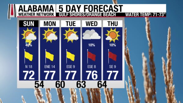
After a long stretch of sunny skies and good beach weather, today will be a bit of a shock. Skies will be overcast until late afternoon, and there is a 40% chance of showers and thunderstorms as the cold front attempts to move out of the state. Winds will be breezy as well, reaching 20-25 mph. Instead of a high in the upper 70s, only the low 70s will be realized today. Despite the poor conditions, the rip current risk is still low, and the surf height is only 1 to 2 feet. These calmer waters are due to the fact that winds are blowing from the north. Southerly winds are usually the ones to stir up the waters.
WEATHERBRAINS 1057
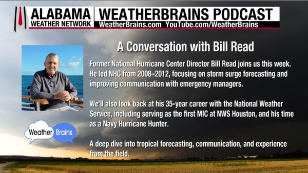
Join Bill Read and the WeatherBrains team tomorrow as they discuss his time as National Hurricane Center Director, as an MIC with the NWS, and as a Navy Hurricane Hunter. Listen to the episode wherever you get your podcasts or watch here.
TODAY IN WEATHER HISTORY
April 19, 2024 – Rare Alaskan Tornado
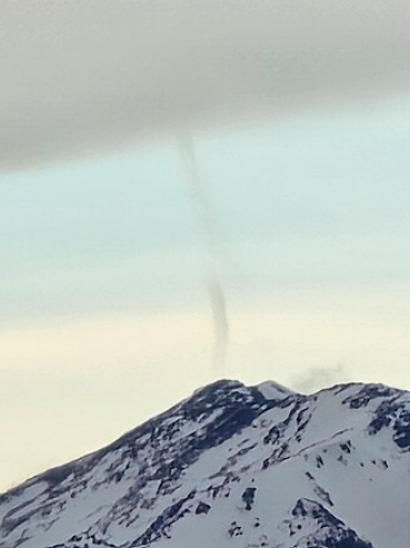
A rare tornado was observed near Rusty Point, Alaska, on April 19, 2024, when a member of the public in Anchorage reported seeing a brief vortex in a region where tornadoes are uncommon. The tornado was classified by the National Weather Service in Anchorage as a weak landspout that formed beneath a lenticular cloud positioned over a nearby mountain peak. With no radar coverage available to assist in diagnosing the event, meteorologists determined that localized terrain effects likely played a key role in its development. Downsloping winds, enhanced by south and southeasterly flow, likely created an area of wind shear across the topographically varied landscape, and this rotation was lifted vertically by upslope winds, allowing the landspout to form. Although the tornado was short-lived and caused no reported damage, the event was notable because it demonstrated that even in Alaska, where tornadoes are extremely uncommon, the right combination of terrain and wind patterns can briefly produce a tornado.
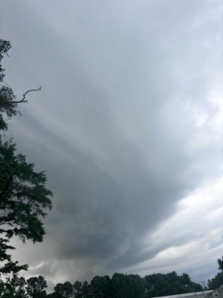
IMAGE OF THE DAY
Skywatcher Ivy Hale captured an awesome shelf cloud in Bremen yesterday!



