


Daily Weather Briefing
Saturday, April 25, 2026
ALABAMA THIS MORNING
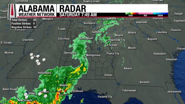
Showers and thunderstorms stretch from northeast to southwest this morning. The thunderstorms in the southwest have been strong, prompting a Special Weather Statement for Mobile County, in effect until 8:15 a.m. CDT. The showers further north are quieter and haven’t prompted any statements or warnings. Over the past twelve hours, Chatom has received the most rainfall, coming in at a measurement of 1.7”. Clouds envelop the entirety of Alabama, and temperatures sit in the mid 60s in the north and centrally and the mid to upper 60s in the south.
ALABAMA 7 DAY FORECAST
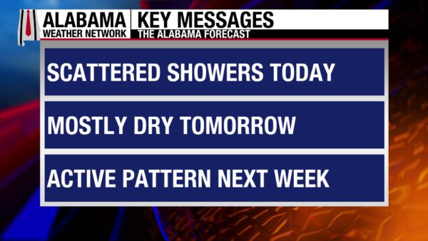
Scattered showers and thunderstorms are the main story across the state after this morning’s widespread showers move out. Tomorrow, rain chances will be even more isolated as dry air behind the cold front that drove last night’s storms pushes into the state. Monday will be mostly dry as upper-level ridging attempts to take place over the eastern U.S., but rain and severe weather chances increase Monday night. Scattered showers and thunderstorms will be the pattern through Friday, and Tuesday will feature another chance of severe weather. The weather pattern has certainly turned active very quickly.
SCATTERED STORMS SATURDAY
After this morning’s widespread showers finally move out of the state, the pattern will shift to a more scattered thunderstorm situation. Any portion of the state has a chance for sub-severe pop-up thunderstorms this afternoon. Regardless of storms, the state will be cloudy, and highs will only reach the mid to upper 70s in the northern half of Alabama and the lower 80s in the southern half.
SHOWERS DISSIPATING THROUGH THE NIGHT
As we head into the overnight hours, showers and thunderstorms will linger. But by the very early morning hours, they will begin to dissipate, and the state will begin to dry. Clouds will remain persistent, and lows will fall to the upper 50s in the north, the upper 50s and lower 60s centrally, and the lower 60s in the south.
MOSTLY DRY SUNDAY
Rain chances dwindle Sunday as dry air filters into the state behind the cold front. A few pop-up showers may develop, but they will be isolated, light, and not severe. Highs will reach back into the low to mid 80s statewide, and clouds will still dominate the sky.
DRY TO WET MONDAY
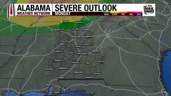
During the day, Monday will be mostly dry as upper-level ridging attempts to take the stage over the eastern U.S. However, another front will make its way toward the state Monday night and bring the chance for some thunderstorms to north and central Alabama. North Alabama is under a Marginal Risk (1/5) of Severe Thunderstorms Monday night, with strong winds and the potential for hail the main concern. Before the showers in the evening, highs will manage to climb into the mid 80s north and mid to upper 80s centrally and in the south. A 90-degree reading may be possible in the southwest.
UNSETTLED PATTERN THROUGH FRIDAY
Monday’s approaching cold front will stall to the northwest of the state Tuesday and very slowly move over Alabama through Wednesday night. This spells out some more rain for the state.
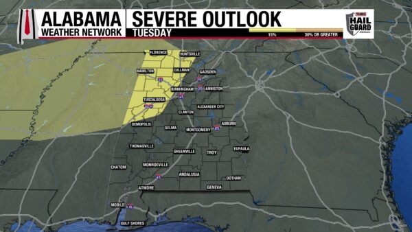
Tuesday sees the return of afternoon showers and thunderstorms to the entire state’s forecast. There is also a low-end severe threat for northwest/central-west Alabama. The system is too far out in advance to know specific timing and impacts just yet, but we’re keeping our eyes on it here at AWN. Highs on Tuesday will range from the lower 80s north, the low to mid 80s centrally, and the upper 80s to possibly 90 degrees in the south.
Wednesday and Thursday will experience the frontal passage and more scattered showers and thunderstorms, but they should be sub-severe. Highs on Wednesday will hit the upper 70s and lower 80s north, lower 80s centrally, and mid 80s south. Highs will increase into the lower 80s across north Alabama Thursday, but the rest of the state’s highs will be similar to Wednesday.
QUIETER FRIDAY
Rain chances decrease a lot from Thursday to Friday, and showers will be light in nature. Highs will be much cooler as well, with north Alabama topping out in the upper 60s, and the low 70s being expected centrally and in the south.
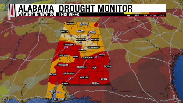
VERY DRY WEEK LED TO EXACERBATED DROUGHT
Last week was a very dry week, and the state’s drought conditions only worsened. There is now not a single part of the state that is in the two least “bad” categories (no drought and abnormally dry). 13.09% of the state is in a Moderate Drought, 40. 62% of the state is in a Severe Drought, and 46.12% is in an Extreme Drought. This category jumped by more than 20% from last week. Additionally, the southeast corner of Alabama accounts for the 0.17% of the state that is under an Exceptional Drought. We desperately need the rain coming from the upcoming systems!
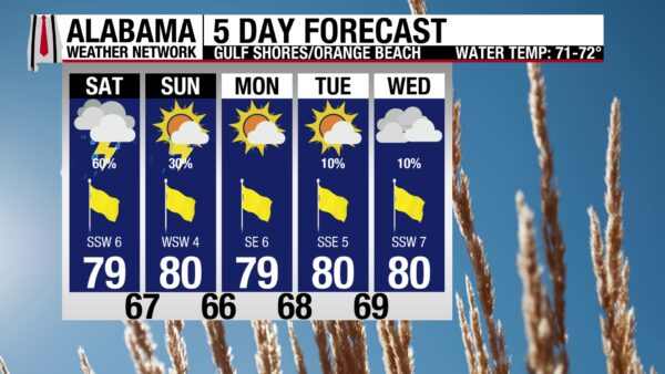
SHOWERS ON THE BEACH
A high temperature in the upper 70s, partly sunny skies, and southwest winds at 5 to 10 mph will create a nice day at the beach. Unfortunately, if you want to enjoy the weather, you’ll have to dodge afternoon showers after this morning’s original storms move out. The rip current risk is low, and the surf height is around two feet, so the water will be pleasant- just make sure to get out of the water if you hear thunder or see lightning. Rain chances stick around tomorrow, then we get a brief break from the rain on Monday.
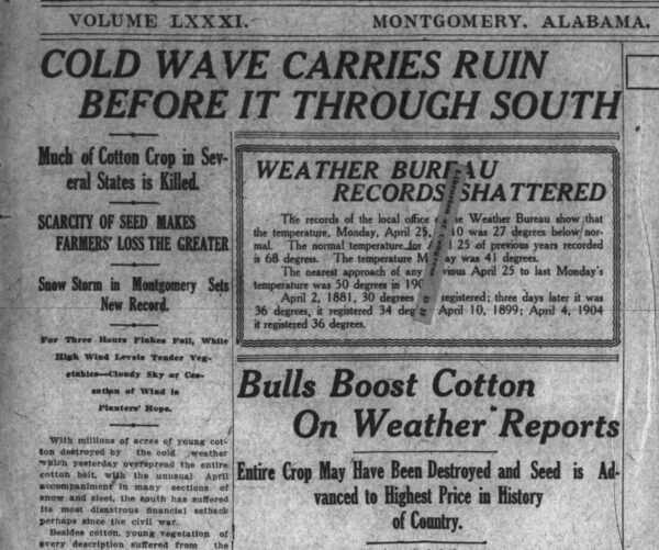
TODAY IN WEATHER HISTORY
April 25, 1910 – April Snow Showers
One of the most unusual late-season winter weather events in the Southeast occurred on April 25, 1910, when a rare outbreak of snow and freezing conditions affected parts of Alabama and surrounding states during a time of year typically associated with spring warmth and thunderstorms. Across the region, areas in Kentucky, Tennessee, Mississippi, Alabama, Georgia, and North Carolina experienced wintry precipitation, with Atlanta and Tuscaloosa each reporting about 1.5 inches of snow, while McMinnville, Tennessee, recorded up to eight inches, and even Pensacola, Florida, reported a trace of frozen precipitation. In Alabama, the event was especially notable because Birmingham recorded a trace of snow during the morning hours, and accounts from Lamar County described as much as an inch of snow on the ground, with temperatures only reaching the 30s, including a low near 33 and a daytime high around 41, which was far below seasonal norms. Local reports also noted significant agricultural impacts, including damage to early corn crops that had already begun to grow. The event remains one of the latest recorded snow occurrences in Birmingham’s history and a striking example of how sharply temperatures can deviate from normal spring conditions in the southern United States.
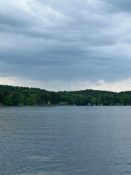
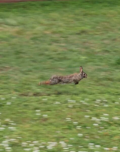
IMAGE(S) OF THE DAY
It was impossible to pick one image today, so we have two!
1. Rain off in the distance in Rockford. Taken by Skywatcher Mike Thomas from Lake Martin.
2. Jack the Rabbit, New Market resident, is enjoying the wet grass this morning. Taken by Skywatcher Sandra Kirkwood.



