


Daily Weather Briefing
Sunday, April 26, 2026
ALABAMA THIS MORNING
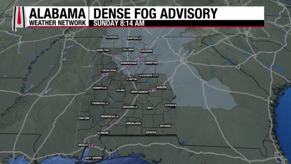
The sun rose over a mostly cloudy sky this morning. Additionally, patchy to dense fog formed over north and central-east Alabama. While it is beginning to dissipate now, caution should be exercised while driving, as a Dense Fog Advisory has been put in place for the region until 9 a.m. CDT. Otherwise, it is a calm morning after a rainy Saturday. Temperatures sit in the lower 60s north, and the mid to upper 60s centrally and in the south. Dothan, Mobile, and Gulf Shores are already in the 70s.
ALABAMA 7 DAY FORECAST
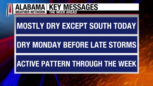
Today and tomorrow will be much drier than the past 36 hours or so. South Alabama may see some showers and thunderstorms today, with southeast Alabama at risk of a low-end severe weather threat. Tomorrow will be mostly dry across the entire state, with just a few pop-up showers possible. Then, a cold front will bring a round of thunderstorms to the state Monday night into Tuesday morning, also bringing a low-level severe threat. Rain will clear mostly through Tuesday before an upper-level shortwave moves through north of Alabama, and convection will encourage another round of thunderstorms and the potential for severe weather Tuesday night through Wednesday morning. Read below to find out about severe weather impacts and timing. On Wednesday, a cold front will push through the state, and scattered to widespread showers and thunderstorms will travel with it, but no severe weather is expected. Thursday and Friday will attempt to stay dry before a low-pressure system is supposed to move across the Gulf Coast on Saturday.
STORMS STILL EXPECTED SOUTH TODAY
North Alabama will stay dry today, and the sun will have no problem shining in mostly clear skies. Highs in the region will sit in the lower 80s.
Central Alabama will be mostly dry today as well, with the low chance for an isolated shower or thunderstorm to develop in the area. The mid 80s are the expected high temperatures.
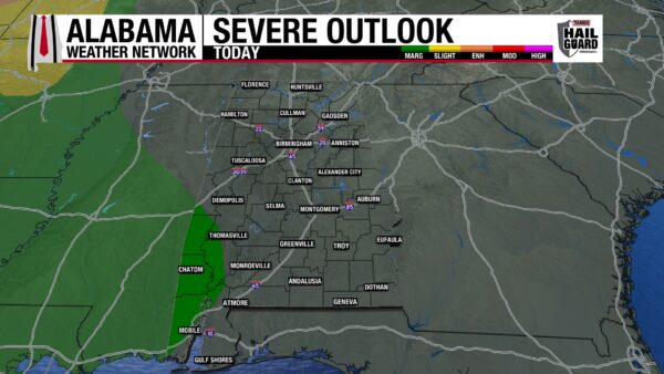
South Alabama will see a wetter day compared to the rest of the state as a mesoscale convective system (small system of organized thunderstorms) moves into the southwest from Mississippi this afternoon. The southwest is under a Marginal Risk (1/5) of Severe Thunderstorms today, and the main concern with any severe storms will be strong, gusty winds and the potential for hail. The region will see highs in the low to mid 80s. Southeast Alabama, on the other hand, will see a more isolated to scattered shower pattern, and no severe weather is expected. Highs will range from the mid to upper 80s.
LOW SHOWER CHANCE TONIGHT
Very isolated showers could develop in the early nighttime, but most of the state will remain dry. Clouds will lightly blanket the state, and lows will fall to the upper 50s and lower 60s in the north and the lower 60s across the rest of the state. The coast will see lows in the mid 60s.
MOSTLY DRY MONDAY
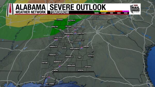
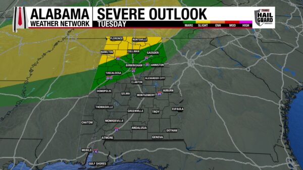
Besides very isolated showers in the south, the state will remain rain-free tomorrow. Clouds will cover the west for most of the day, while the east may see some clearing in the afternoon. Highs will reach the low to mid 80s north, mid 80s centrally, and mid to upper 80s south. Some thunderstorms may develop during the night, but the main thunderstorm event begins Tuesday morning. North Alabama is under a Marginal Risk of Severe Thunderstorms, with strong winds and hail potential possible. Some of northeast Alabama is left out of this region, as is central Alabama, although the areas will see some thunderstorms. Sub-severe thunderstorms can still be strong at times.
THUNDERSTORMS EARLY AND LATE TUESDAY
As mentioned above, a cold front to the north will bring a thunderstorm system to the northern half of the state Monday night into Tuesday morning. North Alabama’s low severe weather threat will continue through the morning. The overnight timing of the storms makes them more dangerous, as most people will be sleeping. Make sure you have a way to receive warnings that will wake you up.
A short break from the storms comes late morning into early afternoon, until showers and thunderstorms begin again mid-afternoon. These will again mostly affect north and central Alabama, with a Slight Risk (2/5) of Severe Thunderstorms stretching across north Alabama. A Marginal Risk will extend into central Alabama. Gusty winds and hail are the main concerns. The severe weather is expected through Tuesday night into Wednesday morning- another overnight event. Please stay weather aware over the next few days so you can be prepared at night.
The focus so far has been on north and central Alabama. That’s because south Alabama will stay mostly dry throughout Tuesday. A few showers may develop in the region, but they will be isolated, short-lived, and sub-severe.
Highs on Tuesday will range from the low 80s north, mid 80s centrally, and upper 80s south.
COLD FRONT WEDNESDAY
A cold front will push through the state throughout the day on Wednesday, bringing more showers and thunderstorms with it. For now, no severe weather is expected with the system. Northern highs will top out at the upper 70s, while central Alabama sits in the low to mid 80s, and the south sees highs in the mid to upper 80s.
COOLER AND FRIDAY THURSDAY
After the cold front, highs on Thursday will only manage to reach the lower 70s in the north, the mid 70s centrally, and the upper 70s to lower 80s in the south. Thursday is also expected to be drier as dry air comes in behind the front.
Friday’s highs will top out at the upper 60s north, low to mid 70s in central Alabama, and the upper 70s in the south. Mostly dry conditions are expected as well.
MORE RAIN SATURDAY
A low-pressure system expected to move along the Gulf Coast will bring rain chances back to the state Saturday. Timing and impacts will be determined closer to the event. Highs in the upper 60s and lower 70s will dominate the northern half of Alabama, while low to mid 70s will spread across the southern half.
STORMS ON THE COAST TODAY
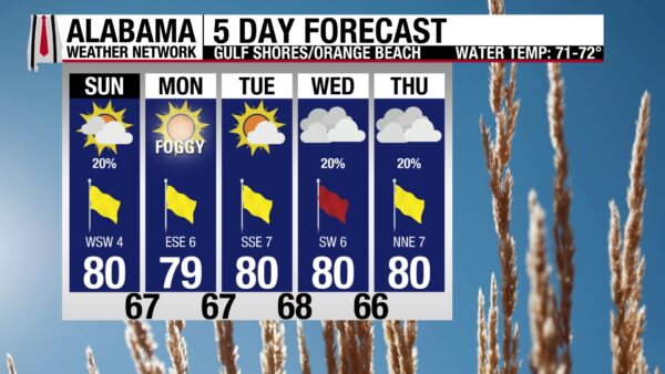
Despite a high around 80 degrees, partly sunny skies, and west to southwest winds around 5 mph, the weather on the coast will not be perfect. This is due to the previously mentioned low-end severe weather threat expected in the southwest today. Showers and thunderstorms may dominate the afternoon. Despite the unsettled weather, the water is calm, and there is a Low rip current risk, and the surf height is at 1 to 2 feet.
WEATHERBRAINS 1058
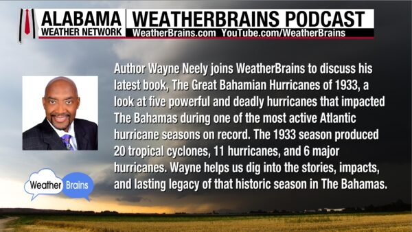
Tomorrow’s WeatherBrains episode features Author Wayne Neely and his newest book, “The Great Bahamian Hurricanes of 1933”. The team and their special guest will dive into one of the most active Atlantic hurricane seasons on record. Listen to the episode wherever you get your podcasts or watch it here.
TODAY IN WEATHER HISTORY
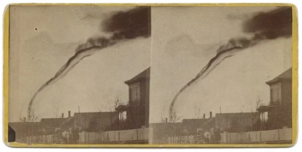
April 26, 1884 – The First Tornado Photograph
On April 26, 1884, a tornado near Garnett, Kansas, became the subject of what is now widely regarded as the first photograph ever taken of a tornado. For several days leading up to the event, the United States Signal Corps tracked a large storm system moving from Colorado into eastern Kansas, though forecasting and warnings were not yet possible. At approximately 5:30 p.m., residents observed a rope-like funnel cloud forming near the small community of Westphalia, Kansas, and moving slowly northeast for about 30 minutes across open prairie. The storm’s relatively slow movement allowed local fruit farmer and amateur photographer A. A. Adams to set up his large box camera near the United Presbyterian Church and capture the image from roughly 14 miles away as the tornado was weakening. Damage from the storm was limited, though one wagon carrying lumber was reportedly lifted and scattered, with the driver and horses thrown some distance but surviving. At the time, tornadoes had previously been documented only through sketches and eyewitness descriptions, so Adams’ photograph provided early meteorologists with rare visual evidence of tornado structure and behavior. He later sold copies of the image as stereographs. Although a more dramatic photograph taken months later in South Dakota briefly received greater attention, modern analysis of weather records and photographic details has confirmed the Garnett image as the earliest known tornado photograph, now preserved by the Kansas Historical Society.
IMAGE(S) OF THE DAY
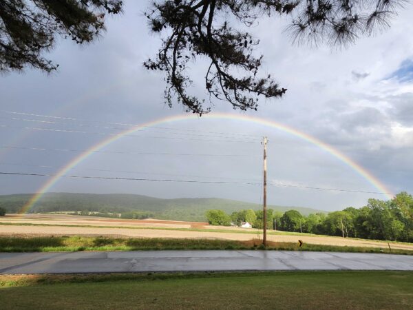
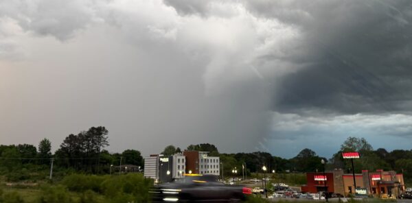
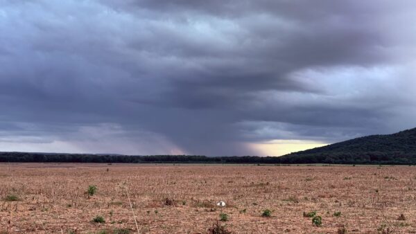
Another morning of hard choices for the Image of the Day! Our Skywatchers sent in a plethora of amazing sky pictures yesterday! There were too many to choose from. Here are some favorites:
1. Double rainbow in New Market by Sandra Kirkwood
2. Rain between Albertville and Guntersville by Tony Bearden
3. Rain shaft looking toward New Hope by Daniel Harbin



