


Daily Weather Briefing
Saturday, May 2, 2026
ALABAMA THIS MORNING
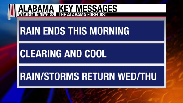
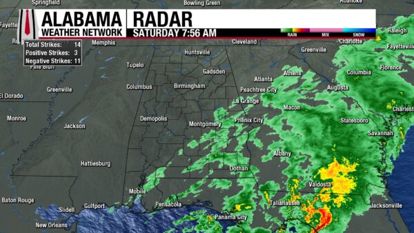
It’s been a rainy morning across Alabama, but showers are winding down, and only impact areas stretching from Mobile to Auburn and areas east and south. Clouds stretch from central to south Alabama, while the north has already cleared out its moisture for the day. Temperatures are in the lower 50s north and mid 50s in central and south Alabama.
ALABAMA 7 DAY FORECAST
Showers are ending from west to east this morning across the southern half of the state, and then most of the day will be cool and dry for Alabama. A high-pressure system will develop over the Southeast this evening into tomorrow, guaranteeing drier weather through Tuesday afternoon. This weekend will be cooler than normal for this time of year, then highs begin to warm up on Monday. Rain chances enter the forecast again Tuesday night ahead of a cold front that will push through the state Wednesday. The rain lingers through Thursday, then another dry period is expected to start Friday.
DRYING OUT TODAY
Showers should conclude in the southeast by lunchtime today, leaving behind a state that is cooler and drier than it was yesterday. Clouds will clear throughout the day, lingering for the longest in the southeast. Winds will be breezy, with wind gusts expected to stay in the 10-20 mph range over Alabama. Highs will be limited to the upper 60s and lower 70s statewide.
COLD RETURNS TONIGHT
We just can’t seem to fully rid ourselves of cold nights just yet. With clear skies and light to calm winds, lows will be able to drop to the low to mid 40s across the state tonight. A few locations in the north may see some patchy frost on the grass.
BRIGHT SUNDAY
Temperatures will warm throughout the day on Sunday to highs in the lower 70s statewide. This warmup will be encouraged by continued clear skies, dry air, and light winds.
WARMER MONDAY AND TUESDAY
This cool spell will not last very long, as the surface high-pressure moves east and causes southerly flow in the state. This will advect warmer temperatures and slightly moister air into the Southeast.
Therefore, highs Monday will reach the upper 70s over the state and even around 80 degrees in a few locations. Skies will be partly cloudy in response to the moister air.
Tuesday will see a mix of upper 70s to around 80-degree highs. A cold front will begin to approach the state during the day, and there is a low chance of showers Tuesday evening in the north. Otherwise, Tuesday is another dry day.
WET WEDNESDAY AND THURSDAY
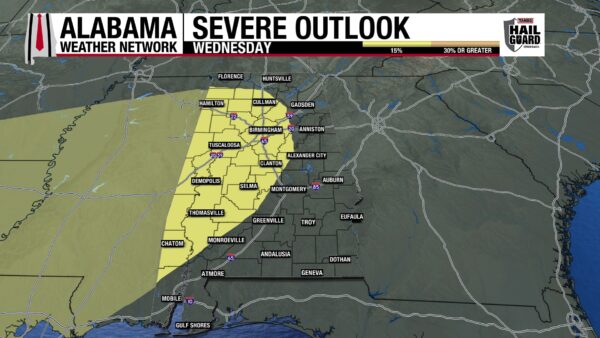
A cold front will move through Alabama throughout the day Wednesday, bringing showers and thunderstorms along with it. We are watching the low chance of severe weather with this system and will be able to be more specific about timing and locations closer to Wednesday. Highs Wednesday will sit in the upper 70s and lower 80s north, and the low to mid 80s centrally and in the south.
Showers and thunderstorms linger Thursday, although there is no severe weather threat for now. Temperatures will begin to fall behind the front, only hitting the lower 70s north, the mid 70s in central Alabama, and the upper 70s to lower 80s south.
DRY FRIDAY
Rain moves out by Friday, and the upper-level trough and surface cold front will be replaced by another high-pressure system. Highs will range from the low 70s north, the mid 70s centrally, to the upper 70s south.
SLIGHTLY WORSE DROUGHT
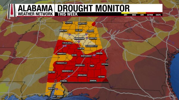
The bad drought in Alabama worsened just a little bit from this past week to this week. The Severe-Exceptional Drought categories all increased by less than 1%. Although this is better than the large increases we saw last week, it is not as encouraging as a lessening of drought conditions would be. Hopefully, with this wetter pattern we will see a better outlook next week.
GLOOMY MORNING, BETTER AFTERNOON
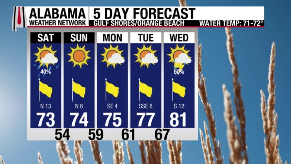
This morning is a gloomy one on the coast, with showers in the area, cloudy skies, and winds from the north at 15 to 20 mph. The high today will only reach the lower 70s, despite clearing skies in the afternoon. Water conditions are a bit rougher than they have been recently, with the rip current risk increased to Moderate today and a surf height of 2 to 3 feet. The next few days will be dry, then storm chances return Wednesday.

TODAY IN WEATHER HISTORY
May 2, 1982 – The Start of the Weather Channel
On May 2, 1982, The Weather Channel officially launched, marking a turning point in how weather information was delivered to the public across the United States. The concept for a 24-hour weather network had been developed in the late 1970s by meteorologist John Coleman, who recognized that brief weather segments on traditional television broadcasts did not meet the growing public demand for timely and continuous information. After facing repeated rejections from major networks, Coleman secured support from Landmark Communications, allowing the project to move forward. A key technological breakthrough was the development of the Weather Star system, which used satellite technology to automatically transmit localized forecasts and warnings from the National Weather Service directly to viewers through their cable providers. The network began broadcasting around the clock with hourly programs featuring on-air meteorologists, national radar imagery, and continuous updates, and it quickly became a central source for weather information, education, and severe weather coverage. Over time, innovations such as live field reporting, expert analysis from specialists like hurricane forecaster John Hope, and educational programming expanded the network’s influence. The launch of The Weather Channel is widely regarded as a foundational moment in modern weather communication, helping ensure that warnings and forecasts could reach the public quickly and consistently at any time of day.

IMAGE OF THE DAY
@barrybutler9 on X posted this wonderful photo of “stillness on a Saturday” from Lincoln Park in Chicago.



