


Daily Weather Briefing
Sunday, May 31, 2026
ALABAMA THIS MORNING
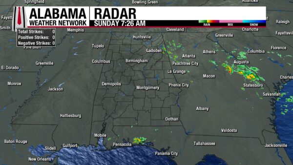
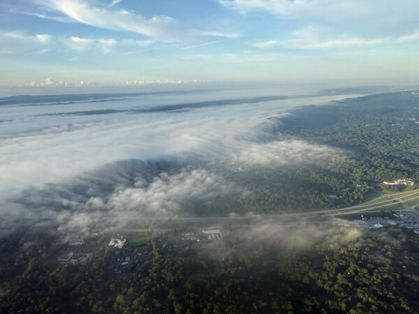
Another muggy morning greets Alabama residents, as temperatures are already in the low to mid 70s from north to south. Patchy to dense fog forms across the state, but is beginning to burn off as the sun rises and peeks through Alabama’s partly cloudy sky. A few isolated light showers impact Froney and west of Gaylesville, and Grantley in eastern north-central Alabama. A light shower approached Heflin as well. To the south, a few stray showers fall over southwest Alabama, more specifically north of Robertsdale, west of Blakeley, and north of Alabama Port, moving over the bay. Bill Murray took off from the Birmingham airport this morning and captured a wonderful view of the fog over I-59 near Roebuck Parkway, looking southwest toward Ruffner Mountains.
ALABAMA 7 DAY FORECAST
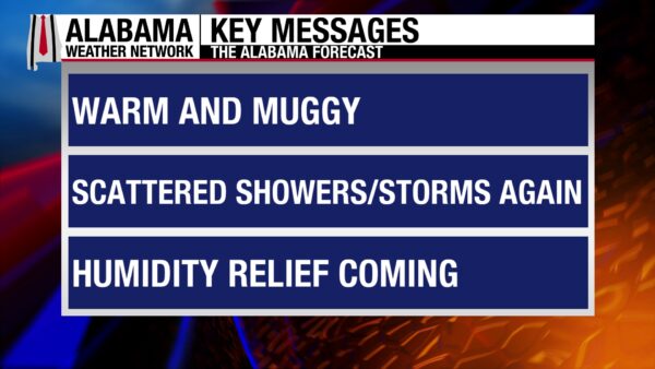
Today features another day of afternoon showers and thunderstorms for the state. A stationary front will sit across central Alabama today and move south tomorrow. Tomorrow, a cluster of strong thunderstorms will make its way through Alabama in the afternoon and evening, bringing a low-level severe threat with it. Then an area of high-pressure will begin to develop on Tuesday, drying out the northern half of the state, while the southern half of the state sees rain chances until Wednesday. Rain chances will be low through Saturday statewide, and a dry pattern will form.
SCATTERED AFTERNOON SHOWERS TO END MAY
May ends with the same weather it has seen over the past two weeks: afternoon showers and thunderstorms. Storms should not be severe, but a few may be strong. Clouds will be persistent, but a few breaks to see the sunshine are possible. Highs will be in the low to mid 80s from east to west in north Alabama, the lower to upper 80s in central Alabama, and the mid 80s to low 90s in the south. The lower end of the highs resides on the eastern border of the state as high pressure to the east brings slightly cooler air to the Carolinas and Georgia today. Heat indices (feels-like temperatures) in the western two-thirds of the state will range from the low to mid 90s, with mid-90s feels-like temperatures expected in the south. If you have outdoor plans today, watch the sky for quick-moving storms, and stay hydrated to avoid heat stress.
LOW END SEVERE THREAT MONDAY
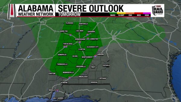
A backdoor cold front will begin to push through Alabama on Monday afternoon. Scattered showers and thunderstorms form in the afternoon before a cluster of organized thunderstorms, known as a mesoscale convective system, will enter north and central Alabama in the late afternoon and evening. Heavy downpours, frequent lightning, strong winds, and a possibility for hail are the main concerns with this system. The atmosphere’s environment does not indicate favorable tornado conditions, but that is subject to change closer to the event. South Alabama will not see severe weather as of right now as the system is expected to fall apart as it reaches the region. Highs will range from the mid to upper 80s in the north to the upper 80s to lower 90s across central and south Alabama. Heat indices in western south-central and south Alabama will reach the upper 90s and even 100 degrees tomorrow. Stay hydrated and cool if you must be outside for a long period of time. Watch young children and older adults for signs of heat stress as well (fatigue, thirst, muscle cramping, confusion, quick heart rate, pale skin, excessive sweating or the inability to sweat).
STUBBORN SHOWERS SOUTH ON TUESDAY
The northern half of the state begins to dry out on Tuesday as drier air behind the front filters into the region, and a high-pressure system begins to take shape across the East. Still, a 20% chance of showers lingers. The front, meanwhile, will sit over the southern half of the state, keeping rain chances elevated through the day. Northern highs will reach the low to mid 80s, central Alabama will hit the mid to upper 80s, and south Alabama will again see highs climb into the upper 80s and lower 90s. Heat indices will once again reach up to 100 degrees in southwest Alabama, and heat safety will need to be everyone’s concern.
DRY PATTERN SETTLES WEDNESDAY
After a prolonged stretch of guaranteed rain over the past two weeks, Wednesday will be the first day across the entire state with little to no chance of rain. The northern half of the state has no rain chance, while the southern half has a small 10% chance. Highs will be cooler as well, only managing the upper 70s to lower 80s in the north and the lower 80s in the south. Lows will fall into the 50s.
SLOW WARM UP THROUGH WEEKEND
Rain chances stay low through Saturday, but highs will slowly warm each day.
Thursday’s highs will be in the low 80s statewide. On Friday, comparatively, highs will rise to the mid 80s across Alabama. Then Saturday will see the mid 80s as well, with south Alabama flirting with the upper 80s.
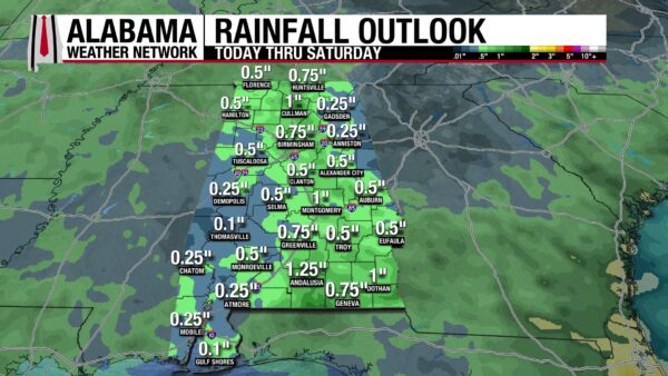
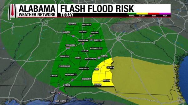
RAINFALL OUTLOOK
The rain we’re expecting over the next seven days will fall mostly today and tomorrow. The Weather Prediction Center has placed most of Alabama under a Marginal Risk (1/4) for Excessive Rainfall, excluding the southwest corner of the state. Additionally, southeast Alabama is under a Slight Risk (2/4) as showers are expected to be more persistent in the region today.
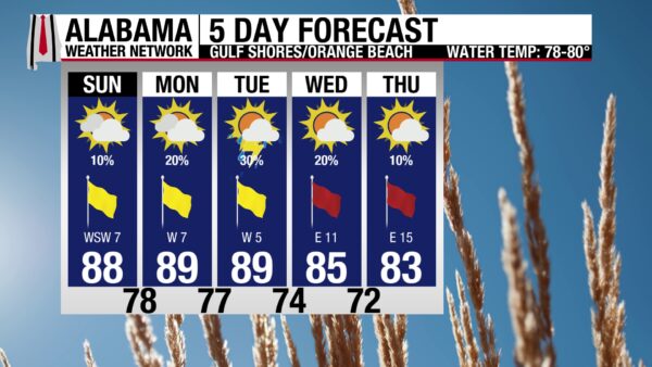
GORGEOUS BEACH DAY
We conclude the weekend with beautiful beach conditions. Today’s high will be in the upper 80s, skies will be mostly sunny, and the UV Index will be Extreme (wear sunscreen!). Winds will provide a nice breeze from the southwest at 5 to 10 mph, and there is only a 10% chance of showers and thunderstorms. If storms do develop, they will be isolated and short-lived, but they should still be taken seriously. The rip current risk is Moderate, and surf height is at 1 to 2 feet. Similar conditions are expected tomorrow. It might be a bit rainier on Tuesday, before rain chances dwindle again, but rip current risk increases later this week.
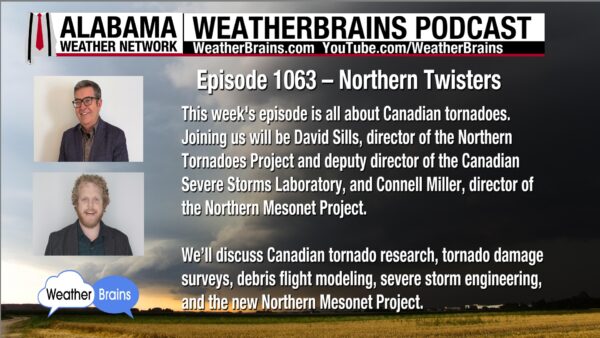
WEATHERBRAINS 1063 – NORTHERN TWISTERS
On tomorrow’s WeatherBrains episode, David Sills and Connell Miller, Canadian tornado experts, will talk all about these northern twisters. Listen to the episode wherever you get your podcasts, or watch here.
TODAY IN WEATHER HISTORY
May 31, 2013 – The Beast of El Reno
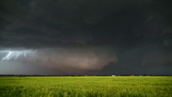
On the evening of May 31, 2013, an extraordinarily dangerous tornado developed west of El Reno, OK, in an environment meteorologists had feared for days. Conditions across central Oklahoma were explosively unstable, with extreme moisture, intense wind shear, and powerful upper-level dynamics combining to create a textbook setup for violent supercells. Hundreds of storm chasers, researchers, photographers, and television crews converged on the area, anticipating a historic tornado day.
By late afternoon, towering cumulus clouds rapidly exploded into a massive supercell thunderstorm southwest of El Reno. The storm grew with astonishing speed, extending more than 60,000 feet into the atmosphere. At 6:03 p.m., a tornado touched down roughly eight miles west-southwest of El Reno. Almost immediately, it became clear this was no ordinary tornado.
The tornado quickly evolved into an enormous wedge, with the visible funnel beneath the cloud base wider than it was tall. Rain wrapped around the circulation early in its life cycle, concealing its true size and structure from observers. What many chasers could not yet see was that the tornado was growing at an astonishing rate while changing direction erratically. Instead of maintaining a steady northeast path typical of many Plains tornadoes, the circulation zigzagged unpredictably while accelerating eastward.
Among those tracking the storm was the legendary TWISTEX research team led by Tim Samaras. Widely respected throughout meteorology and storm chasing communities, Samaras was known for his cautious approach and groundbreaking tornado research. Traveling with his son Paul and fellow researcher Carl Young, the team attempted to maneuver around the storm near El Reno as the tornado rapidly expanded south of Reno Road.
By 6:09 p.m., the tornado was already becoming an enormous rain-wrapped circulation hidden behind curtains of precipitation. As Samaras and his team tried navigating eastward on Reuter Road toward Highway 81, the tornado continued growing larger while accelerating to over 40 mph. Intense inflow winds exceeding 70 mph blasted into the storm, slowing vehicles and making escape increasingly difficult.
What made the El Reno tornado especially terrifying was its internal structure. Doppler on Wheels radar operated by researcher Josh Wurman later revealed multiple violent subvortices rotating within the larger circulation. Some of these subvortices were themselves the size of separate tornadoes. In effect, there were tornadoes inside the tornado.
As the storm neared Highway 81, radar indicated winds approaching 300 mph within one of the subvortices. One Doppler measurement recorded 255 mph winds — equivalent to high-end EF5 intensity. Meanwhile, the tornado itself continued expanding. Officially, the tornado reached 2.6 miles wide, making it the widest tornado ever documented on Earth. Even more astonishing, radar suggested the broader circulation reached nearly 4.3 miles wide at low levels.
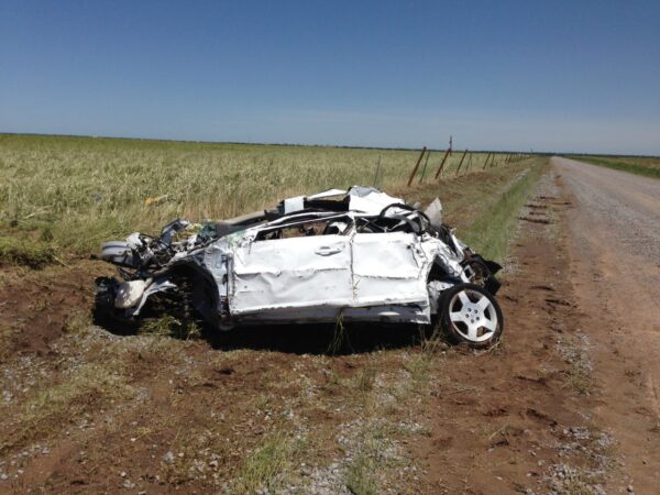
At approximately 6:16 p.m., tragedy unfolded east of Highway 81. The TWISTEX team unknowingly drove into the path of a rapidly moving subvortex embedded within the larger tornado circulation. Their Chevrolet Cobalt was struck and thrown more than 2,000 feet across a field near Reuter and Radio Roads. Tim Samaras was later found inside the crushed vehicle. Paul Samaras and Carl Young were discovered nearby. All three men were killed.
In total, the El Reno tornado claimed multiple lives and injured many others as it carved across Canadian County. Initially, some believed the tornado would receive an EF5 rating due to its extraordinary radar-measured winds. However, because the Enhanced Fujita Scale is based primarily on damage indicators rather than measured winds alone, the official rating was ultimately lowered to EF3. The decision sparked years of debate throughout the meteorological community.
But beyond the statistics and records, the El Reno tornado became a turning point for storm chasing culture itself. The tornado’s unpredictable motion, immense size, hidden circulation, and violent subvortices shattered long-held assumptions about how tornadoes behave. If someone as experienced and safety-conscious as Tim Samaras could be overtaken by a tornado, then no chaser was immune to danger.
The El Reno tornado remains one of the most studied storms in history — not only because it was the widest tornado ever observed, but because it revealed just how complex, deceptive, and dangerous violent tornadoes can truly become.
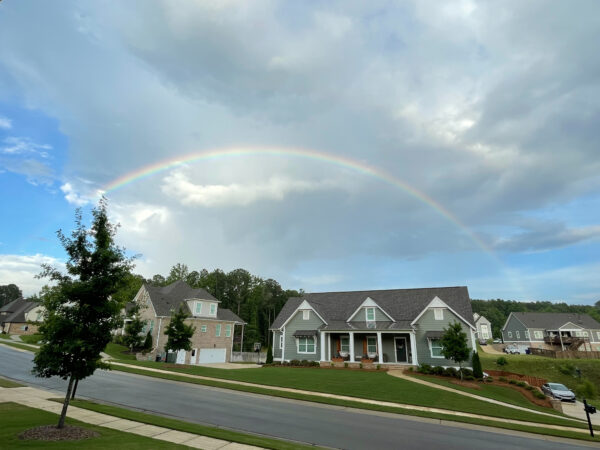
IMAGE OF THE DAY
Skywatcher Andy Klein took this serene picture of a rainbow over houses in Helena yesterday evening.



