


RADAR CHECK: Scattered showers and a few thunderstorms are over the southern third of Alabama this afternoon; the northern counties are dry with a mostly sunny sky. Showers will end soon after dark; otherwise tonight will be mostly clear as drier air moves into the state. Cooler spots across North Alabama will dip into the upper 50s early tomorrow morning.
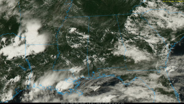
Most of the state will be dry tomorrow with any showers confined to Mobile and Baldwin counties. The sky will be mostly sunny, and the humidity will be lower.
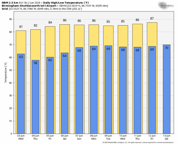
All of Alabama will be dry Thursday and Friday with sunny warm days and clear pleasant nights. Most of the state will see low temperatures in the 50s early Thursday morning.
THE WEEKEND: New global model guidance continues to show a surge of tropical moisture moving back into Alabama and the Deep South, meaning we will need to bring back the chance of scattered showers and thunderstorms Saturday and Sunday. They will be mostly active from noon to midnight; highs will hold in the 80s.
And, for now the weather next week looks pretty routine for June with warm, humid days and the typical risk of “scattered, mostly afternoon and evening showers and thunderstorms”. See the video briefing for maps, graphics, and more details.
TROPICS: This is Day 2 of the Atlantic Basin hurricane season… all is calm and tropical storm formation is not expected for at least the next seven days.
ON THIS DATE IN 1988: Severe thunderstorms in Texas and Oklahoma produced hail more than three inches in diameter near Stillwater OK, and softball size hail in Jones County of north central Texas. Baseball size hail and 70 mph winds caused an estimated 100 million dollars damage around Abilene.
Look for the next video briefing here by 6:00 a.m. tomorrow…



