


COOL START: Temperatures have dropped into the 50s across much of Alabama early this morning, amazingly pleasant for June. Two of the coolest spots are Eufaula and Fort Payne with 53 degrees just before sunrise.
Today will be a sunny day with lower humidity, and no risk of afternoon showers with dry air in place. Not much change tomorrow; most of the state will be mostly sunny and dry with only a small risk of a shower over the southwest corner of the state.
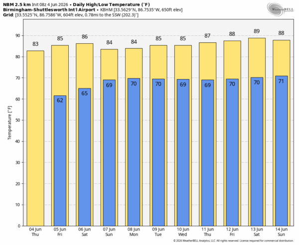
THE ALABAMA WEEKEND: We will bring in a chance of scattered showers and thunderstorms across Southwest Alabama Saturday, but the rest of the state will stay dry with a partly to mostly sunny sky. Then, we will mention the chance of scattered showers and storms statewide Sunday. Highest coverage will be over the western half of the state, and mainly during the afternoon and evening hours. Highs will stay in the 80s over the weekend.
NEXT WEEK: We will maintain the chance of scattered showers and thunderstorms statewide Monday and Tuesday, mainly from noon to midnight. Global models suggest showers will become fewer in number over the latter half of the week as an upper ridge begins to rebuild across the region. Highs will remain in the 80s… See the video briefing for maps, graphics, and more details.
TROPICS: The weather is calm across the Atlantic basin and tropical storm formation is not expected over the next seven days.
ON THIS DATE IN 1825: An early season hurricane moves off the East Coast and tracks south of New York causing several ship wrecks, and killing seven people.
Look for the next video briefing here by 3:00 this afternoon… enjoy the day!



