


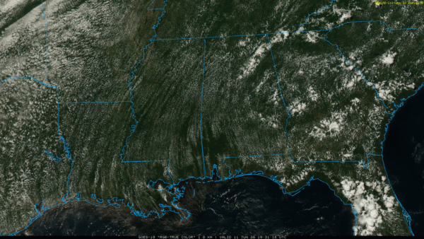
RADAR CHECK: While most of Alabama is hot and dry this afternoon, we have a few spotty showers over the northeast counties of the state. Away from those showers, temperatures are in the low 90s in many areas with a partly sunny sky. Isolated showers will end soon after sunset… tonight will be mostly clear with lows in the 70s.
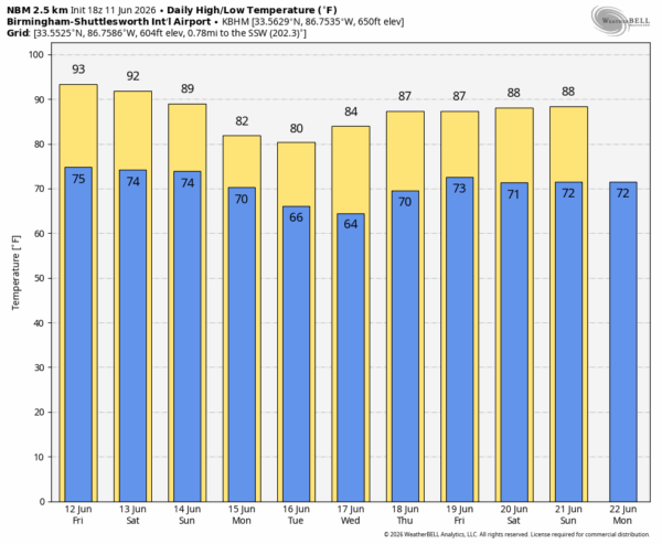
TOMORROW: There are signals in high resolution models of an organized band of showers and storms pushing into North Alabama from Tennessee at some point during the day. These showers will likely fade as they move into the central counties thanks to the upper ridge in place. Otherwise, tomorrow will be a partly sunny, hot, humid day with highs back in the low 90s in many areas.
THE WEEKEND: The upper ridge over the region will weaken, and that will open the door and an increase in the number of showers and storms over the weekend. Highest rain chances will come from noon to midnight, and the highest coverage will likely be on Sunday. But the weekend won’t be a total wash-out, and there will be intervals of sunshine.
We will maintain a good chance of showers and storms across most of the state Monday and Tuesday; rain could be heavy at times and we will have to watch for any potential flooding issues. We do note global models are trending toward the highest coverage of showers and storms over the southern 2/3 of the state on these two days as drier air creeps into North Alabama.
Scattered showers and storms will be possible over the latter half of the week, but they should be fewer in number. See the video briefing for maps, graphics, and more details.
TROPICS: A broad area of low pressure is likely to form over the Bay of Campeche tomorrow from a westward-moving tropical wave currently located over the Yucatan Peninsula of Mexico. Environmental conditions are forecast to be only marginally conducive for development before the system moves inland over eastern Mexico late Saturday or Sunday.
The chance of development is only ten percent, and the rest of the Atlantic basin is very quiet.
ON THIS DATE IN 2005: Tropical Storm Arlene made landfall near Perdido Key. As Arlene tracked inland across South Alabama, it took a path eerily similar to Hurricane Ivan just nine months prior. Since Arlene followed a very similar track as Ivan, trees that had been severely damaged by Ivan were blown down as Arlene moved inland. One of the highest wind speeds during Arlene was at the Navarre Fire Station with a recorded wind gust of 60 mph. Some South Alabama communities received over four inches of rain.
Look for the next video briefing here by 6:00 a.m. tomorrow…



