


RADAR CHECK: Again today we have random, scattered showers and thunderstorms across Alabama. They are most numerous over North and East Alabama, and are producing gusty winds and heavy rain in spots. A flash flood warning was issued for the Birmingham metro due to a slow moving downpour over the city.
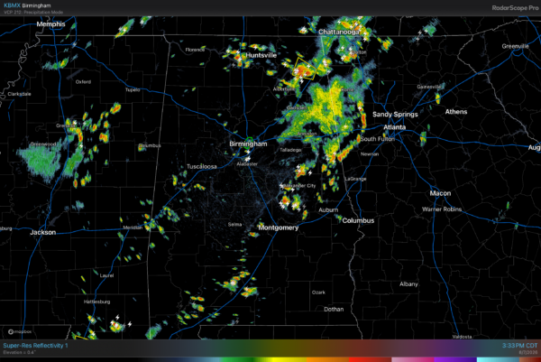
Scattered storms end after sunset.
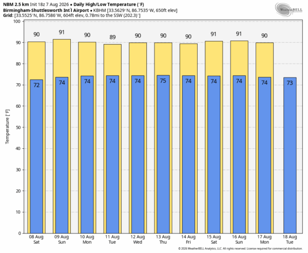
THE DAYS AHEAD: We are in the time of the year when the weather just doesn’t vary much day to day. Classic summer weather will continue across Alabama through the weekend with partly sunny days along with random, scattered, mostly afternoon and evening showers and thunderstorms. Most of the showers will come from noon to 9:00 p.m… and the chance of any one spot getting wet is 30/35 percent. Higher coverage of afternoon showers/storms will be over the northern half of the state, and afternoon highs will be generally in the 88-93 degree range.
NEXT WEEK: Same story. A standard summer ridge will across the Deep South, meaning more standard summer weather. Temperatures near or slightly below average for mid-August (highs 88-93), and spotty showers and storms around during the afternoon/evening hours. See the video briefing for maps, graphics, and more details.
TROPICS: All remains quiet across the Atlantic basin, and tropical storm formation is not expected for at least the next 7-10 days.
ON THIS DATE IN 1980: Hurricane Allen bottomed out at 899 millibars (26.55 inches of mercury) while moving through the Yucatan Channel in the southeastern part of the Gulf. Allen was the second lowest pressure ever recorded in the Western Hemisphere up to that time. Allen’s winds at the time were sustained at 190 mph. The hurricane then slowly weakened and made landfall near Brownsville, Texas as a low-end Category 3 major hurricane three days later on August 10.
Look for my next video briefing here by 6:00 a.m. Monday… enjoy the weekend!



