


SUN, HEAT, STORMS: Expect a high in the 93-99 degree range for most Alabama communities today, and like recent days random, scattered showers and storms will fire up during the late afternoon heat. Highest coverage will be over the western half of the state, where SPC has defined a “marginal risk” (level 1/5) of severe thunderstorms.
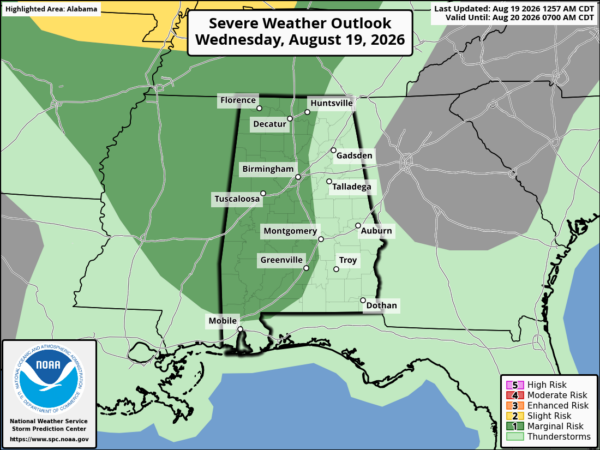
Heavier storms this afternoon will be capable of producing strong, gusty winds, heavy rain, and lots of lightning. They will fade after sunset.
The weather won’t change much tomorrow through the weekend as the August summer grind continues. Highs on most days will be in the low to mid 90s, highest risk of a passing shower or storm will come from noon to midnight. Pretty much what we expect this time of the year in Alabama.
NEXT WEEK: The classic summer pattern will roll along through the week. Partly sunny days, highs between 90 and 94, and “scattered, mostly afternoon and evening showers and thunderstorms” around on a daily basis. See the video briefing for maps, graphics, and more details.
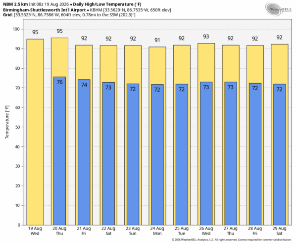
FOOTBALL WEATHER: High school football returns with games tomorrow night and Friday night. You will be dealing with routine August weather; humid nights with temperatures falling through the 80s during the games. A few storms will around during the evening hours. Totally random, be sure and watch radar trends and don’t stay outside if you hear thunder.
TROPICS: All remains quiet across the Atlantic basin and tropical storm formation is not expected through at least the next seven days.
ON THIS DATE IN 2008: Tropical Storm Fay made its second Florida landfall, near Cape Romano, south of Naples with winds around 60 mph. Fay actually strengthened over Florida that day, reaching its maximum intensity of about 70 mph while inland.
Look for the next video briefing here by 3:00 this afternoon… enjoy the day!



