


SUMMER SHOWERS: Humid tropical air that has been over South Alabama will move northward today, and accordingly we have a chance of scattered showers and thunderstorms statewide. While we have a few isolated showers over the northern counties early this morning, most of the showers/storms will come from noon to midnight. SPC has defined a “marginal risk” (level 1/5) of severe thunderstorms this afternoon for parts of West and Northwest Alabama.
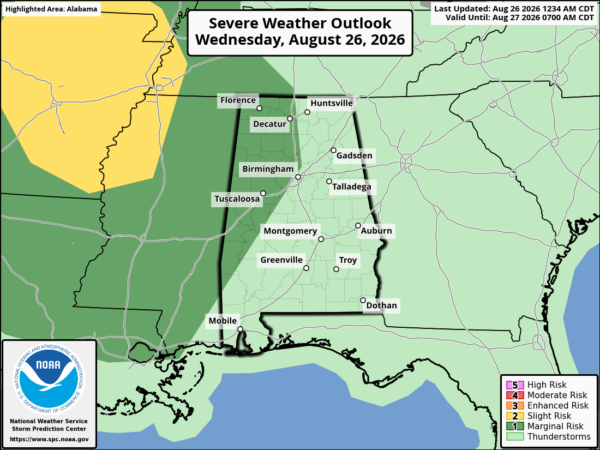
Heavier storms this afternoon and early tonight could produce strong wind gusts and lots of lightning. Expect a high this afternoon in the low 90s for most places.
No real change tomorrow; it will be a humid day with random, scattered, mostly afternoon and evening showers and thunderstorms around.
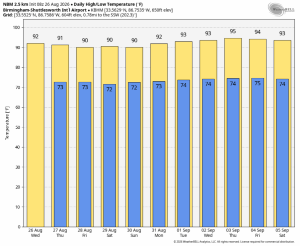
FRIDAY AND THE WEEKEND: Afternoon highs will hold mostly in the low 90s, but we expect a trend toward fewer showers as an upper ridge begins to build into the Deep South from the west. Odds of any one spot seeing rain by the weekend will be in the 20-25 percent range, with most of the showers/storms over the southern half of the state.
NEXT WEEK: The upper ridge will hold, and temperatures rise into the mid 90s over the latter half of the week. Afternoon showers and storms will be rather isolated… See the video briefing for maps, graphics, and more details.
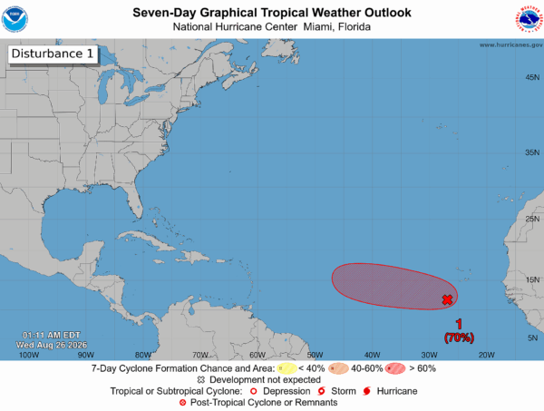
TROPICS: An area of low pressure (Invest 96L) associated with a tropical wave, located a few hundred miles south-southwest of the Cabo Verde Islands, is producing showers and thunderstorms that are displaced to the southwest of its center. Environmental conditions remain somewhat favorable for development over the next couple of days, and a tropical depression is likely to form over the next day or two as the system moves westward to west-northwestward across the eastern and central tropical Atlantic. Environmental conditions are forecast to become less favorable by this weekend, potentially ending its chances for development.
NHC maintains a 70 percent chance of development, but we note some reliable global models show no development at all. If by chance anything develops and survives, it will likely turn north into the open Atlantic well east of the U.S.
No tropical storms or hurricanes are expected over the Gulf for at least the next 10 days.
LUNAR ECLIPSE TOMORROW NIGHT: Alabama will get a spectacular deep partial lunar eclipse tomorrow night (Thursday night). The eclipse begins subtly around 8:23p CT, but the really noticeable partial eclipse begins at 9:33p CT. The peak comes a little before 11:15p CT, when about 96% of the Moon will be covered by Earth’s dark shadow. The Moon will take on a dramatic reddish-orange color. No special glasses are needed—just hope for breaks in the clouds!
ON THIS DATE IN 1992: Andrew made a second landfall near Burns, LA as a Category 3 hurricane. Morgan City, LA recorded sustained winds of 92 mph with a peak gust of 108 mph. Hammond, LA was deluged with 11.92 inches of rain. As Andrew moved inland and weakened, it spawned 47 tornadoes from this date through the 28th from the South to the Mid-Atlantic States.
Look for the next video briefing here by 4:00 this afternoon… enjoy the day!



