


RADAR CHECK: As expected, we have a few scattered showers and thunderstorms over the southern half of Alabama this afternoon, otherwise the sky is partly sunny with temperatures generally in the 88-93 degree range. Scattered showers fade late tonight.
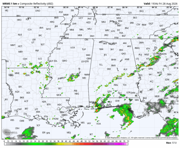
The weather won’t change much over the weekend. Just a few isolated afternoon showers around over the central and southern counties with highs generally in the low 90s.
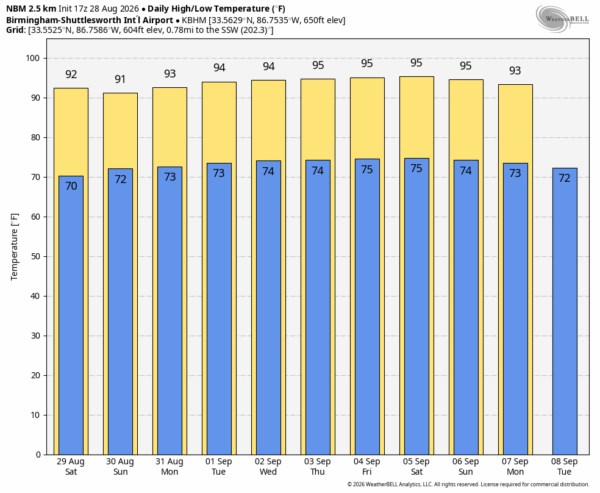
NEXT WEEK: An upper ridge will be in place, meaning rising heat levels and only spotty, isolated afternoon showers. Afternoon highs rise into the mid 90s over the latter half of the week, and the best chance of a cooling shower will remain across South Alabama. Highs will likely hold in the mid 90s through the Labor Day weekend (September 5-7)… See the video briefing for maps, graphics, and more details.
FOOTBALL WEATHER: For tonight’s high school games temperatures will fall from the mid 80s at kickoff, into the 70s by the final whistle. A few showers will be around during the evening hours across the southern third of the state.
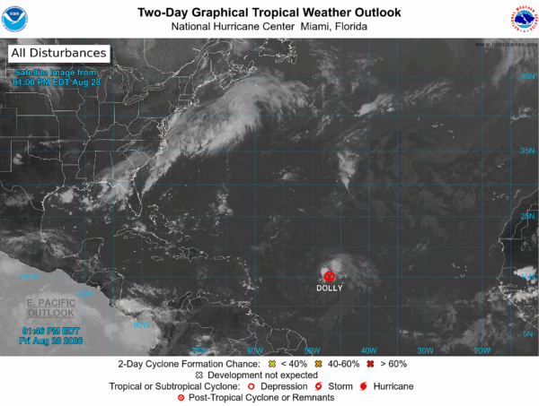
TROPICS: Tropical Storm Dolly has dissipated in the Atlantic; it is now just an open wave with additional development not expected. Tropical storm formation is not expected across the Atlantic basin for at least the next seven days.
ON THIS DATE IN 1990: Between 3:15 p.m. and 3:45 p.m. a devastating F5 tornado ripped a 16.4 mile-long path through portions of Kendall and Will counties in northern Illinois. A total of 29 people were killed, and 350 more were injured.
ON THIS DATE IN 2005: Hurricane Katrina attained Category 5 status on the morning of August 28 and reached its peak strength during the midday hours, with maximum sustained winds of 175 mph and a minimum central pressure of 902 mb.
Look for my next video briefing here by 6:00 a.m. Monday… enjoy the weekend!



