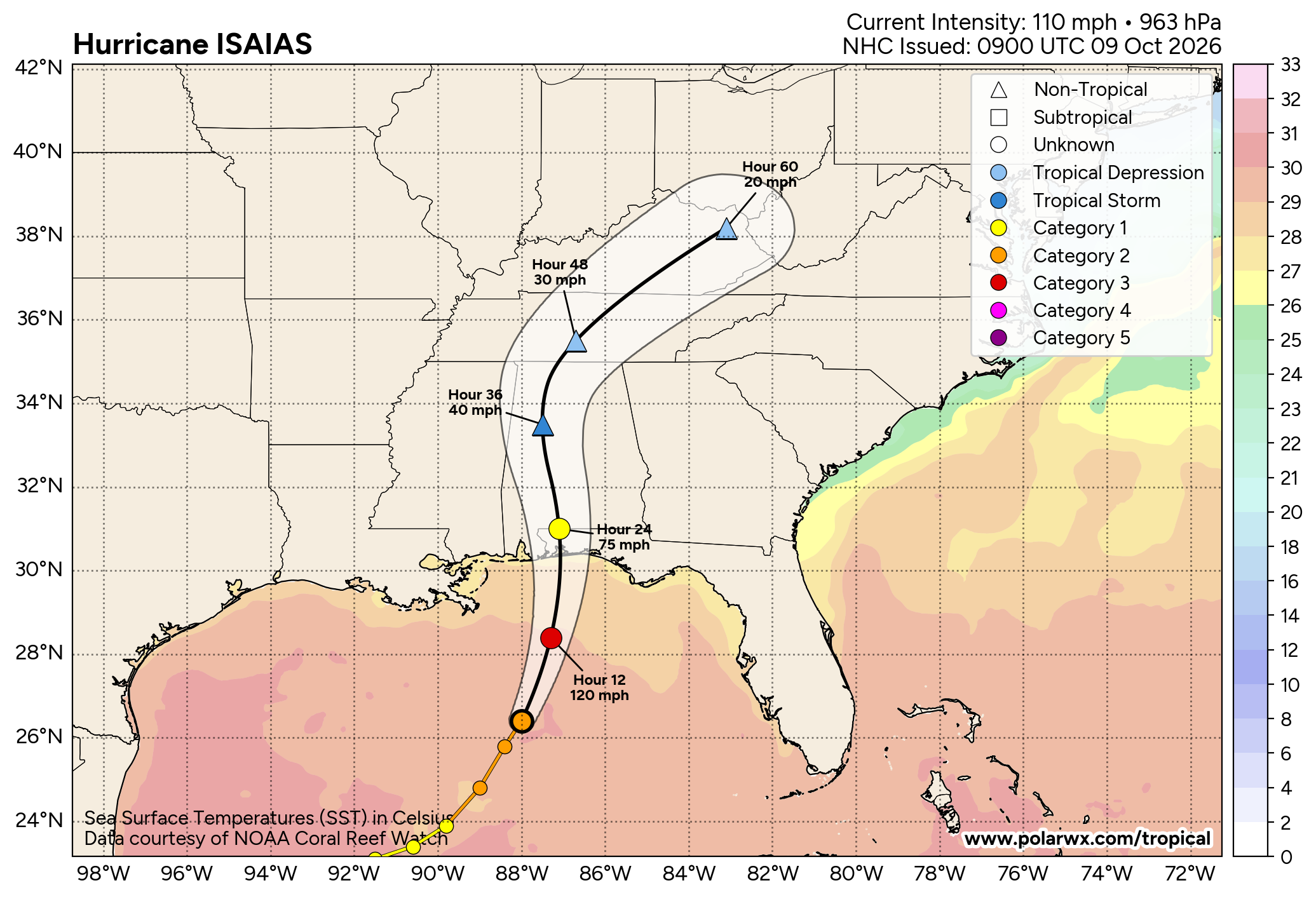
The remnants of Isaias are pulling away toward the Appalachians this morning, closing a stormy chapter for Alabama and the central Gulf Coast. What follows is a long stretch of dry, steadily warming weather, with highs that could approach record levels by the middle of the week.
Isaias left a considerable mark before departing. On Friday evening the storm came ashore along the western Florida Panhandle, where preliminary reports from the National Weather Service in Mobile included gusts of 117 mph near Oriole Beach and 92 mph at Pensacola. Along the Alabama coast, gusts reached 66 mph at Gulf Shores and 59 mph at the Mobile airport. Rainfall was heaviest near the Florida line, where Florala measured 7.01 inches and Andalusia 4.19 inches in the 24 hours ending Saturday morning. Farther north, Huntsville and Birmingham each collected just over two inches, and Spann Skywatchers reported storm totals ranging from about one and a half inches to more than four. Under a persistent ceiling of cloud, Saturday’s highs reached only the 60s and lower 70s across much of the state, roughly 9 to 14 degrees below normal for mid-October.
Today, low clouds and patches of drizzle will linger across north and central Alabama early, but drier air should break up the overcast by late morning. Highs will range from the middle 70s in the Tennessee Valley to the middle 80s near Mobile. Although the rain has ended, minor to moderate flooding continues along the Pea and lower Choctawhatchee Rivers in southeast Alabama, and residents near those waterways should keep watch on river levels until they begin to fall.
Beginning Monday, an upper-level ridge will strengthen over the Southeast, bringing abundant sunshine and a steady climb in temperature. From Tuesday through Thursday, highs will reach the upper 80s and lower 90s from Birmingham southward, and the National Weather Service in Birmingham indicates that some locations could approach daily records. A dry cold front on Friday will return more seasonable air in time for next weekend. Little to no rain is expected anywhere in the state over the next seven days, which will give rivers time to recede and soils soaked by Isaias time to dry.
At the coast, sunshine returns today with highs in the 80s, surf near two feet, and water temperatures in the middle 70s. A High Rip Current Risk remains in effect through this afternoon, so swimmers should stay near a lifeguard. The risk falls to low from Columbus Day through Wednesday, setting up a pleasant stretch of beach weather.
Across the nation, Isaias will carry rain and a few severe storms up the East Coast today, with a Slight Risk of severe weather in Virginia and North Carolina. Moisture from Tropical Storm Rachel threatens flash flooding across the Desert Southwest, including the Las Vegas area. Meanwhile, the northern Plains remain unusually warm: Sioux Falls reached 90 degrees on Saturday, the fourth-latest date on record for a 90-degree reading there. In sharp contrast, the first winter storm of the season may leave more than a foot of snow on the higher terrain of Montana by Monday.
With the Atlantic tropics expected to remain quiet for the next seven days, Alabama can settle into a calm and remarkably warm pattern for the middle of October.