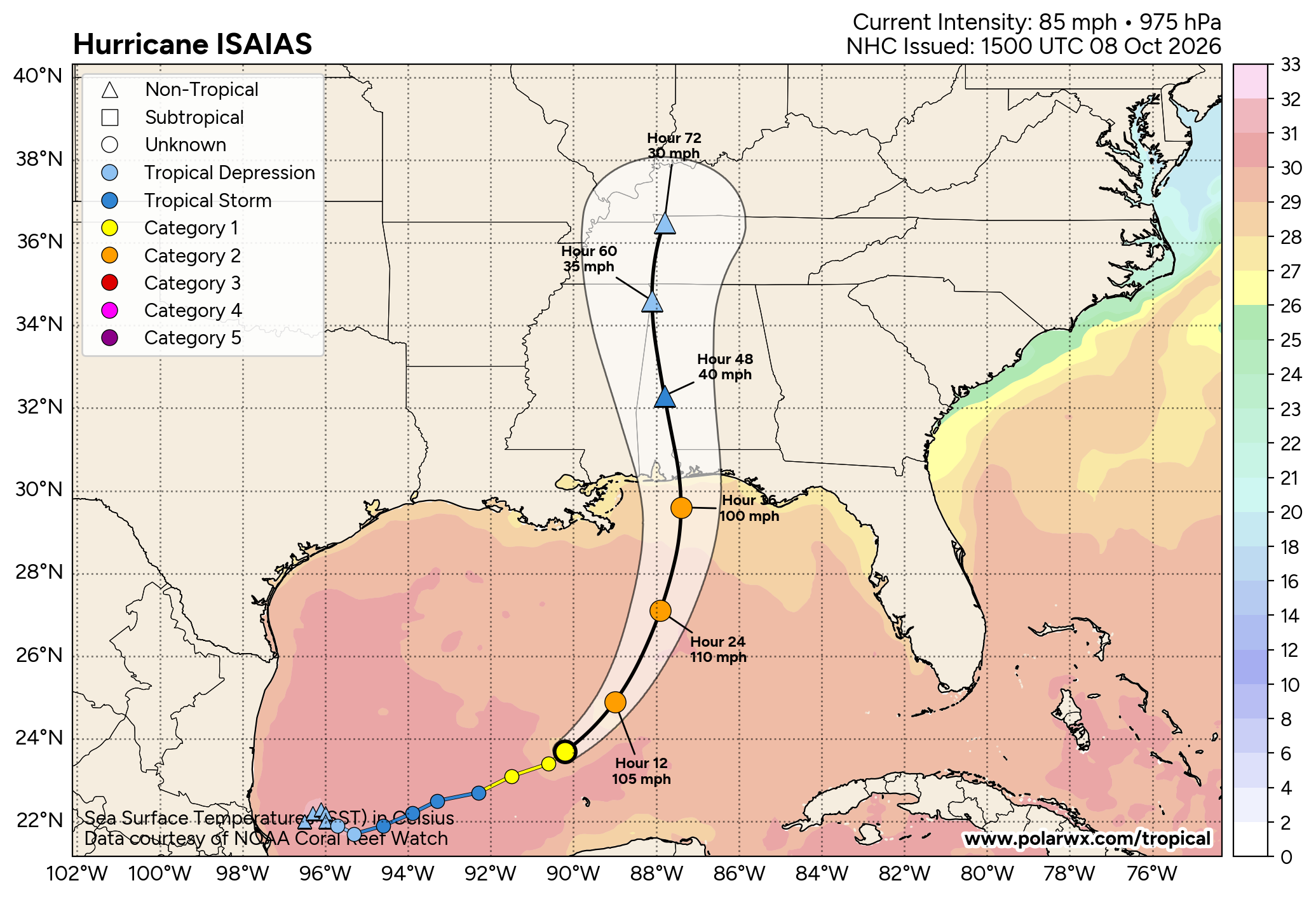
ISAIAS GETTING CLOSER TO LANDFALL: This morning Hurricane Isaias, with winds of 110 mph, is about 200 miles south/southeast of the mouth of the Mississippi River. It is moving to the north/northeast at 15 mph. The hurricane will begin to accelerate today, and landfall comes tonight near Pensacola Beach. Winds will be 90-100 mph at landfall.
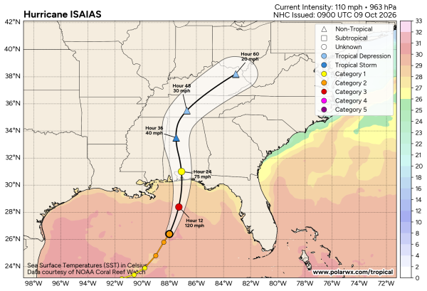
The system will move quickly through West Alabama tomorrow morning. Keep in mind the main wind/rain/storm surge impact will be along and to the east of the circulation center.
Key messages….
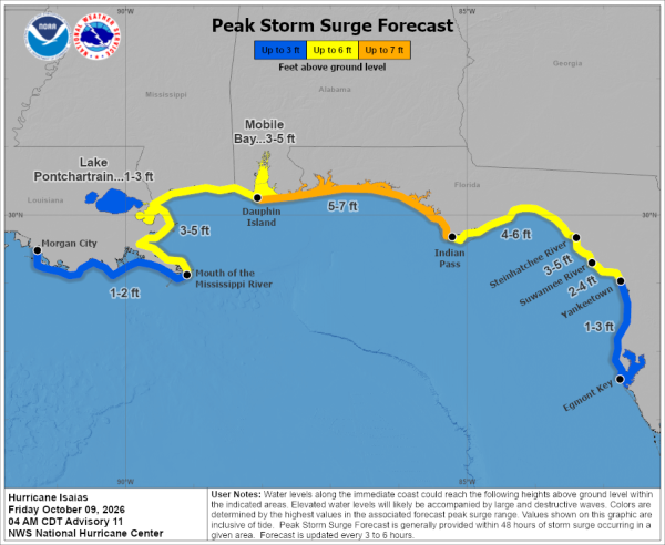
*A 5-7 foot storm surge is forecast from Dauphin Island to Indian Pass. Storm surge for Mobile Bay will be 3-5 ft. A storm surge warning is in effect.
*Rain amounts along the coast will be in the 4-8 inch range along the coast and across far South Alabama. Amounts of 1-3 inches are likely over the northern and central counties of the state. A flash flood watch is in effect.
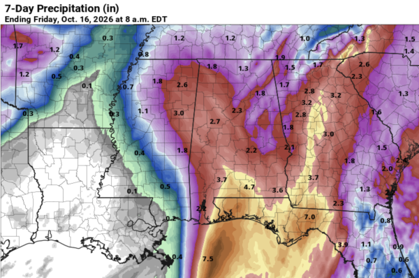
*Winds could gust as high as 50-60 mph across much of Alabama tomorrow morning; tropical storm warnings are in effect up to I-20, and a high wind watch is in effect north of I-20. The brings the possibility of long-duration power outages, not just on the coast, but for much of Alabama as well. Highest wind for the coast will come tonight from 6:00 p.m. until 3:00 a.m. For inland parts of Alabama, highest velocities will come from 3:00 a.m. until 12 noon.
*A few isolated tornadoes are possible across Southeast Alabama. The tornado threat has shifted eastward in the latest SPC outlook for tomorrow.
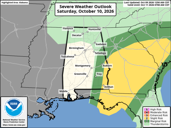
Models continue to trend faster, much of the rain will be out of Alabama by 12 noon tomorrow. Tomorrow night will be dry for the major outdoor events with diminishing wind.
Sunday will be a dry day with lots of sun and a high around 80 degrees. And, at this point most all of next week looks dry with warm afternoons; highs will be well into the 80s. See the video briefing for maps, graphics, and more details.
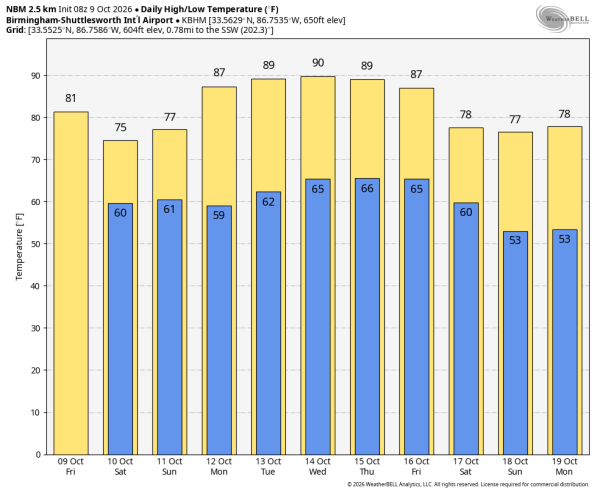
FOOTBALL WEATHER: The weather will be dry for tomorrow night’s Alabama/Georgia game in Tuscaloosa (6:30p CT kickoff). Winds averaging 10-20 mph, temperatures in the low 70s.
ON THIS DATE IN 2001: An unusually strong fall outbreak of tornadoes spawned at least 23 twisters across parts of Nebraska and Oklahoma.
We will be going into live, continuous coverage on the Alabama Weather Network this morning; watch us for comprehensive coverage of Isaias!